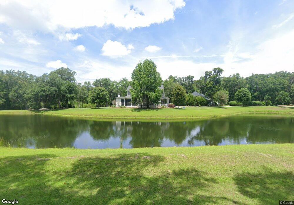
15 Elisabeth Cove Beaufort, SC 29907
Estimated Value: $953,804 - $1,098,000
3
Beds
4
Baths
2,847
Sq Ft
$354/Sq Ft
Est. Value
About This Home
This home is located at 15 Elisabeth Cove, Beaufort, SC 29907 and is currently estimated at $1,008,201, approximately $354 per square foot. 15 Elisabeth Cove is a home with nearby schools including Coosa Elementary School, Lady's Island Middle School, and Beaufort High School.
Ownership History
Date
Name
Owned For
Owner Type
Purchase Details
Closed on
May 6, 2015
Sold by
Jeter Construction Company Inc
Bought by
Mitchell Mark W and Mitchell Sandra B
Current Estimated Value
Home Financials for this Owner
Home Financials are based on the most recent Mortgage that was taken out on this home.
Original Mortgage
$410,800
Interest Rate
3.77%
Mortgage Type
Construction
Purchase Details
Closed on
Dec 13, 2001
Sold by
Coosaw Point Llc
Bought by
Jeter Construction Company Inc
Create a Home Valuation Report for This Property
The Home Valuation Report is an in-depth analysis detailing your home's value as well as a comparison with similar homes in the area
Home Values in the Area
Average Home Value in this Area
Purchase History
| Date | Buyer | Sale Price | Title Company |
|---|---|---|---|
| Mitchell Mark W | $43,500 | -- | |
| Jeter Construction Company Inc | $70,500 | -- |
Source: Public Records
Mortgage History
| Date | Status | Borrower | Loan Amount |
|---|---|---|---|
| Closed | Mitchell Mark W | $410,800 |
Source: Public Records
Tax History Compared to Growth
Tax History
| Year | Tax Paid | Tax Assessment Tax Assessment Total Assessment is a certain percentage of the fair market value that is determined by local assessors to be the total taxable value of land and additions on the property. | Land | Improvement |
|---|---|---|---|---|
| 2024 | $3,119 | $33,368 | $2,600 | $30,768 |
| 2023 | $3,119 | $33,368 | $2,600 | $30,768 |
| 2022 | $2,923 | $21,892 | $2,600 | $19,292 |
| 2021 | $2,836 | $21,892 | $2,600 | $19,292 |
| 2020 | $2,806 | $21,892 | $2,600 | $19,292 |
| 2019 | $2,741 | $21,892 | $2,600 | $19,292 |
| 2018 | $2,663 | $18,730 | $0 | $0 |
| 2017 | $2,343 | $16,290 | $0 | $0 |
| 2016 | $660 | $2,100 | $0 | $0 |
| 2014 | -- | $2,100 | $0 | $0 |
Source: Public Records
Map
Nearby Homes
- 106 Coosaw Club Dr
- 110 Coosaw Club Dr
- 9 Hendersons Way
- 4 Flyway Dr
- 53 Park Way
- 20 Millers Pond Dr
- 27 Western Way
- 23 Western Way
- 28 Western Way
- 1 Park Row
- 37 Park Square S
- 1 Carter Oaks Dr
- 29 Carter Oaks Dr
- 140 Coosaw Club Dr
- 4 Waterbird Dr
- 97 Western Trace
- 63 Woodland Ridge Cir
- 7 Waterbird Dr
- 6 Tuxedo Dr
- 218 Coosaw Point Blvd
- 17 Elizabeth Cove
- 17 Elisabeth Cove
- 107 Coosaw Club Dr
- 105 Coosaw Club Dr
- 14 Elisabeth Cove
- 12 Elisabeth Cove
- 11 Flyway Dr
- 16 Park Square N
- 108 Coosaw Club Dr
- 27 Long Pond Dr
- 9 Flyway Dr
- 15 Flyway Dr
- 23 Long Pond Dr
- 4 Park Square N Unit co
- 4 Park Square N
- 8 Park Square N
- 5 Flyway Dr Unit Develop
- 5 Flyway Dr
- 112 Coosaw Club Dr
- 12 Park Square N