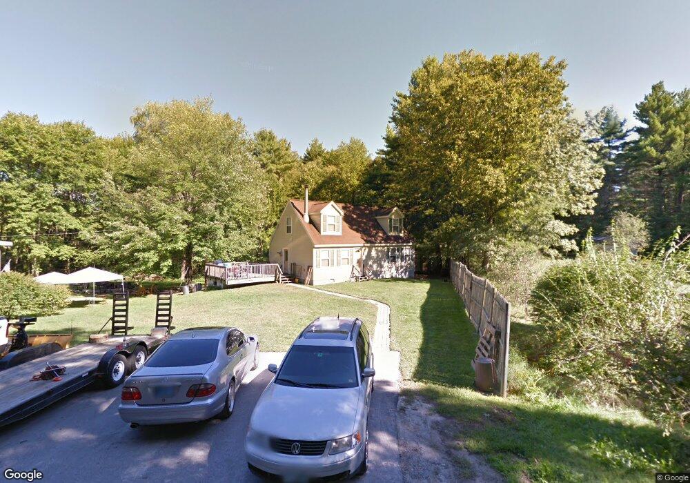
15 Fanny Dr Allenstown, NH 03275
Suncook NeighborhoodEstimated Value: $431,000 - $504,000
3
Beds
2
Baths
1,488
Sq Ft
$321/Sq Ft
Est. Value
About This Home
This home is located at 15 Fanny Dr, Allenstown, NH 03275 and is currently estimated at $477,225, approximately $320 per square foot. 15 Fanny Dr is a home located in Merrimack County with nearby schools including Allenstown Elementary School, Armand R. Dupont School, and Tender Years Child Care & Learning Center.
Ownership History
Date
Name
Owned For
Owner Type
Purchase Details
Closed on
Oct 22, 2004
Sold by
Lyon Troy
Bought by
Caputo Jessica R
Current Estimated Value
Home Financials for this Owner
Home Financials are based on the most recent Mortgage that was taken out on this home.
Original Mortgage
$140,625
Interest Rate
5.85%
Mortgage Type
Purchase Money Mortgage
Purchase Details
Closed on
Nov 8, 1999
Sold by
Bourke Michael A and Bourke Shirley A
Bought by
Conseco Fin Svcs
Create a Home Valuation Report for This Property
The Home Valuation Report is an in-depth analysis detailing your home's value as well as a comparison with similar homes in the area
Home Values in the Area
Average Home Value in this Area
Purchase History
| Date | Buyer | Sale Price | Title Company |
|---|---|---|---|
| Caputo Jessica R | $188,000 | -- | |
| Conseco Fin Svcs | $93,000 | -- |
Source: Public Records
Mortgage History
| Date | Status | Borrower | Loan Amount |
|---|---|---|---|
| Open | Conseco Fin Svcs | $186,200 | |
| Closed | Conseco Fin Svcs | $140,625 | |
| Previous Owner | Conseco Fin Svcs | $83,075 |
Source: Public Records
Tax History Compared to Growth
Tax History
| Year | Tax Paid | Tax Assessment Tax Assessment Total Assessment is a certain percentage of the fair market value that is determined by local assessors to be the total taxable value of land and additions on the property. | Land | Improvement |
|---|---|---|---|---|
| 2024 | $9,477 | $372,800 | $109,000 | $263,800 |
| 2023 | $7,903 | $372,800 | $109,000 | $263,800 |
| 2022 | $7,270 | $372,800 | $109,000 | $263,800 |
| 2021 | $7,280 | $231,100 | $65,200 | $165,900 |
| 2020 | $6,522 | $222,600 | $65,200 | $157,400 |
| 2019 | $6,802 | $218,700 | $65,200 | $153,500 |
| 2018 | $6,087 | $201,900 | $65,200 | $136,700 |
| 2017 | $6,207 | $193,300 | $65,200 | $128,100 |
| 2016 | $5,668 | $167,400 | $48,900 | $118,500 |
| 2015 | $4,941 | $150,500 | $46,500 | $104,000 |
| 2014 | $5,084 | $150,500 | $46,500 | $104,000 |
| 2013 | $4,745 | $150,500 | $46,500 | $104,000 |
Source: Public Records
Map
Nearby Homes
- 307 Dearborn Rd
- 9 Pine Acres Rd
- 1 1/2 Bartlett St
- 19 Sullivan Dr
- 111 Glass St
- 10 Lane Dr
- 2 Cheryl Dr
- 12-14 Church St Unit 12,14
- 422 Dawn Dr Unit 23
- 427 Dawn Dr Unit 15
- 233 Pembroke St
- 100 Main St Unit M10
- 100 Main St Unit 204
- 15 Sullivan Dr
- 259 Pembroke St
- 4 Rodger Rd
- 7 Ferry St
- 101 4th Range Rd Unit 4
- 15 Main St
- 5 Catamount Hill Dr
- 11 Fanny Dr
- 21 Fanny Dr
- 1 Riverside Park Rd
- 1 Riverside Dr
- 4 Riverside Dr
- 92 Pinewood Rd
- 5 Riverside Dr
- 6 Riverside Dr
- 10 Riverside Dr
- 11 Riverside Dr
- 12 Riverside Dr
- 91 Pinewood Rd
- 20 Riverside Dr
- 14 Riverside Dr
- 24 Riverside Dr
- 17 Riverside Dr
- 26 Riverside Dr
- 28 Riverside Dr
- 126 River Rd
- 30 Riverside Dr