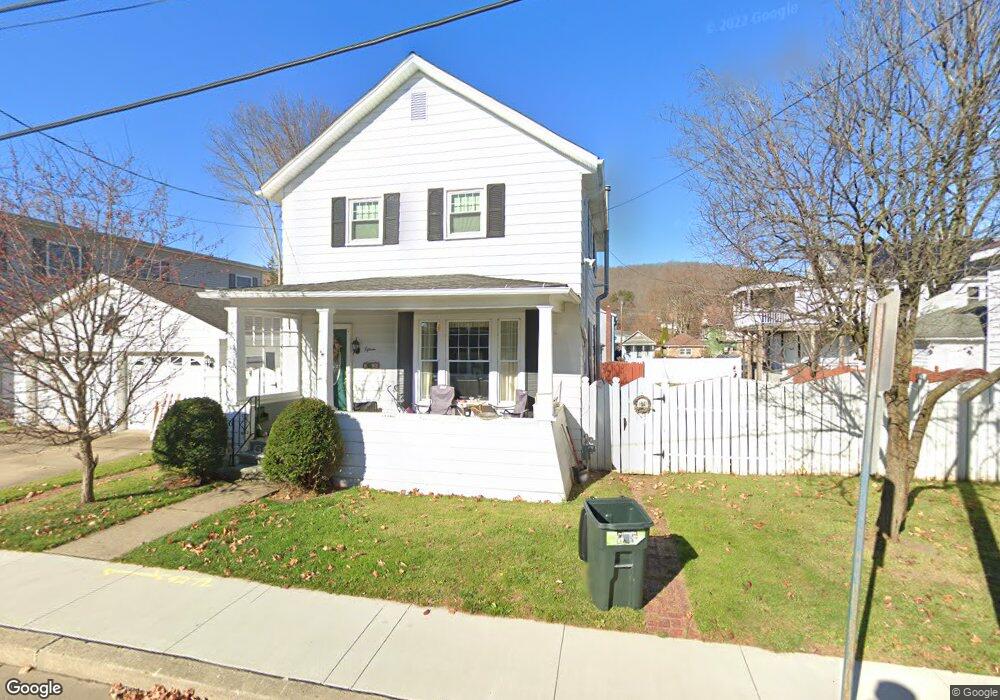
15 Forman St Bradford, PA 16701
Estimated Value: $128,000
4
Beds
2
Baths
1,694
Sq Ft
$76/Sq Ft
Est. Value
About This Home
This home is located at 15 Forman St, Bradford, PA 16701 and is currently estimated at $128,000, approximately $75 per square foot. 15 Forman St is a home located in McKean County with nearby schools including George Blaisdell Elementary School, School Street Elementary School, and Floyd C. Fretz Middle School.
Ownership History
Date
Name
Owned For
Owner Type
Purchase Details
Closed on
Dec 6, 2024
Sold by
Mascho Michael L
Bought by
Mascho Michael L
Current Estimated Value
Purchase Details
Closed on
Apr 9, 2021
Sold by
Obrien Timothy J and Obrien Nancy E
Bought by
Mascho Michael L
Home Financials for this Owner
Home Financials are based on the most recent Mortgage that was taken out on this home.
Original Mortgage
$90,000
Interest Rate
3.1%
Mortgage Type
Commercial
Purchase Details
Closed on
Oct 19, 2015
Sold by
Brien Daniel J O and Brien Sandra K O
Bought by
Brien Timothy J O and Brien Thomas W O
Purchase Details
Closed on
Dec 21, 2009
Sold by
Obrien Daniel J and Obrien Sandra K
Bought by
Obrien Daniel J and Obrien Sandra K
Create a Home Valuation Report for This Property
The Home Valuation Report is an in-depth analysis detailing your home's value as well as a comparison with similar homes in the area
Home Values in the Area
Average Home Value in this Area
Purchase History
| Date | Buyer | Sale Price | Title Company |
|---|---|---|---|
| Mascho Michael L | -- | None Listed On Document | |
| Mascho Michael L | -- | None Listed On Document | |
| Mascho Michael L | $90,000 | None Listed On Document | |
| Brien Timothy J O | -- | None Available | |
| Obrien Daniel J | -- | None Available |
Source: Public Records
Mortgage History
| Date | Status | Borrower | Loan Amount |
|---|---|---|---|
| Previous Owner | Mascho Michael L | $90,000 |
Source: Public Records
Tax History Compared to Growth
Tax History
| Year | Tax Paid | Tax Assessment Tax Assessment Total Assessment is a certain percentage of the fair market value that is determined by local assessors to be the total taxable value of land and additions on the property. | Land | Improvement |
|---|---|---|---|---|
| 2024 | $2,141 | $40,480 | $5,550 | $34,930 |
| 2023 | $2,141 | $40,480 | $5,550 | $34,930 |
| 2022 | $2,141 | $40,480 | $5,550 | $34,930 |
| 2021 | $2,141 | $40,480 | $5,550 | $34,930 |
| 2020 | $2,141 | $40,480 | $5,550 | $34,930 |
| 2019 | $2,080 | $40,480 | $5,550 | $34,930 |
| 2018 | $21 | $40,480 | $5,550 | $34,930 |
| 2017 | -- | $40,480 | $5,550 | $34,930 |
| 2016 | $2,009 | $40,480 | $5,550 | $34,930 |
| 2015 | $1,003 | $40,480 | $5,550 | $34,930 |
| 2014 | $1,003 | $40,480 | $5,550 | $34,930 |
Source: Public Records
Map
Nearby Homes
- 26 Jackson Ave
- 11 Boylston St
- 22 Williams St
- 65 Jackson Ave
- 25 School St
- 52 Summer St
- 52 Elm St
- 112 Pleasant St
- 79 Main St
- 170 Elm St
- 126 Barbour St
- 160 Pleasant St
- 165 Pleasant St
- 173 Pleasant St
- 28 Rosedale Ave
- 51 Interstate Pkwy
- 174 N Bennett St
- 0 W Washington St Unit R1643118
- 2 Abbott Rd
- 149 Jackson Ave