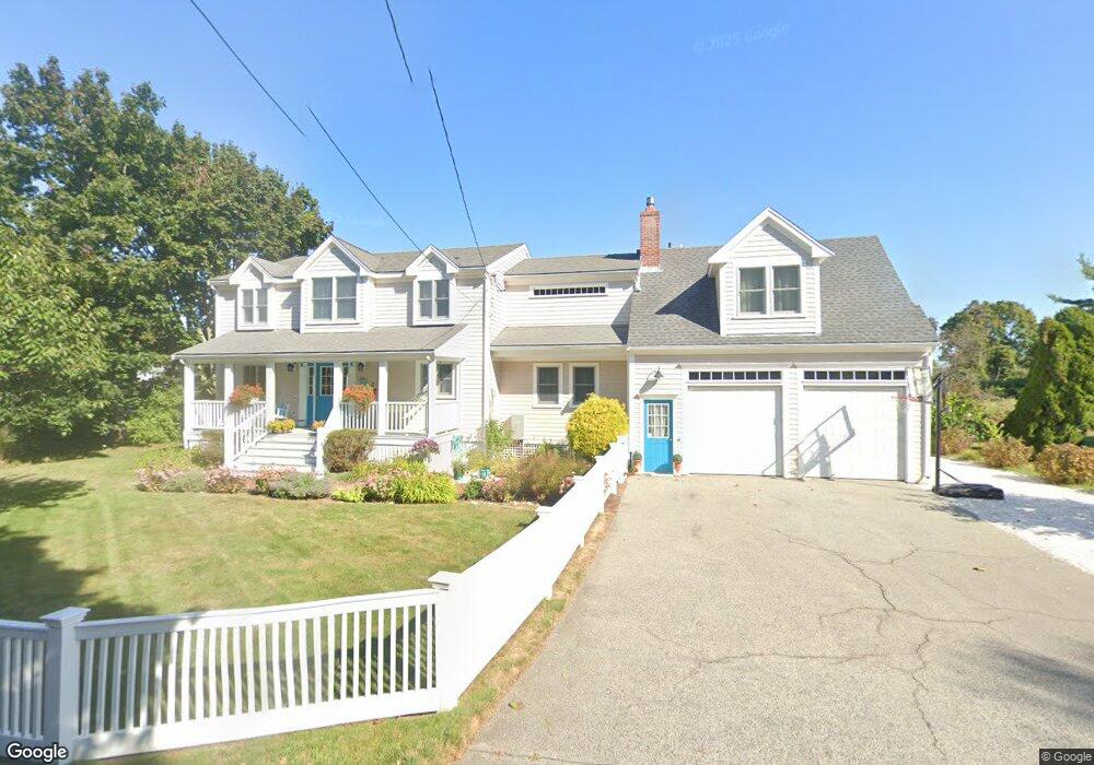
15 Gilson Rd Scituate, MA 02066
Estimated Value: $1,016,000 - $1,490,000
3
Beds
4
Baths
2,664
Sq Ft
$492/Sq Ft
Est. Value
About This Home
This home is located at 15 Gilson Rd, Scituate, MA 02066 and is currently estimated at $1,309,992, approximately $491 per square foot. 15 Gilson Rd is a home located in Plymouth County with nearby schools including Jenkins Elementary School, Lester J. Gates Middle School, and Scituate High School.
Ownership History
Date
Name
Owned For
Owner Type
Purchase Details
Closed on
Jun 21, 2024
Sold by
Manning Christa
Bought by
Christa Degnan Manning Lt and Manning
Current Estimated Value
Purchase Details
Closed on
Nov 15, 2004
Sold by
Williams James H and Williams Dawn
Bought by
Manning Robert and Degnan Christa
Home Financials for this Owner
Home Financials are based on the most recent Mortgage that was taken out on this home.
Original Mortgage
$539,920
Interest Rate
5.75%
Mortgage Type
Purchase Money Mortgage
Purchase Details
Closed on
Jun 18, 2001
Sold by
Boynton James A and Boynton Melissa
Bought by
Williams James H and Williams Dawn
Purchase Details
Closed on
Mar 24, 1998
Sold by
Zucker Dennis
Bought by
Boynton James A and Boynton Melissa J
Create a Home Valuation Report for This Property
The Home Valuation Report is an in-depth analysis detailing your home's value as well as a comparison with similar homes in the area
Home Values in the Area
Average Home Value in this Area
Purchase History
| Date | Buyer | Sale Price | Title Company |
|---|---|---|---|
| Christa Degnan Manning Lt | -- | None Available | |
| Manning Robert | $674,900 | -- | |
| Manning Robert | $674,900 | -- | |
| Williams James H | $479,900 | -- | |
| Williams James H | $479,900 | -- | |
| Boynton James A | $130,000 | -- | |
| Boynton James A | $130,000 | -- |
Source: Public Records
Mortgage History
| Date | Status | Borrower | Loan Amount |
|---|---|---|---|
| Previous Owner | Boynton James A | $55,000 | |
| Previous Owner | Boynton James A | $539,920 |
Source: Public Records
Tax History Compared to Growth
Tax History
| Year | Tax Paid | Tax Assessment Tax Assessment Total Assessment is a certain percentage of the fair market value that is determined by local assessors to be the total taxable value of land and additions on the property. | Land | Improvement |
|---|---|---|---|---|
| 2025 | $10,162 | $1,017,200 | $513,200 | $504,000 |
| 2024 | $9,882 | $953,900 | $485,200 | $468,700 |
| 2023 | $9,385 | $843,200 | $441,100 | $402,100 |
| 2022 | $9,062 | $718,100 | $376,700 | $341,400 |
| 2021 | $8,783 | $658,900 | $358,700 | $300,200 |
| 2020 | $8,519 | $631,000 | $344,900 | $286,100 |
| 2019 | $8,401 | $611,400 | $338,100 | $273,300 |
| 2018 | $8,062 | $577,900 | $326,300 | $251,600 |
| 2017 | $7,707 | $547,000 | $304,500 | $242,500 |
| 2016 | $7,735 | $547,000 | $304,500 | $242,500 |
| 2015 | $6,881 | $525,300 | $282,800 | $242,500 |
Source: Public Records
Map
Nearby Homes
- 59 Greenfield Ln
- 67 Greenfield Ln
- 12 Meeting House Ln Unit 308
- 2 Collier Rd
- 37 Moorland Rd
- 50 First Parish Rd
- 48 Moorland Rd
- 91 Front St Unit 106
- 76 A Brook St
- 76 A Brook St Unit 1
- 29 Ladds Way Unit 29
- 23 Sunset Rd
- 74 Tilden Rd
- 19 Ford Place Unit 3
- 19 Ford Place Unit 1
- 19 Ford Place Unit 4
- 146 Chief Justice Cushing Hwy
- 12 Sassamon Rd
- 32 Barker Rd Unit 3
- 12 Richfield Rd
- 11 Gilson Rd
- 9 Gilson Rd
- 17 Gilson Rd
- 14 Gilson Rd
- 21 Gilson Rd
- 18 Gilson Rd
- 129 Kent St
- 0 Greenfield Ln Unit 72120105
- 133 Kent St
- 25 Gilson Rd Unit MA
- 25 Gilson Rd
- 125 Kent St
- 12 Gilson Rd
- 29 Gilson Rd
- 12 Blanchard Rd
- 8 Blanchard Rd
- 26 Gilson Rd
- 16 Blanchard Rd
- 20 Blanchard Rd
- 4 Blanchard Rd Unit FARM