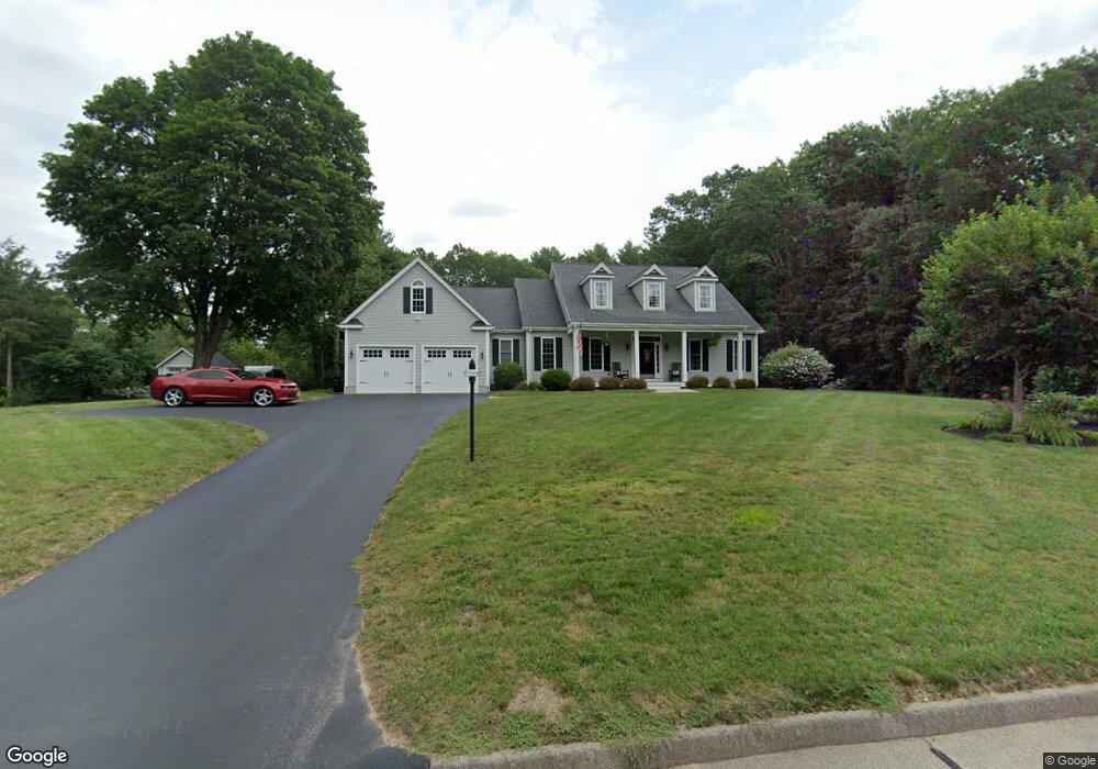
15 Heather Ln Wrentham, MA 02093
West Wrentham NeighborhoodEstimated Value: $813,000 - $932,000
3
Beds
3
Baths
2,206
Sq Ft
$401/Sq Ft
Est. Value
About This Home
This home is located at 15 Heather Ln, Wrentham, MA 02093 and is currently estimated at $883,930, approximately $400 per square foot. 15 Heather Ln is a home located in Norfolk County with nearby schools including Delaney Elementary School, Charles E Roderick, and Mercymount Country Day School.
Ownership History
Date
Name
Owned For
Owner Type
Purchase Details
Closed on
Sep 29, 2025
Sold by
Robitaille Robert R and Robitaille Kathryn A
Bought by
Robitaille Ft and Robitaille
Current Estimated Value
Purchase Details
Closed on
May 24, 2010
Sold by
Mckenna William J and Mckenna Mary J
Bought by
Robitaille Robert R and Robitaille Kathryn A
Home Financials for this Owner
Home Financials are based on the most recent Mortgage that was taken out on this home.
Original Mortgage
$210,000
Interest Rate
5.23%
Mortgage Type
Purchase Money Mortgage
Create a Home Valuation Report for This Property
The Home Valuation Report is an in-depth analysis detailing your home's value as well as a comparison with similar homes in the area
Home Values in the Area
Average Home Value in this Area
Purchase History
| Date | Buyer | Sale Price | Title Company |
|---|---|---|---|
| Robitaille Ft | -- | -- | |
| Robitaille Robert R | $210,000 | -- | |
| Robitaille Robert R | $210,000 | -- |
Source: Public Records
Mortgage History
| Date | Status | Borrower | Loan Amount |
|---|---|---|---|
| Previous Owner | Robitaille Robert R | $210,000 |
Source: Public Records
Tax History Compared to Growth
Tax History
| Year | Tax Paid | Tax Assessment Tax Assessment Total Assessment is a certain percentage of the fair market value that is determined by local assessors to be the total taxable value of land and additions on the property. | Land | Improvement |
|---|---|---|---|---|
| 2025 | $9,484 | $818,300 | $288,000 | $530,300 |
| 2024 | $8,676 | $723,000 | $288,000 | $435,000 |
| 2023 | $8,607 | $682,000 | $261,900 | $420,100 |
| 2022 | $8,824 | $645,500 | $255,100 | $390,400 |
| 2021 | $8,584 | $610,100 | $238,400 | $371,700 |
| 2020 | $7,960 | $558,600 | $182,000 | $376,600 |
| 2019 | $7,797 | $552,200 | $182,000 | $370,200 |
| 2018 | $7,566 | $531,300 | $181,800 | $349,500 |
| 2017 | $7,407 | $519,800 | $178,300 | $341,500 |
| 2016 | $7,306 | $511,600 | $173,200 | $338,400 |
| 2015 | $7,271 | $485,400 | $166,500 | $318,900 |
| 2014 | $7,199 | $470,200 | $160,100 | $310,100 |
Source: Public Records
Map
Nearby Homes
- 50 Heather Ln
- 60 Grant Ave
- 39 Sumner Brown Rd
- 236 Williams St
- 2095 West St
- 4 Evans St
- 180 Pine Swamp Rd
- 56 Pine Swamp Rd
- 300 Tower Hill Rd
- 4022 Diamond Hill Rd
- 11 Amber Dr
- 25 Nature View Dr
- 20 Nature View Dr
- 51 Reservoir Rd
- 80 Carriage House Ln
- 955 Summer St
- 17 Stanford Rd
- 10 Stanford Rd
- 19 Chestnut Lot 0
- 851 Washington St
- 25 Heather Ln
- 20 Heather Ln
- 87 Cumberland Rd
- 77 Cumberland Rd
- 10 Heather Ln
- 30 Heather Ln
- 80 Cumberland Rd
- 35 Heather Ln
- 40 Heather Ln
- 145 Cumberland Rd
- 44 Ray Rd
- 10 Comstock Dr
- 133 Cumberland Rd
- 155 Cumberland Rd
- 0 Lot 5 Comstock Unit 50357240
- 5 Comstock Dr
- 10 Grants Mill Rd
- 50 Cumberland Rd
- 5 Grants Mill Rd
- 57 Ray Rd