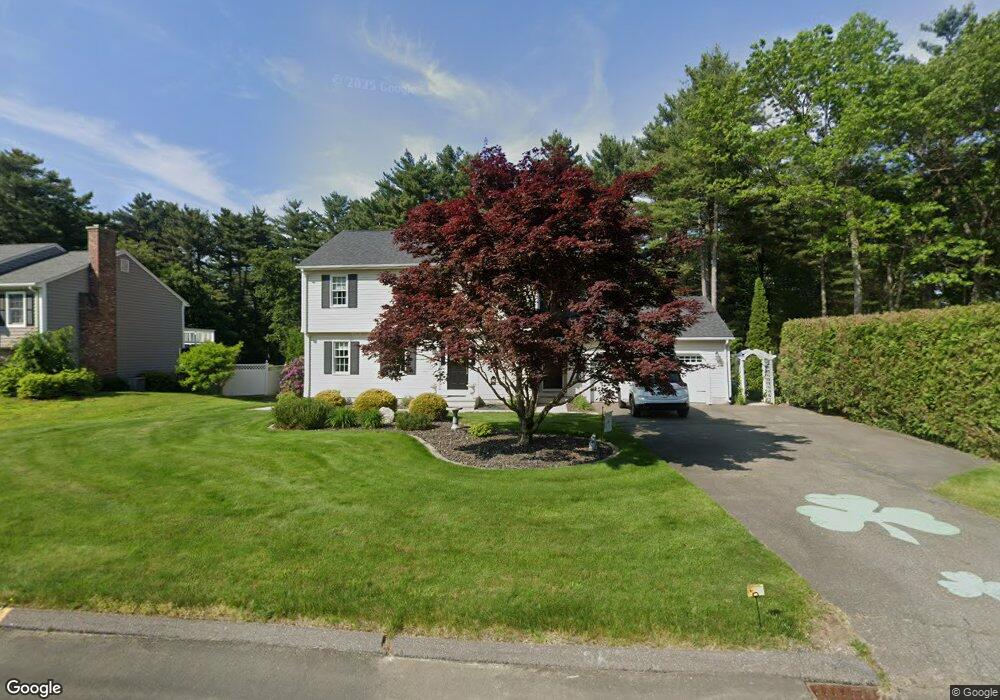
15 Hemlock Dr Holyoke, MA 01040
Estimated Value: $479,050 - $629,000
3
Beds
2
Baths
2,048
Sq Ft
$264/Sq Ft
Est. Value
About This Home
This home is located at 15 Hemlock Dr, Holyoke, MA 01040 and is currently estimated at $540,263, approximately $263 per square foot. 15 Hemlock Dr is a home located in Hampden County with nearby schools including Lt. Clayre Sullivan Elementary School, Holyoke High School, and Westfield Christian Academy.
Ownership History
Date
Name
Owned For
Owner Type
Purchase Details
Closed on
Sep 26, 2001
Sold by
Moye Donald and Moye Michelle E
Bought by
Walsh Jeffrey E and Walsh Dianne F
Current Estimated Value
Home Financials for this Owner
Home Financials are based on the most recent Mortgage that was taken out on this home.
Original Mortgage
$168,000
Interest Rate
6.91%
Mortgage Type
Purchase Money Mortgage
Purchase Details
Closed on
Dec 1, 1989
Sold by
Ngw Dev Inc
Bought by
Moye Donald
Create a Home Valuation Report for This Property
The Home Valuation Report is an in-depth analysis detailing your home's value as well as a comparison with similar homes in the area
Home Values in the Area
Average Home Value in this Area
Purchase History
| Date | Buyer | Sale Price | Title Company |
|---|---|---|---|
| Walsh Jeffrey E | $233,000 | -- | |
| Moye Donald | $181,500 | -- | |
| Moye Donald | $181,500 | -- |
Source: Public Records
Mortgage History
| Date | Status | Borrower | Loan Amount |
|---|---|---|---|
| Closed | Moye Donald | $50,000 | |
| Open | Moye Donald | $145,000 | |
| Closed | Moye Donald | $168,000 |
Source: Public Records
Tax History Compared to Growth
Tax History
| Year | Tax Paid | Tax Assessment Tax Assessment Total Assessment is a certain percentage of the fair market value that is determined by local assessors to be the total taxable value of land and additions on the property. | Land | Improvement |
|---|---|---|---|---|
| 2025 | $6,895 | $394,900 | $66,300 | $328,600 |
| 2024 | $6,644 | $350,600 | $63,200 | $287,400 |
| 2023 | $6,273 | $334,400 | $63,200 | $271,200 |
| 2022 | $5,992 | $311,100 | $63,200 | $247,900 |
| 2021 | $5,727 | $297,200 | $60,400 | $236,800 |
| 2020 | $5,415 | $283,800 | $60,400 | $223,400 |
| 2019 | $3,149 | $283,300 | $60,400 | $222,900 |
| 2018 | $3,100 | $271,600 | $60,400 | $211,200 |
| 2017 | $5,207 | $271,600 | $60,400 | $211,200 |
| 2016 | $5,101 | $266,800 | $62,400 | $204,400 |
| 2015 | $5,080 | $266,800 | $62,400 | $204,400 |
Source: Public Records
Map
Nearby Homes
- 36 County Rd
- 39 Cook Rd
- 178 County Rd
- 267 Southampton Rd
- 63 Pomeroy St
- 26 Eastwood Ln
- 7 Western View Rd
- Lot 57 White Loaf Rd
- 59 Mountain Rd
- 40 Division St
- 40 Strong Rd
- 1 Autumn Dr
- 13 Golden Dr
- 128 Middle Rd
- 94 Pequot Rd (Rear)
- 9 Sandra Rd
- 150 Middle Rd
- 21 Old County Rd
- 369 College Hwy
- 351 Apremont Hsy
- 11 Hemlock Dr
- 14 Hemlock Dr
- 12 Hemlock Dr
- 16 Hemlock Dr
- 9 Hemlock Dr
- 5 Deer Run
- 10 Hemlock Dr
- 18 Hemlock Dr
- 7 Hemlock Dr
- 411 Southampton Rd
- 413 Southampton Rd
- 409 Southampton Rd
- 415 Southampton Rd
- 407 Southampton Rd
- 8 Deer Run
- 5 Hemlock Dr
- 417 Southampton Rd
- 405 Southampton Rd
- 419 Southampton Rd
- 403 Southampton Rd