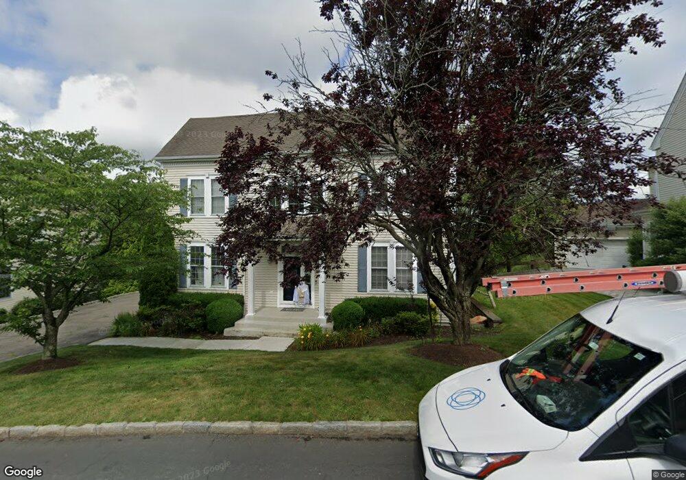
15 High Point Cir Port Chester, NY 10573
Purchase NeighborhoodEstimated Value: $1,469,995 - $1,496,000
4
Beds
4
Baths
3,442
Sq Ft
$432/Sq Ft
Est. Value
About This Home
This home is located at 15 High Point Cir, Port Chester, NY 10573 and is currently estimated at $1,485,998, approximately $431 per square foot. 15 High Point Cir is a home located in Westchester County with nearby schools including Bruno M. Ponterio Ridge Street School, Blind Brook Rye Middle School, and Blind Brook High School.
Ownership History
Date
Name
Owned For
Owner Type
Purchase Details
Closed on
Sep 27, 2016
Sold by
Aaj Family Llc
Bought by
Hashimoto Yuta and Nakamura-Hashimoto Yuka
Current Estimated Value
Home Financials for this Owner
Home Financials are based on the most recent Mortgage that was taken out on this home.
Original Mortgage
$450,000
Outstanding Balance
$360,759
Interest Rate
3.46%
Mortgage Type
New Conventional
Estimated Equity
$1,125,239
Purchase Details
Closed on
Oct 2, 2009
Sold by
Schmid Dorothy A Eremita
Bought by
Aaj Family Llc
Purchase Details
Closed on
Jul 19, 2000
Sold by
The Bellefair Home & Land Company
Bought by
Siegel Daniel S and Siegel Susan B
Create a Home Valuation Report for This Property
The Home Valuation Report is an in-depth analysis detailing your home's value as well as a comparison with similar homes in the area
Home Values in the Area
Average Home Value in this Area
Purchase History
| Date | Buyer | Sale Price | Title Company |
|---|---|---|---|
| Hashimoto Yuta | $1,055,000 | Madison Title Agency Llc | |
| Aaj Family Llc | $955,000 | Future Title Company Inc | |
| Siegel Daniel S | $519,691 | -- |
Source: Public Records
Mortgage History
| Date | Status | Borrower | Loan Amount |
|---|---|---|---|
| Open | Hashimoto Yuta | $450,000 |
Source: Public Records
Tax History Compared to Growth
Tax History
| Year | Tax Paid | Tax Assessment Tax Assessment Total Assessment is a certain percentage of the fair market value that is determined by local assessors to be the total taxable value of land and additions on the property. | Land | Improvement |
|---|---|---|---|---|
| 2024 | $34,593 | $1,253,700 | $173,500 | $1,080,200 |
| 2023 | $31,082 | $1,205,500 | $165,200 | $1,040,300 |
| 2022 | $31,689 | $1,126,600 | $165,200 | $961,400 |
| 2021 | $31,352 | $1,083,300 | $165,200 | $918,100 |
| 2020 | $28,079 | $1,083,300 | $165,200 | $918,100 |
| 2019 | $52,485 | $1,097,600 | $146,800 | $950,800 |
| 2018 | $19,673 | $1,076,100 | $144,200 | $931,900 |
| 2017 | $4,604 | $1,078,100 | $142,900 | $935,200 |
| 2016 | $40,649 | $1,087,300 | $181,400 | $905,900 |
| 2015 | -- | $1,058,500 | $145,100 | $913,400 |
| 2014 | -- | $952,600 | $123,400 | $829,200 |
| 2013 | -- | $967,500 | $120,100 | $847,400 |
Source: Public Records
Map
Nearby Homes
- 26 Reunion Rd
- 21 Honeysuckle Ln
- 27 Lavender Ln
- 1 Primrose Ln
- 1 Element Ln
- 8 Chieftans Rd
- 15 Arrowwood Cir Unit 136
- 27 Doral Greens Dr E
- 125 Bowman Dr
- 21 Dorann Rd
- 5 Bristol Ln
- 6 Katsura Dr
- 3747 Purchase St
- 9 Lincoln Woods
- 28 Thunder Mountain Rd
- 53 Country Ridge Dr
- 1 Cedar Ln
- 122 Lincoln Ave
- 267 Riversville Rd
- 29 Beverly Rd
- 17 High Point Cir
- 11 High Point Cir
- 16 High Point Cir
- 19 High Point Cir
- 9 High Point Cir
- 14 High Point Cir
- 12 High Point Cir
- 10 High Point Cir
- 40 Bellefair Rd
- 42 Bellefair Rd
- 38 Bellefair Rd
- 2 Parade Ln
- 8 High Point Cir
- 44 Bellefair Rd
- 1 Parade Ln
- 6 Heritage Ct
- 21 High Point Cir
- 7 High Point Cir
- 46 Bellefair Rd
- 4 Parade Ln