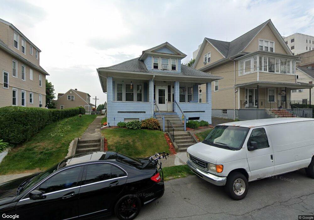
15 Hunting St Bridgeport, CT 06606
Brooklawn-Saint Vincent NeighborhoodEstimated Value: $349,000 - $434,000
3
Beds
1
Bath
1,632
Sq Ft
$234/Sq Ft
Est. Value
About This Home
This home is located at 15 Hunting St, Bridgeport, CT 06606 and is currently estimated at $381,129, approximately $233 per square foot. 15 Hunting St is a home located in Fairfield County with nearby schools including Read School, Central High School, and Catholic Academy of Bridgeport-St. Raphael Academy.
Ownership History
Date
Name
Owned For
Owner Type
Purchase Details
Closed on
Nov 21, 1996
Sold by
Devellis Frances Est
Bought by
Kapral Susan A
Current Estimated Value
Home Financials for this Owner
Home Financials are based on the most recent Mortgage that was taken out on this home.
Original Mortgage
$52,200
Outstanding Balance
$5,018
Interest Rate
7.81%
Mortgage Type
Unknown
Estimated Equity
$376,111
Create a Home Valuation Report for This Property
The Home Valuation Report is an in-depth analysis detailing your home's value as well as a comparison with similar homes in the area
Home Values in the Area
Average Home Value in this Area
Purchase History
| Date | Buyer | Sale Price | Title Company |
|---|---|---|---|
| Kapral Susan A | $55,000 | -- | |
| Kapral Susan A | $55,000 | -- |
Source: Public Records
Mortgage History
| Date | Status | Borrower | Loan Amount |
|---|---|---|---|
| Open | Kapral Susan A | $52,200 | |
| Closed | Kapral Susan A | $52,200 |
Source: Public Records
Tax History Compared to Growth
Tax History
| Year | Tax Paid | Tax Assessment Tax Assessment Total Assessment is a certain percentage of the fair market value that is determined by local assessors to be the total taxable value of land and additions on the property. | Land | Improvement |
|---|---|---|---|---|
| 2025 | $5,600 | $128,890 | $71,090 | $57,800 |
| 2024 | $5,600 | $128,890 | $71,090 | $57,800 |
| 2023 | $5,600 | $128,890 | $71,090 | $57,800 |
| 2022 | $5,600 | $128,890 | $71,090 | $57,800 |
| 2021 | $5,600 | $128,890 | $71,090 | $57,800 |
| 2020 | $5,701 | $105,600 | $43,080 | $62,520 |
| 2019 | $5,701 | $105,600 | $43,080 | $62,520 |
| 2018 | $5,741 | $105,600 | $43,080 | $62,520 |
| 2017 | $5,741 | $105,600 | $43,080 | $62,520 |
| 2016 | $5,741 | $105,600 | $43,080 | $62,520 |
| 2015 | $5,295 | $125,480 | $43,440 | $82,040 |
| 2014 | $5,295 | $125,480 | $43,440 | $82,040 |
Source: Public Records
Map
Nearby Homes
- 936 Lindley St
- 926 Hart St
- 916 Hart St
- 330 French St
- 39 Infield St
- 1265 Lindley St
- 138 Infield St
- 106 Manhattan Ave Unit 108
- 508 Hawley Ave
- 123 Harlem Ave
- 235 Indian Ave
- 245 Indian Ave
- 45 Stevens St Unit 2
- 2395 Main St Unit 2397
- 355 Chamberlain Ave
- 330 Oakwood St
- 203 Wayne St
- 385 Chamberlain Ave
- 724 Capitol Ave Unit 726
- 119 Madison Terrace
- 25 Hunting St Unit 25-27
- 25 Hunting St Unit 27
- 25 Hunting St Unit 1
- 25 Hunting St Unit 2
- 25 Hunting St Unit 3
- 25-27 Hunting St Unit 2
- 7 Hunting St Unit second floor
- 7 Hunting St
- 7-9 Hunting St
- 909 Lindley St
- 280 Gurdon St
- 4 Hunting St
- 14 Hunting St
- 18 Hunting St
- 270 Gurdon St
- 30 Hunting St
- 897 Lindley St
- 260 Gurdon St
- 40 Hunting St
- 934 Lindley St