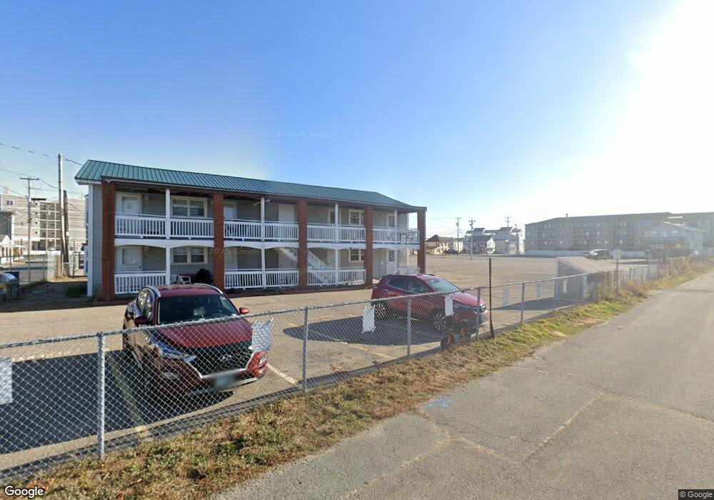
15 Island Path Unit 1 Hampton, NH 03842
Estimated Value: $215,000 - $260,000
1
Bed
1
Bath
432
Sq Ft
$545/Sq Ft
Est. Value
About This Home
This home is located at 15 Island Path Unit 1, Hampton, NH 03842 and is currently estimated at $235,225, approximately $544 per square foot. 15 Island Path Unit 1 is a home located in Rockingham County with nearby schools including Hampton Centre School, Adeline C. Marston Elementary School, and Hampton Academy.
Ownership History
Date
Name
Owned For
Owner Type
Purchase Details
Closed on
Apr 25, 2008
Sold by
Damato Marlene Est
Bought by
Blondeau Raymond G and Blondeau Vivian R
Current Estimated Value
Purchase Details
Closed on
Nov 20, 2000
Sold by
Dufresne Edward H and Dufresne Catherine A
Bought by
Dufresne Edward H and Dufresne Bonnie L
Home Financials for this Owner
Home Financials are based on the most recent Mortgage that was taken out on this home.
Original Mortgage
$55,000
Interest Rate
7.78%
Create a Home Valuation Report for This Property
The Home Valuation Report is an in-depth analysis detailing your home's value as well as a comparison with similar homes in the area
Home Values in the Area
Average Home Value in this Area
Purchase History
| Date | Buyer | Sale Price | Title Company |
|---|---|---|---|
| Blondeau Raymond G | $250,000 | -- | |
| Dufresne Edward H | $79,000 | -- |
Source: Public Records
Mortgage History
| Date | Status | Borrower | Loan Amount |
|---|---|---|---|
| Previous Owner | Dufresne Edward H | $55,000 |
Source: Public Records
Tax History Compared to Growth
Tax History
| Year | Tax Paid | Tax Assessment Tax Assessment Total Assessment is a certain percentage of the fair market value that is determined by local assessors to be the total taxable value of land and additions on the property. | Land | Improvement |
|---|---|---|---|---|
| 2024 | $2,303 | $186,900 | $0 | $186,900 |
| 2023 | $2,281 | $136,200 | $0 | $136,200 |
| 2022 | $2,157 | $136,200 | $0 | $136,200 |
| 2021 | $2,157 | $136,200 | $0 | $136,200 |
| 2020 | $2,170 | $136,200 | $0 | $136,200 |
| 2019 | $2,181 | $136,200 | $0 | $136,200 |
| 2018 | $1,743 | $102,400 | $0 | $102,400 |
| 2017 | $1,676 | $102,400 | $0 | $102,400 |
| 2016 | $1,647 | $102,400 | $0 | $102,400 |
| 2015 | $1,638 | $85,500 | $0 | $85,500 |
| 2014 | $1,566 | $85,500 | $0 | $85,500 |
Source: Public Records
Map
Nearby Homes
- 12 Kentville Terrace
- 10 Kentville Terrace
- 73 Church St
- 19 F St
- 27 Hobson Ave
- 22 1/2 I St Unit 2
- 401A Ocean Blvd Unit 1
- 401A Ocean Blvd Unit 2
- 16 Bruce St
- 435 Ocean Blvd Unit 401
- 3 Perkins Ave Unit 1
- 27 Perkins Ave
- 17 Johnson Ave
- 449 Ocean Blvd Unit 306
- 449 Ocean Blvd Unit 113
- 449 Ocean Blvd Unit 212
- 449 Ocean Blvd Unit 102
- 461 Ocean Blvd Unit B3
- 461 Ocean Blvd Unit A7
- 465 Ocean Blvd Unit 301
- 15 Island Path Unit 8
- 15 Island Path Unit 7
- 15 Island Path Unit 6
- 15 Island Path Unit 5
- 15 Island Path Unit 4
- 15 Island Path Unit 3
- 15 Island Path Unit 2
- 12 Island Path
- 10 Island Path
- 21 Island Path
- 21 Island Path Unit ID1045445P
- 10 Jones Ave Unit 6
- 8 Jones Ave
- 12 Jones Ave Unit 4 Avenue
- 12 Jones Ave Unit 5
- 8 Jones Ave Unit 5
- 16 Jones Ave
- 8-16 Jones Ave
- 22 Island Path Unit 1
- 22 Island Path