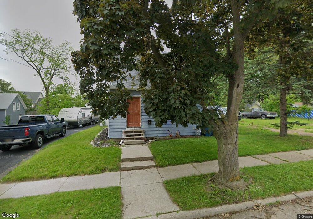
15 Janoah Ave Battle Creek, MI 49015
Central Battle Creek NeighborhoodEstimated Value: $60,000 - $119,000
3
Beds
1
Bath
1,340
Sq Ft
$71/Sq Ft
Est. Value
About This Home
This home is located at 15 Janoah Ave, Battle Creek, MI 49015 and is currently estimated at $95,467, approximately $71 per square foot. 15 Janoah Ave is a home located in Calhoun County with nearby schools including Ann J. Kellogg School, Springfield Middle School, and Battle Creek Central High School.
Ownership History
Date
Name
Owned For
Owner Type
Purchase Details
Closed on
Dec 15, 2014
Sold by
Wank Michael
Bought by
Burd Michelle and Burd Steve
Current Estimated Value
Purchase Details
Closed on
Oct 7, 2010
Sold by
Deutsche Bank National Trust Company
Bought by
Wank Michael
Purchase Details
Closed on
Feb 25, 2010
Sold by
Mcdonald Darryl L and Mcdonald Vickie M
Bought by
Deutsche Bank National Trust Company
Purchase Details
Closed on
Sep 15, 2004
Sold by
Washington Fay
Bought by
Mcdonald Darryl L and Mcdonald Vicki M
Purchase Details
Closed on
Feb 26, 2003
Bought by
Washington Fay
Purchase Details
Closed on
Nov 30, 2001
Sold by
Drain Timothy L and Drain Wanda A
Bought by
Bankers Trust Co Trustee
Purchase Details
Closed on
Mar 25, 1996
Bought by
Drain ('92 Lc Ff)
Create a Home Valuation Report for This Property
The Home Valuation Report is an in-depth analysis detailing your home's value as well as a comparison with similar homes in the area
Home Values in the Area
Average Home Value in this Area
Purchase History
| Date | Buyer | Sale Price | Title Company |
|---|---|---|---|
| Burd Michelle | $15,185 | None Available | |
| Wank Michael | $11,500 | None Available | |
| Deutsche Bank National Trust Company | $30,000 | None Available | |
| Mcdonald Darryl L | $25,000 | Fatic | |
| Washington Fay | $19,900 | -- | |
| Bankers Trust Co Trustee | $32,000 | -- | |
| Drain ('92 Lc Ff) | $22,500 | -- |
Source: Public Records
Tax History Compared to Growth
Tax History
| Year | Tax Paid | Tax Assessment Tax Assessment Total Assessment is a certain percentage of the fair market value that is determined by local assessors to be the total taxable value of land and additions on the property. | Land | Improvement |
|---|---|---|---|---|
| 2025 | -- | $35,400 | $0 | $0 |
| 2024 | $646 | $29,721 | $0 | $0 |
| 2023 | $738 | $28,591 | $0 | $0 |
| 2022 | $583 | $20,986 | $0 | $0 |
| 2021 | $696 | $19,219 | $0 | $0 |
| 2020 | $681 | $18,993 | $0 | $0 |
| 2019 | $699 | $14,425 | $0 | $0 |
| 2018 | $699 | $14,645 | $433 | $14,212 |
| 2017 | $858 | $16,673 | $0 | $0 |
| 2016 | $879 | $19,044 | $0 | $0 |
| 2015 | $1,453 | $21,251 | $1,801 | $19,450 |
| 2014 | $1,453 | $22,616 | $1,801 | $20,815 |
Source: Public Records
Map
Nearby Homes
- 17 Tennyson Ave
- 57 Boulder St
- 35 Eldred St
- 71 Burnham St W
- 96 Battle Creek Ave
- 171 Goguac St W
- 296 Meachem Ave
- 66 Cleveland St
- 41 Randolph St
- 1 Grand Blvd
- 210 Battle Creek Ave
- 100 Eldred St
- 212 Goguac St W
- 178 Webber St
- 32 Territorial Rd E
- 21 Spring St
- 9 Foster Ave
- 30 Harris St
- 127 W Territorial Rd
- 39 Harris St
- 19 Janoah Ave
- 23 Janoah Ave
- 18 Tennyson Ave
- 12 Tennyson Ave
- 421 Capital Ave SW
- 417 Capital Ave SW
- 38 Janoah Ave
- 16 Janoah Ave
- 413 Capital Ave SW
- 29 Janoah Ave
- 20 Janoah Ave
- 409 Capital Ave SW
- 30 Tennyson Ave
- 24 Janoah Ave
- 33 Janoah Ave
- 28 Janoah Ave
- 418 Capital Ave SW
- 433 Capital Ave SW
- 36 Tennyson Ave
- 35 Janoah Ave