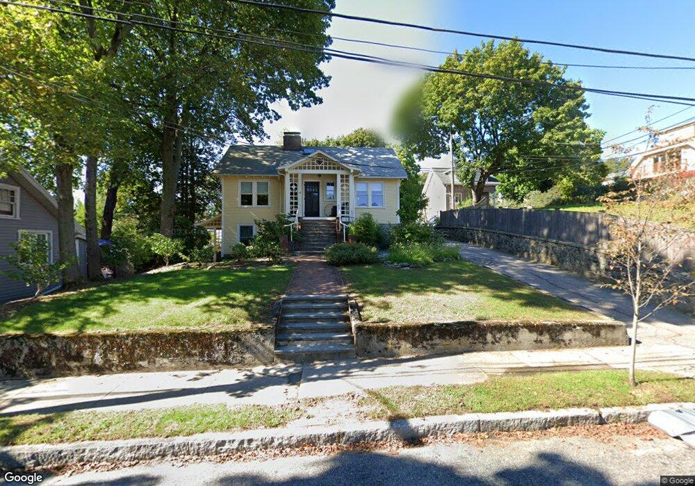
15 Lanark Rd Arlington, MA 02476
Arlington Heights NeighborhoodEstimated Value: $729,000 - $941,892
2
Beds
1
Bath
880
Sq Ft
$949/Sq Ft
Est. Value
About This Home
This home is located at 15 Lanark Rd, Arlington, MA 02476 and is currently estimated at $834,973, approximately $948 per square foot. 15 Lanark Rd is a home located in Middlesex County with nearby schools including Dallin Elementary School, Ottoson Middle School, and Arlington High School.
Ownership History
Date
Name
Owned For
Owner Type
Purchase Details
Closed on
Jul 1, 2015
Sold by
Desenne Philip and Calderon-Saenz Gloria
Bought by
Santospago Andrew and Santospago Karen E
Current Estimated Value
Home Financials for this Owner
Home Financials are based on the most recent Mortgage that was taken out on this home.
Original Mortgage
$383,000
Outstanding Balance
$292,398
Interest Rate
3.83%
Mortgage Type
New Conventional
Estimated Equity
$542,575
Purchase Details
Closed on
Jun 13, 2002
Sold by
Cox Douglas and Rose Sienna
Bought by
Desenne Philip and Claderon-Saenz Gloria
Purchase Details
Closed on
Jul 30, 1997
Sold by
Raab Michael and Raab Elizabeth F
Bought by
Cox Douglas and Cox Susan H
Purchase Details
Closed on
Jun 20, 1994
Sold by
Morash Theresa
Bought by
Patten David and Patten Susan B
Purchase Details
Closed on
Aug 20, 1993
Sold by
Patten Andrew and Patten Meta B
Bought by
Raab Michael and Raab Elizabeth F
Create a Home Valuation Report for This Property
The Home Valuation Report is an in-depth analysis detailing your home's value as well as a comparison with similar homes in the area
Home Values in the Area
Average Home Value in this Area
Purchase History
| Date | Buyer | Sale Price | Title Company |
|---|---|---|---|
| Santospago Andrew | $479,000 | -- | |
| Desenne Philip | $320,000 | -- | |
| Cox Douglas | $222,000 | -- | |
| Cox Douglas W | $222,000 | -- | |
| Patten David | $143,500 | -- | |
| Raab Michael | $189,000 | -- |
Source: Public Records
Mortgage History
| Date | Status | Borrower | Loan Amount |
|---|---|---|---|
| Open | Santospago Andrew | $383,000 | |
| Previous Owner | Raab Michael | $282,000 |
Source: Public Records
Tax History
| Year | Tax Paid | Tax Assessment Tax Assessment Total Assessment is a certain percentage of the fair market value that is determined by local assessors to be the total taxable value of land and additions on the property. | Land | Improvement |
|---|---|---|---|---|
| 2025 | $9,691 | $899,800 | $490,400 | $409,400 |
| 2024 | $8,065 | $761,600 | $472,000 | $289,600 |
| 2023 | $7,719 | $688,600 | $441,300 | $247,300 |
| 2022 | $7,192 | $629,800 | $429,100 | $200,700 |
| 2021 | $7,069 | $623,400 | $429,100 | $194,300 |
| 2020 | $6,895 | $623,400 | $429,100 | $194,300 |
| 2019 | $6,792 | $603,200 | $422,900 | $180,300 |
| 2018 | $6,128 | $505,200 | $324,900 | $180,300 |
| 2017 | $6,114 | $486,800 | $306,500 | $180,300 |
| 2016 | $5,917 | $462,300 | $282,000 | $180,300 |
| 2015 | $5,867 | $433,000 | $263,600 | $169,400 |
Source: Public Records
Map
Nearby Homes
- 12 Arnold St
- 122 Sylvia St
- 4 Aerial St
- 120 Massachusetts Ave Unit 120
- 8 Colonial Village Dr Unit 3
- 64 Browning Rd
- 211 Florence Ave
- 451 Appleton St
- 20 Homer Rd
- 82 Oak St
- 7 Park Avenue Extension
- 23 Tucker Ave
- 1 Watermill Place Unit 312
- 231 Wachusett Ave
- 11 Lowell St Unit B
- 53 Birch Hill Rd
- 278 Hillside Ave
- 52 Albemarle Ave
- 27 Peacock Farm Rd
- 37 Fountain Rd Unit 2
Your Personal Tour Guide
Ask me questions while you tour the home.