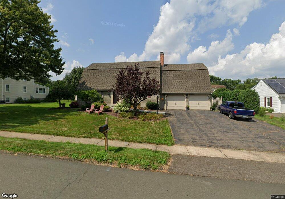
15 Lantern Ln Wethersfield, CT 06109
Estimated Value: $585,118 - $686,000
4
Beds
3
Baths
3,214
Sq Ft
$197/Sq Ft
Est. Value
About This Home
This home is located at 15 Lantern Ln, Wethersfield, CT 06109 and is currently estimated at $634,530, approximately $197 per square foot. 15 Lantern Ln is a home located in Hartford County with nearby schools including Highcrest School, Silas Deane Middle School, and Wethersfield High School.
Ownership History
Date
Name
Owned For
Owner Type
Purchase Details
Closed on
Nov 30, 2005
Sold by
Spicer Timothy P and Spicer Catherine A
Bought by
Roberts Richard P and Roberts Melissa A
Current Estimated Value
Home Financials for this Owner
Home Financials are based on the most recent Mortgage that was taken out on this home.
Original Mortgage
$344,800
Interest Rate
1%
Purchase Details
Closed on
May 15, 2000
Sold by
Watson Wendy S
Bought by
Sipcer Timothy P and Spicer Catherine A
Create a Home Valuation Report for This Property
The Home Valuation Report is an in-depth analysis detailing your home's value as well as a comparison with similar homes in the area
Home Values in the Area
Average Home Value in this Area
Purchase History
| Date | Buyer | Sale Price | Title Company |
|---|---|---|---|
| Roberts Richard P | $431,000 | -- | |
| Sipcer Timothy P | $262,000 | -- |
Source: Public Records
Mortgage History
| Date | Status | Borrower | Loan Amount |
|---|---|---|---|
| Open | Sipcer Timothy P | $372,000 | |
| Closed | Sipcer Timothy P | $89,750 | |
| Closed | Sipcer Timothy P | $344,800 |
Source: Public Records
Tax History
| Year | Tax Paid | Tax Assessment Tax Assessment Total Assessment is a certain percentage of the fair market value that is determined by local assessors to be the total taxable value of land and additions on the property. | Land | Improvement |
|---|---|---|---|---|
| 2025 | $14,108 | $342,270 | $111,760 | $230,510 |
| 2024 | $10,744 | $248,600 | $86,910 | $161,690 |
| 2023 | $10,397 | $248,850 | $86,920 | $161,930 |
| 2022 | $10,223 | $248,850 | $86,920 | $161,930 |
| 2021 | $10,121 | $248,850 | $86,920 | $161,930 |
| 2020 | $10,126 | $248,850 | $86,920 | $161,930 |
| 2019 | $10,138 | $248,850 | $86,920 | $161,930 |
| 2018 | $10,949 | $268,500 | $86,000 | $182,500 |
| 2017 | $10,678 | $268,500 | $86,000 | $182,500 |
| 2016 | $10,348 | $268,500 | $86,000 | $182,500 |
| 2015 | $10,254 | $268,500 | $86,000 | $182,500 |
| 2014 | $9,865 | $268,500 | $86,000 | $182,500 |
Source: Public Records
Map
Nearby Homes
- 268 Fox Hill Rd
- 186 Hang Dog Ln
- 155 Old Common Rd
- 508 Highland St
- 5 Robeth Ln
- 25 Heather Hill
- 101 Collier Rd
- 0 Collier Rd
- 6 Vinnie Dr
- 8 Stella Dr
- 76 Luca Lane Homesite 8
- 61 Luca Ln
- 18 Stone Hill Dr
- 9 Dogwood Ct
- 229 Cottonwood Rd Unit 229
- 89 Merriman Rd
- 72 Concord Dr
- 50 Concord Dr Unit 50
- 378 Cypress Rd
- 455 Brimfield Rd
- 23 Lantern Ln
- 7 Lantern Ln
- 334 Fox Hill Rd
- 326 Fox Hill Rd
- 14 Lantern Ln
- 204 Highcrest Rd
- 6 Lantern Ln
- 24 Lantern Ln
- 318 Fox Hill Rd
- 31 Lantern Ln
- 42 Lantern Ln
- 310 Fox Hill Rd
- 225 Highcrest Rd
- 217 Highcrest Rd
- 12 Old Common Rd
- 39 Lantern Ln
- 335 Fox Hill Rd
- 6 Quail Hill
- 6 Quail Hill Rd
- 196 Highcrest Rd
Your Personal Tour Guide
Ask me questions while you tour the home.