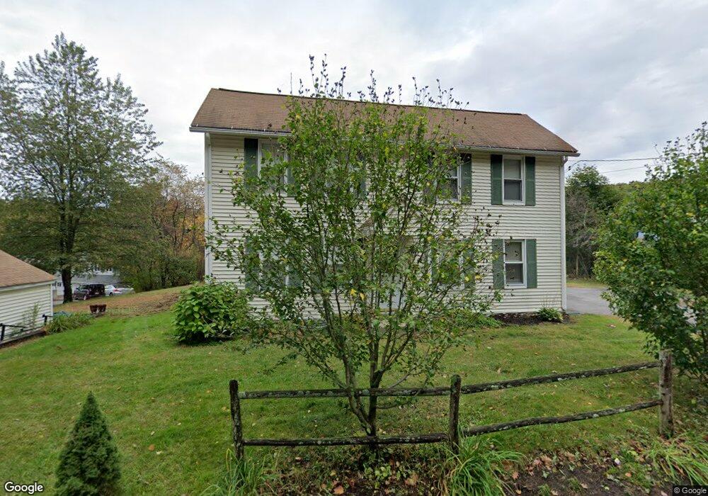
15 Laurelwood Rd Sterling, MA 01564
Estimated Value: $501,000 - $617,000
3
Beds
2
Baths
1,969
Sq Ft
$276/Sq Ft
Est. Value
About This Home
This home is located at 15 Laurelwood Rd, Sterling, MA 01564 and is currently estimated at $543,293, approximately $275 per square foot. 15 Laurelwood Rd is a home located in Worcester County with nearby schools including Wachusett Regional High School.
Ownership History
Date
Name
Owned For
Owner Type
Purchase Details
Closed on
Jun 12, 2015
Sold by
Cove Michael
Bought by
Belair Ann M
Current Estimated Value
Purchase Details
Closed on
May 3, 2010
Sold by
Devlin Leigh M and Grady Carlton M
Bought by
Sterling Acres T and Grady Carlton M
Purchase Details
Closed on
Jun 11, 2008
Sold by
Long Beach Mtg Loan T
Bought by
Belair Ann Marie and Cove Michael
Purchase Details
Closed on
Apr 14, 2006
Sold by
Theriault Donald E
Bought by
Theriault Linda
Home Financials for this Owner
Home Financials are based on the most recent Mortgage that was taken out on this home.
Original Mortgage
$20,000
Interest Rate
6.28%
Mortgage Type
Purchase Money Mortgage
Purchase Details
Closed on
Feb 11, 2002
Sold by
Sterling Acres Trust and Grady Leigh M
Bought by
Jarvis Michael R
Home Financials for this Owner
Home Financials are based on the most recent Mortgage that was taken out on this home.
Original Mortgage
$152,000
Interest Rate
7.13%
Mortgage Type
Purchase Money Mortgage
Purchase Details
Closed on
Nov 9, 1998
Sold by
Sterling Silver Trust and Inman Dale
Bought by
Sterling Acres Trust and Devlin Leigh M
Purchase Details
Closed on
Jan 26, 1994
Sold by
Cunningham Roy A
Bought by
Elliott Matthew A
Create a Home Valuation Report for This Property
The Home Valuation Report is an in-depth analysis detailing your home's value as well as a comparison with similar homes in the area
Home Values in the Area
Average Home Value in this Area
Purchase History
| Date | Buyer | Sale Price | Title Company |
|---|---|---|---|
| Belair Ann M | -- | -- | |
| Sterling Acres T | -- | -- | |
| Belair Ann Marie | $114,000 | -- | |
| Theriault Linda | -- | -- | |
| Theriault Linda | $44,000 | -- | |
| Jarvis Michael R | $190,000 | -- | |
| Sterling Acres Trust | $100,000 | -- | |
| Elliott Matthew A | $40,000 | -- |
Source: Public Records
Mortgage History
| Date | Status | Borrower | Loan Amount |
|---|---|---|---|
| Previous Owner | Theriault Linda | $20,000 | |
| Previous Owner | Elliott Matthew A | $203,100 | |
| Previous Owner | Elliott Matthew A | $152,000 | |
| Previous Owner | Elliott Matthew A | $80,000 |
Source: Public Records
Tax History Compared to Growth
Tax History
| Year | Tax Paid | Tax Assessment Tax Assessment Total Assessment is a certain percentage of the fair market value that is determined by local assessors to be the total taxable value of land and additions on the property. | Land | Improvement |
|---|---|---|---|---|
| 2025 | $4,964 | $385,400 | $123,000 | $262,400 |
| 2024 | $4,651 | $349,400 | $123,000 | $226,400 |
| 2023 | $4,845 | $338,800 | $123,000 | $215,800 |
| 2022 | $4,308 | $282,500 | $111,900 | $170,600 |
| 2021 | $9,078 | $270,500 | $111,900 | $158,600 |
| 2020 | $4,293 | $255,400 | $111,900 | $143,500 |
| 2019 | $4,150 | $240,300 | $111,900 | $128,400 |
| 2018 | $8,103 | $228,700 | $112,800 | $115,900 |
| 2017 | $3,175 | $176,100 | $104,400 | $71,700 |
| 2016 | $3,248 | $177,200 | $104,400 | $72,800 |
| 2015 | $3,266 | $188,900 | $110,900 | $78,000 |
| 2014 | $3,198 | $188,900 | $110,900 | $78,000 |
Source: Public Records
Map
Nearby Homes
- 45 Meetinghouse Hill Rd
- 2 Stuart Rd
- 41 Meetinghouse Hill Rd
- 4 Redstone Hill Rd
- 25 North Row
- 5 Leo's Way Unit 1
- 7 Leo's Way Unit 1
- 5 Pine Woods Ln
- 17 Taft Rd
- 6 Ashton Ln
- 96 Clinton Rd
- 45 Kendall Hill Rd
- 6 Belmont Dr
- 20 Woodside Dr
- 133 Rowley Hill Rd
- 121 &125 Flanagan Hill Rd
- 25 N Row Rd
- 28 Sandy Ridge Rd
- 163 Rowley Hill Rd
- 0 Brockelman Rd Unit 73424117
- 50 Leominster Rd Unit 1
- 50 Leominster Rd Unit 12
- 50 Leominster Rd Unit 3
- 50 Leominster Rd
- 2 Colby Rd
- 18 Laurelwood Rd
- 1 Colby Rd
- 5 Colby Rd
- 20 Laurelwood Rd
- 7 Colby Rd
- 64 Leominster Rd
- 64 Leominster Rd Unit 1
- 13 Olde Parish Ln
- 11 Olde Parish Ln
- 24 Laurelwood Rd
- 9 Olde Parish Ln
- 9 Colby Rd
- 11 Colby Rd
- 10 Olde Parish Ln
- 8 Olde Parish Ln