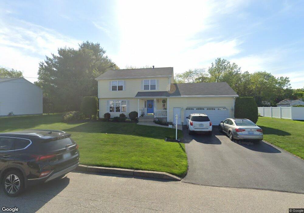
15 Leah Dr Cranston, RI 02921
Comstock Gardens NeighborhoodEstimated Value: $613,094 - $695,000
3
Beds
3
Baths
1,726
Sq Ft
$377/Sq Ft
Est. Value
About This Home
This home is located at 15 Leah Dr, Cranston, RI 02921 and is currently estimated at $650,774, approximately $377 per square foot. 15 Leah Dr is a home located in Providence County with nearby schools including Stone Hill School, Western Hills Middle School, and Cranston High School West.
Ownership History
Date
Name
Owned For
Owner Type
Purchase Details
Closed on
Nov 17, 2021
Sold by
Marotto Raymond V and Marotto Camella A
Bought by
Raymond & C Marotto Irt
Current Estimated Value
Purchase Details
Closed on
Mar 29, 2013
Sold by
Khang Thong N and Khang Makara C
Bought by
Marrotto Raymond V
Home Financials for this Owner
Home Financials are based on the most recent Mortgage that was taken out on this home.
Original Mortgage
$152,000
Interest Rate
3.56%
Mortgage Type
New Conventional
Purchase Details
Closed on
Apr 3, 1995
Sold by
F Paolino Homes Inc
Bought by
Marotto Raymond V and Marotto Camella
Home Financials for this Owner
Home Financials are based on the most recent Mortgage that was taken out on this home.
Original Mortgage
$153,000
Interest Rate
8.8%
Create a Home Valuation Report for This Property
The Home Valuation Report is an in-depth analysis detailing your home's value as well as a comparison with similar homes in the area
Home Values in the Area
Average Home Value in this Area
Purchase History
| Date | Buyer | Sale Price | Title Company |
|---|---|---|---|
| Raymond & C Marotto Irt | -- | None Available | |
| Marrotto Raymond V | $190,000 | -- | |
| Marotto Raymond V | $170,000 | -- |
Source: Public Records
Mortgage History
| Date | Status | Borrower | Loan Amount |
|---|---|---|---|
| Previous Owner | Marotto Raymond V | $152,000 | |
| Previous Owner | Marotto Raymond V | $85,000 | |
| Previous Owner | Marotto Raymond V | $30,000 | |
| Previous Owner | Marotto Raymond V | $153,000 |
Source: Public Records
Tax History Compared to Growth
Tax History
| Year | Tax Paid | Tax Assessment Tax Assessment Total Assessment is a certain percentage of the fair market value that is determined by local assessors to be the total taxable value of land and additions on the property. | Land | Improvement |
|---|---|---|---|---|
| 2025 | $6,557 | $472,400 | $175,700 | $296,700 |
| 2024 | $6,429 | $472,400 | $175,700 | $296,700 |
| 2023 | $6,452 | $341,400 | $125,600 | $215,800 |
| 2022 | $6,319 | $341,400 | $125,600 | $215,800 |
| 2021 | $6,145 | $341,400 | $125,600 | $215,800 |
| 2020 | $6,412 | $308,700 | $125,600 | $183,100 |
| 2019 | $6,412 | $308,700 | $125,600 | $183,100 |
| 2018 | $6,264 | $308,700 | $125,600 | $183,100 |
| 2017 | $6,345 | $276,600 | $107,700 | $168,900 |
| 2016 | $6,210 | $276,600 | $107,700 | $168,900 |
| 2015 | $6,210 | $276,600 | $107,700 | $168,900 |
| 2014 | $5,842 | $255,800 | $103,200 | $152,600 |
Source: Public Records
Map
Nearby Homes
- 20 Doreen Ct
- 30 Dutchess Dr
- 26 Scituate Farms Dr
- 95 Amy Dr
- 105 Amy Dr
- 435 Scituate Ave
- 17 Woodview Dr
- 53 Charcalee Dr
- 20 Wild Berry Dr
- 11 Red Robin Rd
- 75 Rowe Dr
- 134 Lake Garden Dr
- 118 Westfield Dr
- 18 Quail Ridge Rd
- 51 Stone Dr
- 27 Nardolillo St
- 27 Tartaglia St
- 0 Phenix Ave Unit 1384514
- 26 Rachela St
- 1603 Plainfield Pike Unit D5
- 11 Leah Dr
- 21 Leah Dr
- 16 Leah Dr
- 10 Leah Dr
- 668 Scituate Ave
- 658 Scituate Ave
- 65 Janet Dr
- 75 Janet Dr
- 646 Scituate Ave
- 22 Leah Dr
- 0 Old Scituate Ave Unit 1022954
- 0 Old Scituate Ave Unit 1039925
- 0 Old Scituate Ave Unit 1056891
- 51 Janet Dr
- 638 Scituate Ave
- 692 Scituate Ave
- 60 Janet Dr
- 39 Janet Dr
- 50 Janet Dr
- 626 Scituate Ave