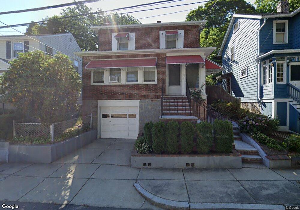
15 Lindall St Roslindale, MA 02131
Roslindale NeighborhoodEstimated Value: $572,000 - $823,000
3
Beds
2
Baths
1,579
Sq Ft
$466/Sq Ft
Est. Value
About This Home
This home is located at 15 Lindall St, Roslindale, MA 02131 and is currently estimated at $736,351, approximately $466 per square foot. 15 Lindall St is a home located in Suffolk County with nearby schools including Brooke Charter School Roslindale, Sacred Heart STEM School, and St. Clare High School.
Ownership History
Date
Name
Owned For
Owner Type
Purchase Details
Closed on
Mar 7, 2011
Sold by
Misttetta Antonia
Bought by
Mistretta Giovanna F
Current Estimated Value
Purchase Details
Closed on
Mar 23, 1993
Sold by
Jb Rt and Miller
Bought by
Obrien Michael
Create a Home Valuation Report for This Property
The Home Valuation Report is an in-depth analysis detailing your home's value as well as a comparison with similar homes in the area
Home Values in the Area
Average Home Value in this Area
Purchase History
| Date | Buyer | Sale Price | Title Company |
|---|---|---|---|
| Mistretta Giovanna F | -- | -- | |
| Obrien Michael | $30,250 | -- |
Source: Public Records
Mortgage History
| Date | Status | Borrower | Loan Amount |
|---|---|---|---|
| Previous Owner | Obrien Michael | $50,000 |
Source: Public Records
Tax History Compared to Growth
Tax History
| Year | Tax Paid | Tax Assessment Tax Assessment Total Assessment is a certain percentage of the fair market value that is determined by local assessors to be the total taxable value of land and additions on the property. | Land | Improvement |
|---|---|---|---|---|
| 2025 | $7,100 | $613,100 | $184,500 | $428,600 |
| 2024 | $6,398 | $587,000 | $186,800 | $400,200 |
| 2023 | $5,890 | $548,400 | $174,500 | $373,900 |
| 2022 | $5,526 | $507,900 | $161,600 | $346,300 |
| 2021 | $5,094 | $477,400 | $155,400 | $322,000 |
| 2020 | $5,045 | $477,700 | $150,600 | $327,100 |
| 2019 | $4,794 | $454,800 | $120,900 | $333,900 |
| 2018 | $4,539 | $433,100 | $120,900 | $312,200 |
| 2017 | $4,328 | $408,700 | $120,900 | $287,800 |
| 2016 | $4,124 | $374,900 | $120,900 | $254,000 |
| 2015 | $3,970 | $327,800 | $112,300 | $215,500 |
| 2014 | $3,745 | $297,700 | $112,300 | $185,400 |
Source: Public Records
Map
Nearby Homes
- 108 Florence St Unit 1
- 108 Florence St Unit 3
- 108 Florence St Unit 2
- 21 Bexley Rd
- 67 Cummins Hwy Unit 101
- 117 Sycamore St Unit 1
- 20 Taft Hill Park Unit 5
- 187 Florence St Unit 2L
- 4281 Washington St Unit 4B
- 27 Rowe St
- 25 Harrison St Unit C
- 65 Birch St Unit 3
- 46 Belgrade Ave Unit 2
- 39 Harrison St Unit B
- 391 Hyde Park Ave Unit 112
- 15 S Fairview St Unit 3
- 250 Poplar St Unit 1
- 18 Robert St Unit 14
- 18 Robert St Unit 4
- 375 Hyde Park Ave Unit 3
- 17 Lindall St
- 9 Lindall St
- 19 Lindall St Unit 21
- 5 Lindall St
- 76 Florence St
- 14 Lindall St
- 70 Florence St
- 23 Lindall St Unit 25
- 80 Florence St
- 68 Lindall St
- 1 Lindall St
- 84 Florence St
- 39 Basile St Unit 41
- 27 Lindall St
- 48 Cummins Hwy
- 38 Basile St
- 44 Cummins Hwy
- 44 Cummins Hwy Unit 2
- 88 Florence St
- 2 Lindall St