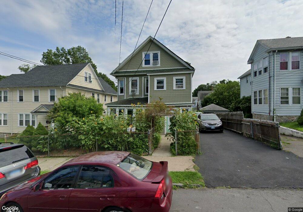
15 Manhattan Ave Unit 17 Bridgeport, CT 06606
Brooklawn-Saint Vincent NeighborhoodEstimated Value: $483,816 - $663,000
7
Beds
2
Baths
2,968
Sq Ft
$204/Sq Ft
Est. Value
About This Home
This home is located at 15 Manhattan Ave Unit 17, Bridgeport, CT 06606 and is currently estimated at $605,454, approximately $203 per square foot. 15 Manhattan Ave Unit 17 is a home located in Fairfield County with nearby schools including Madison School, Central High School, and Catholic Academy of Bridgeport-St. Raphael Academy.
Ownership History
Date
Name
Owned For
Owner Type
Purchase Details
Closed on
Aug 9, 1996
Sold by
Sboros Angelo and Sboros Joan
Bought by
Garcia Miguel G
Current Estimated Value
Home Financials for this Owner
Home Financials are based on the most recent Mortgage that was taken out on this home.
Original Mortgage
$98,800
Interest Rate
8.24%
Mortgage Type
Unknown
Create a Home Valuation Report for This Property
The Home Valuation Report is an in-depth analysis detailing your home's value as well as a comparison with similar homes in the area
Home Values in the Area
Average Home Value in this Area
Purchase History
| Date | Buyer | Sale Price | Title Company |
|---|---|---|---|
| Garcia Miguel G | $104,000 | -- | |
| Garcia Miguel G | $104,000 | -- |
Source: Public Records
Mortgage History
| Date | Status | Borrower | Loan Amount |
|---|---|---|---|
| Open | Garcia Miguel G | $175,000 | |
| Closed | Garcia Miguel G | $95,000 | |
| Closed | Garcia Miguel G | $98,800 |
Source: Public Records
Tax History Compared to Growth
Tax History
| Year | Tax Paid | Tax Assessment Tax Assessment Total Assessment is a certain percentage of the fair market value that is determined by local assessors to be the total taxable value of land and additions on the property. | Land | Improvement |
|---|---|---|---|---|
| 2025 | $9,535 | $219,440 | $76,060 | $143,380 |
| 2024 | $9,535 | $219,440 | $76,060 | $143,380 |
| 2023 | $9,535 | $219,440 | $76,060 | $143,380 |
| 2022 | $9,535 | $219,440 | $76,060 | $143,380 |
| 2021 | $9,535 | $219,440 | $76,060 | $143,380 |
| 2020 | $8,290 | $153,540 | $42,910 | $110,630 |
| 2019 | $8,290 | $153,540 | $42,910 | $110,630 |
| 2018 | $8,348 | $153,540 | $42,910 | $110,630 |
| 2017 | $8,348 | $153,540 | $42,910 | $110,630 |
| 2016 | $8,348 | $153,540 | $42,910 | $110,630 |
| 2015 | $8,498 | $201,370 | $51,930 | $149,440 |
| 2014 | $8,498 | $201,370 | $51,930 | $149,440 |
Source: Public Records
Map
Nearby Homes
- 106 Manhattan Ave Unit 108
- 123 Harlem Ave
- 508 Hawley Ave
- 203 Wayne St
- 252 Harlem Ave Unit B6
- 252 Harlem Ave Unit B5
- 936 Lindley St
- 105 Tremont Ave Unit E
- 105 Tremont Ave Unit B
- 631 Fairview Ave
- 119 Madison Terrace
- 234 Savoy St
- 330 French St
- 1265 Lindley St
- 926 Hart St
- 916 Hart St
- 724 Capitol Ave Unit 726
- 376 Savoy St
- 485 Westfield Ave
- 2395 Main St Unit 2397
- 9 Manhattan Ave
- 27 Manhattan Ave Unit 2
- 11 Manhattan Ave
- 16 Manhattan Ave Unit 18
- 35 Manhattan Ave
- 26 Manhattan Ave
- 116 Morningside Dr Unit 118
- 122 Morningside Dr
- 116-118 Morningside Dr
- 124-126 Bronx
- 114 Bronx Ave Unit 116
- 126 Morningside Dr
- 47 Manhattan Ave
- 126 Bronx Ave Unit 3
- 54 Manhattan Ave
- 96 Morningside Dr
- 60 Manhattan Ave Unit 62
- 124 Bronx Ave Unit 126
- 136 Morningside Dr