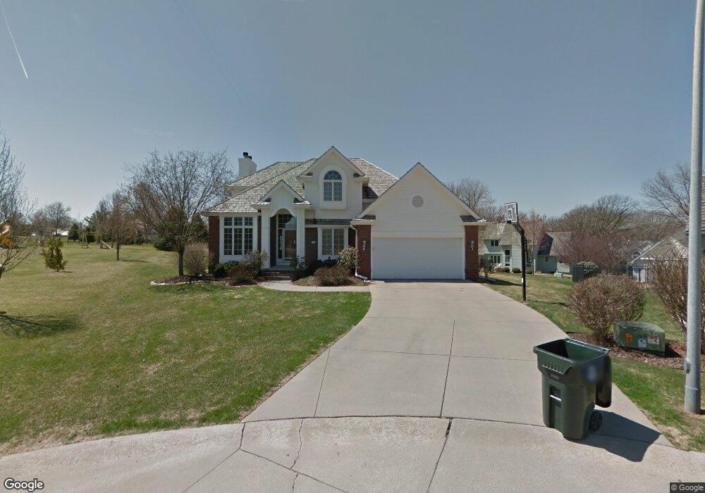
15 Maywood Ct Council Bluffs, IA 51503
Eastern Council Bluffs NeighborhoodEstimated Value: $458,750 - $530,000
4
Beds
4
Baths
1,177
Sq Ft
$416/Sq Ft
Est. Value
About This Home
This home is located at 15 Maywood Ct, Council Bluffs, IA 51503 and is currently estimated at $489,188, approximately $415 per square foot. 15 Maywood Ct is a home located in Pottawattamie County with nearby schools including E.A. Kreft Primary School, Titan Hill Intermediate School, and Lewis Central Middle School.
Ownership History
Date
Name
Owned For
Owner Type
Purchase Details
Closed on
Apr 17, 2020
Sold by
Stazzoni Ronald L and Stazzoni Susan J
Bought by
Larsen Bryan K and Larsen Katelyn E
Current Estimated Value
Home Financials for this Owner
Home Financials are based on the most recent Mortgage that was taken out on this home.
Original Mortgage
$276,000
Outstanding Balance
$245,417
Interest Rate
3.6%
Mortgage Type
New Conventional
Estimated Equity
$243,771
Create a Home Valuation Report for This Property
The Home Valuation Report is an in-depth analysis detailing your home's value as well as a comparison with similar homes in the area
Home Values in the Area
Average Home Value in this Area
Purchase History
| Date | Buyer | Sale Price | Title Company |
|---|---|---|---|
| Larsen Bryan K | $345,000 | None Available |
Source: Public Records
Mortgage History
| Date | Status | Borrower | Loan Amount |
|---|---|---|---|
| Open | Larsen Bryan K | $276,000 |
Source: Public Records
Tax History Compared to Growth
Tax History
| Year | Tax Paid | Tax Assessment Tax Assessment Total Assessment is a certain percentage of the fair market value that is determined by local assessors to be the total taxable value of land and additions on the property. | Land | Improvement |
|---|---|---|---|---|
| 2025 | $7,558 | $433,000 | $58,500 | $374,500 |
| 2024 | $7,558 | $422,900 | $50,800 | $372,100 |
| 2023 | $7,318 | $422,900 | $50,800 | $372,100 |
| 2022 | $6,640 | $328,600 | $56,900 | $271,700 |
| 2021 | $10,134 | $328,600 | $56,900 | $271,700 |
| 2020 | $6,282 | $328,600 | $56,900 | $271,700 |
| 2019 | $6,536 | $293,000 | $41,800 | $251,200 |
| 2018 | $6,386 | $293,000 | $41,800 | $251,200 |
| 2017 | $6,500 | $293,000 | $41,800 | $251,200 |
| 2015 | $6,386 | $293,000 | $41,800 | $251,200 |
| 2014 | $6,424 | $293,000 | $41,800 | $251,200 |
Source: Public Records
Map
Nearby Homes
- 131 Norwood Dr
- 411 Redwood Dr
- 128 Charles Park Dr
- 1759 Blackthorn St
- 1780 Blackthorn St
- 1768 Blackthorn St
- 1843 Sycamore St
- 1800 Sycamore St
- 208 Red Bud Ln
- 1742 Blackthorn St
- 1715 Blackthorn St
- 1711 Blackthorn St
- 20425 Greenview Rd
- 2526 Franklin Ave
- 31 Balsam Cir
- 23 Balsam Cir
- 20.57 AC. M L State Orchard Rd
- 200 Timber Dr
- 19 Balsam Cir
- 4 Balsam Cir
- 15 Maywood Cir
- 9 Maywood Ct
- 9 Maywood Cir
- 12 Maywood Cir
- 139 Norwood Dr
- 135 Norwood Dr
- 12 Maywood Ct
- 143 Norwood Dr
- 335 Golden Oaks Dr
- 8 Maywood Ct
- 147 Norwood Dr
- 339 Golden Oaks Dr
- 127 Norwood Dr
- 4 Aspen Ct
- 327 Golden Oaks Dr
- 8 Aspen Ct
- 151 Norwood Dr
- 12 Aspen Ct
- 323 Golden Oaks Dr
- 305 Golden Oaks Dr