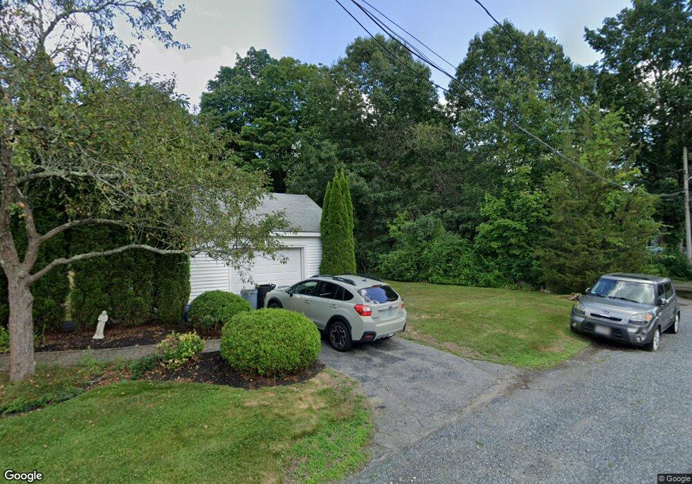
15 Mcgrath Way Stoughton, MA 02072
Estimated Value: $457,000 - $519,351
2
Beds
1
Bath
1,008
Sq Ft
$493/Sq Ft
Est. Value
About This Home
This home is located at 15 Mcgrath Way, Stoughton, MA 02072 and is currently estimated at $497,088, approximately $493 per square foot. 15 Mcgrath Way is a home located in Norfolk County with nearby schools including Joseph H. Gibbons Elementary School, Dr. Robert G. O'Donnell Middle School, and Stoughton High School.
Create a Home Valuation Report for This Property
The Home Valuation Report is an in-depth analysis detailing your home's value as well as a comparison with similar homes in the area
Home Values in the Area
Average Home Value in this Area
Tax History Compared to Growth
Tax History
| Year | Tax Paid | Tax Assessment Tax Assessment Total Assessment is a certain percentage of the fair market value that is determined by local assessors to be the total taxable value of land and additions on the property. | Land | Improvement |
|---|---|---|---|---|
| 2025 | $5,002 | $404,000 | $201,400 | $202,600 |
| 2024 | $4,892 | $384,300 | $184,000 | $200,300 |
| 2023 | $4,741 | $349,900 | $170,100 | $179,800 |
| 2022 | $4,528 | $314,200 | $156,200 | $158,000 |
| 2021 | $4,270 | $282,800 | $133,700 | $149,100 |
| 2020 | $4,133 | $277,600 | $128,500 | $149,100 |
| 2019 | $4,074 | $265,600 | $128,500 | $137,100 |
| 2018 | $3,584 | $242,000 | $121,500 | $120,500 |
| 2017 | $3,282 | $226,500 | $109,400 | $117,100 |
| 2016 | $3,177 | $212,200 | $107,600 | $104,600 |
| 2015 | $3,053 | $201,800 | $97,200 | $104,600 |
| 2014 | $2,852 | $181,200 | $90,300 | $90,900 |
Source: Public Records
Map
Nearby Homes