J
Seller's Agent in 2021
Jim Feiner
Feiner Real Estate

Estimated Value: $1,055,000 - $1,208,328
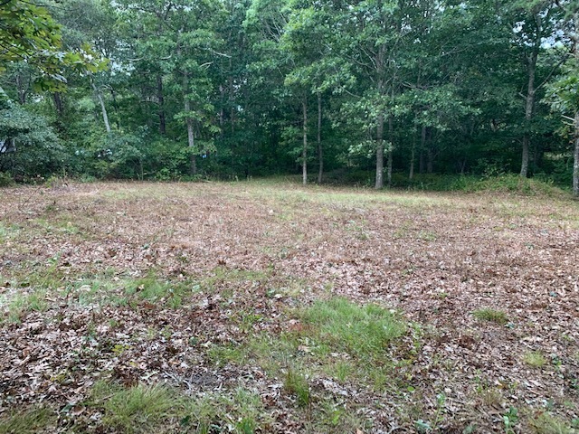
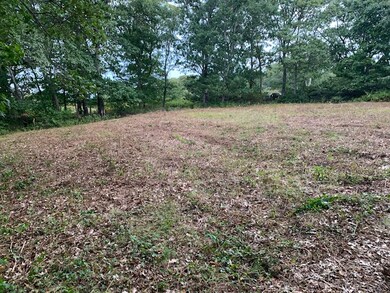
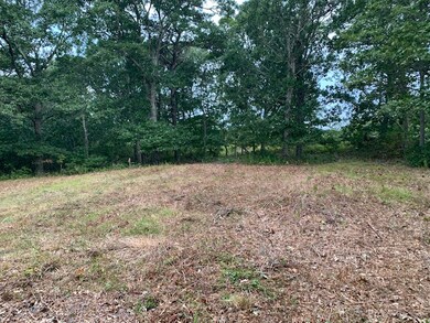
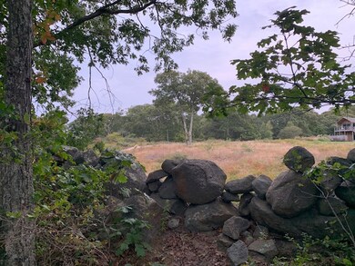
A rare find. One of the last unbuilt parcels close to Menemsha This land is a destination location where you can leave the car behind. Set on almost 2 acres of land on Menemsha Inn Rd., this lot is fully engineered with a 6 bedroom septic system and well installed. A bucolic path winds through the farm lands with cows and chickens, across salt marsh and tidal flats to Menemsha beach. You can also do the 1 minute drive down the hill. Property has been brushcut to allow you to fully appreciate the stonewalls on 2 sides and imagine your building site. There are views across the meadows and great evening skies towards the sunset. Great hiking trails nearby connect to Menemsha Hill reservation and the only thing missing is your house design. This is a very easy and turnkey parcel. Will sell quickly.
Last Agent to Sell the Property
Jim Feiner
Feiner Real Estate Listed on: 09/26/2020
| Date | Buyer | Sale Price | Title Company |
|---|---|---|---|
| Gerson Noel L | $815,000 | None Available |
| Date | Status | Borrower | Loan Amount |
|---|---|---|---|
| Open | Gerson Noel L | $441,250 |
| Date | Event | Price | List to Sale | Price per Sq Ft |
|---|---|---|---|---|
| 02/12/2021 02/12/21 | Sold | $815,000 | -6.9% | -- |
| 11/30/2020 11/30/20 | Pending | -- | -- | -- |
| 09/26/2020 09/26/20 | For Sale | $875,000 | -- | -- |
| Year | Tax Paid | Tax Assessment Tax Assessment Total Assessment is a certain percentage of the fair market value that is determined by local assessors to be the total taxable value of land and additions on the property. | Land | Improvement |
|---|---|---|---|---|
| 2025 | $2,231 | $991,500 | $991,500 | $0 |
| 2024 | $2,031 | $957,900 | $957,900 | $0 |
| 2023 | $2,132 | $810,500 | $810,500 | $0 |
| 2022 | $1,385 | $491,200 | $491,200 | $0 |
| 2021 | $1,429 | $491,200 | $491,200 | $0 |
| 2020 | $1,377 | $481,600 | $481,600 | $0 |
| 2019 | $1,387 | $481,600 | $481,600 | $0 |
| 2018 | $1,324 | $481,600 | $481,600 | $0 |
| 2017 | $1,291 | $481,600 | $481,600 | $0 |
| 2016 | $1,305 | $481,600 | $481,600 | $0 |
| 2015 | $1,267 | $481,600 | $481,600 | $0 |
| 2014 | $1,240 | $500,000 | $500,000 | $0 |
J
Seller's Agent in 2021
Jim Feiner
Feiner Real Estate
Source: LINK (Vineyard)
MLS Number: 37246
APN: CHIL-000020-000000-000009