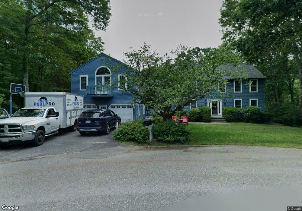
15 Mulberry Rd Dracut, MA 01826
Estimated Value: $838,399 - $1,043,000
4
Beds
3
Baths
3,490
Sq Ft
$262/Sq Ft
Est. Value
About This Home
This home is located at 15 Mulberry Rd, Dracut, MA 01826 and is currently estimated at $913,600, approximately $261 per square foot. 15 Mulberry Rd is a home located in Middlesex County with nearby schools including Joseph A. Campbell Elementary School, Richardson Middle School, and Dracut Senior High School.
Ownership History
Date
Name
Owned For
Owner Type
Purchase Details
Closed on
Sep 17, 2025
Sold by
Grady John R
Bought by
John R Grady Ret and Grady
Current Estimated Value
Purchase Details
Closed on
Nov 20, 1985
Bought by
Grady John R and Grady Barbara A
Create a Home Valuation Report for This Property
The Home Valuation Report is an in-depth analysis detailing your home's value as well as a comparison with similar homes in the area
Home Values in the Area
Average Home Value in this Area
Purchase History
| Date | Buyer | Sale Price | Title Company |
|---|---|---|---|
| John R Grady Ret | -- | -- | |
| Grady John R | $151,800 | -- |
Source: Public Records
Mortgage History
| Date | Status | Borrower | Loan Amount |
|---|---|---|---|
| Previous Owner | Grady John R | $115,200 | |
| Previous Owner | Grady John R | $130,000 |
Source: Public Records
Tax History
| Year | Tax Paid | Tax Assessment Tax Assessment Total Assessment is a certain percentage of the fair market value that is determined by local assessors to be the total taxable value of land and additions on the property. | Land | Improvement |
|---|---|---|---|---|
| 2025 | $8,773 | $866,900 | $255,400 | $611,500 |
| 2024 | $8,506 | $814,000 | $243,400 | $570,600 |
| 2023 | $8,464 | $730,900 | $211,800 | $519,100 |
| 2022 | $8,313 | $676,400 | $192,600 | $483,800 |
| 2021 | $8,031 | $617,300 | $174,900 | $442,400 |
| 2020 | $7,744 | $580,100 | $169,600 | $410,500 |
| 2019 | $7,382 | $536,900 | $161,500 | $375,400 |
| 2018 | $7,486 | $529,400 | $161,500 | $367,900 |
| 2017 | $7,392 | $529,400 | $161,500 | $367,900 |
| 2016 | $7,286 | $491,000 | $162,300 | $328,700 |
| 2015 | $6,989 | $468,100 | $162,300 | $305,800 |
| 2014 | $6,499 | $448,500 | $162,300 | $286,200 |
Source: Public Records
Map
Nearby Homes
- 277 Loon Hill Rd
- 10 Lanseigne St
- 89 Newbury St
- 55 Grant St
- 4 Hazelwood Ave Unit 12
- 31 Varnum Ave
- 315 Broadway Rd Unit 7
- 241 Broadway Rd Unit 50
- 15 Wildwood St Unit B10
- 14 Mount Pleasant Ave
- 35 Thissell Ave
- 675 Robbins Ave Unit 1
- 668 Robbins Ave Unit 1
- 50 Cheever Ave
- 700 Robbins Ave Unit 6
- 821 Merrimack Ave
- 23 Blackberry Fields Rd
- 785 Broadway Rd
- 173 Merrimack Meadows Ln Unit 162
- 127 Thornton Ave
- 7 Mulberry Rd
- 19 Bayberry Rd
- 139 Cranberry Rd
- 139 Cranberry Rd Unit 139
- 16 Mulberry Rd
- 4 Mulberry Rd
- 149 Cranberry Rd
- 28 Bayberry Rd
- 119 Cranberry Rd
- 35 Bayberry Rd
- 20 Bayberry Rd
- 7 Bayberry Rd
- 140 Cranberry Rd
- 109 Cranberry Rd
- 41 Bayberry Rd
- 118 Cranberry Rd
- 36 Bayberry Rd
- 14 Trout Brook Rd
- 150 Pelczar Rd
- 17 Trout Brook Rd