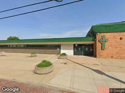
15 N Maple St Akron, OH 44303
West Hill Neighborhood
--
Bed
4
Baths
167,495
Sq Ft
13
Acres
About This Home
This home is located at 15 N Maple St, Akron, OH 44303. 15 N Maple St is a home located in Summit County with nearby schools including Findley Community Learning Center, North High School, and Edge Academy, The.
Ownership History
Date
Name
Owned For
Owner Type
Purchase Details
Closed on
Apr 29, 2004
Sold by
Pilla Rev Anthony M
Bought by
Svsm Foundation Properties Llc
Create a Home Valuation Report for This Property
The Home Valuation Report is an in-depth analysis detailing your home's value as well as a comparison with similar homes in the area
Home Values in the Area
Average Home Value in this Area
Purchase History
| Date | Buyer | Sale Price | Title Company |
|---|---|---|---|
| Svsm Foundation Properties Llc | -- | -- |
Source: Public Records
Mortgage History
| Date | Status | Borrower | Loan Amount |
|---|---|---|---|
| Closed | Svsm Foundation Properties Llc | $0 | |
| Closed | Svsm Foundation Properties Llc | $750,000 | |
| Closed | Svsm Foundation Properties Llc | $3,200,000 | |
| Closed | Svsm Foundation Properties Llc | $1,500,000 |
Source: Public Records
Tax History Compared to Growth
Tax History
| Year | Tax Paid | Tax Assessment Tax Assessment Total Assessment is a certain percentage of the fair market value that is determined by local assessors to be the total taxable value of land and additions on the property. | Land | Improvement |
|---|---|---|---|---|
| 2025 | $5,346 | $4,297,623 | $159,499 | $4,138,124 |
| 2024 | $5,346 | $4,297,623 | $159,499 | $4,138,124 |
| 2023 | $2,969 | $4,297,623 | $159,499 | $4,138,124 |
| 2022 | $2,969 | $4,297,623 | $159,499 | $4,138,124 |
| 2021 | $2,969 | $4,295,691 | $157,567 | $4,138,124 |
| 2020 | $2,647 | $4,295,690 | $157,570 | $4,138,120 |
| 2019 | $1,991 | $3,874,510 | $199,660 | $3,674,850 |
| 2018 | $1,716 | $3,415,220 | $114,750 | $3,300,470 |
| 2017 | $1,716 | $3,415,220 | $114,750 | $3,300,470 |
| 2016 | $1,716 | $3,594,040 | $120,790 | $3,473,250 |
| 2015 | $1,716 | $3,594,040 | $120,790 | $3,473,250 |
| 2014 | $1,716 | $3,594,040 | $120,790 | $3,473,250 |
| 2013 | $1,716 | $3,597,740 | $102,670 | $3,495,070 |
Source: Public Records
Map
Nearby Homes
- S-L 33 Oak Park Dr
- 32 King Dr
- 34 Oak Park Dr
- 21 Furnace St Unit 705
- 21 Furnace St Unit 608
- 95 Hall St
- 374 Crosby St
- 59 Aqueduct St
- 125 Mustill St
- 295 Grove St
- 286 Grove St
- 63 Rosalind Ct
- 243 S Balch St
- 68 N Balch St
- 180 Elizabeth Pkwy
- 142 Westwood Ave
- 182 Westwood Ave
- 360 Turner St
- 146 E Glenwood Ave
- 38 Royal Place
- 15 N Maple St
- 197 King Ct Unit 1
- 197 King Ct
- 192 Division St
- 204 Division St
- 15 S Walnut St Unit 2
- 213 King Ct
- 212 Division St
- 14 S Bates St
- 217 W Market St
- 21 S Walnut St
- 37 S Maple St
- 207 Myrtle Place Unit 4
- 207 Myrtle Place Unit 3
- 207 Myrtle Place Unit 2 & 3
- 207 Myrtle Place Unit 2
- 207 Myrtle Place Unit 1
- 207 Myrtle Place Unit 5
- 207 Myrtle Place Unit 8
- 207 Myrtle Place Unit 6