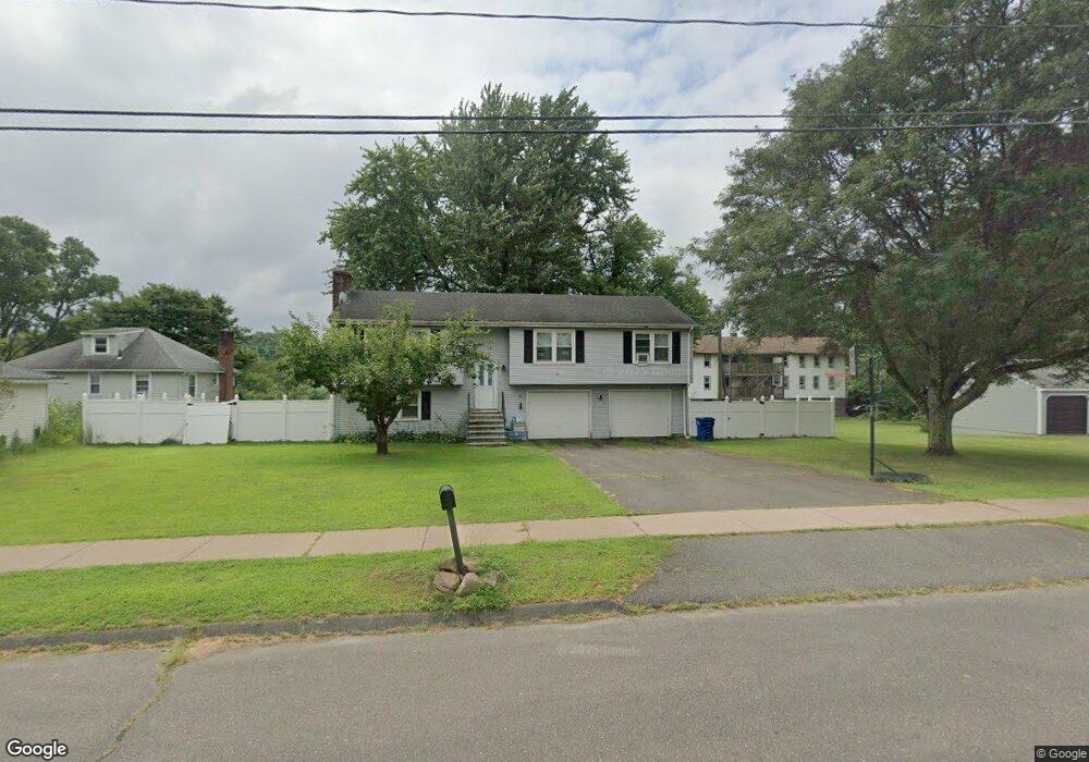
15 Niles Rd Windsor, CT 06095
West Windsor NeighborhoodEstimated Value: $371,000 - $471,000
3
Beds
2
Baths
1,334
Sq Ft
$300/Sq Ft
Est. Value
About This Home
This home is located at 15 Niles Rd, Windsor, CT 06095 and is currently estimated at $400,640, approximately $300 per square foot. 15 Niles Rd is a home located in Hartford County with nearby schools including Poquonock Elementary School, Clover Street School, and Sage Park Middle School.
Ownership History
Date
Name
Owned For
Owner Type
Purchase Details
Closed on
Jun 20, 2025
Sold by
Howard Tkai G
Bought by
Howard Aaron L
Current Estimated Value
Purchase Details
Closed on
Apr 19, 2004
Sold by
Reid Maria
Bought by
Howard Aaron and Howard Tkai
Home Financials for this Owner
Home Financials are based on the most recent Mortgage that was taken out on this home.
Original Mortgage
$199,900
Interest Rate
7.65%
Mortgage Type
Purchase Money Mortgage
Purchase Details
Closed on
Sep 22, 1994
Sold by
Masterson Michael and Masterson Kimberly
Bought by
Ferris Richard and Ferris Janice
Create a Home Valuation Report for This Property
The Home Valuation Report is an in-depth analysis detailing your home's value as well as a comparison with similar homes in the area
Home Values in the Area
Average Home Value in this Area
Purchase History
| Date | Buyer | Sale Price | Title Company |
|---|---|---|---|
| Howard Aaron L | -- | -- | |
| Howard Aaron | $199,900 | -- | |
| Howard Aaron | $199,900 | -- | |
| Ferris Richard | $139,000 | -- | |
| Ferris Richard | $139,000 | -- |
Source: Public Records
Mortgage History
| Date | Status | Borrower | Loan Amount |
|---|---|---|---|
| Previous Owner | Ferris Richard | $229,500 | |
| Previous Owner | Ferris Richard | $199,900 | |
| Previous Owner | Ferris Richard | $149,600 |
Source: Public Records
Tax History
| Year | Tax Paid | Tax Assessment Tax Assessment Total Assessment is a certain percentage of the fair market value that is determined by local assessors to be the total taxable value of land and additions on the property. | Land | Improvement |
|---|---|---|---|---|
| 2025 | $6,022 | $211,680 | $62,440 | $149,240 |
| 2024 | $6,418 | $211,680 | $62,440 | $149,240 |
| 2023 | $4,789 | $142,520 | $49,560 | $92,960 |
| 2022 | $4,742 | $142,520 | $49,560 | $92,960 |
| 2021 | $4,742 | $142,520 | $49,560 | $92,960 |
| 2020 | $4,719 | $142,520 | $49,560 | $92,960 |
| 2019 | $4,615 | $142,520 | $49,560 | $92,960 |
| 2018 | $4,517 | $137,060 | $49,560 | $87,500 |
| 2017 | $4,448 | $137,060 | $49,560 | $87,500 |
| 2016 | $4,320 | $137,060 | $49,560 | $87,500 |
| 2015 | $4,238 | $137,060 | $49,560 | $87,500 |
| 2014 | $4,176 | $137,060 | $49,560 | $87,500 |
Source: Public Records
Map
Nearby Homes
- 1946 Poquonock Ave
- 308 Prospect Hill Rd
- 1 Deanne Lynn Cir
- 10 Cleary Ln
- 24 Mary Catherine Cir
- 22 Eastview Dr
- 118 High Path Rd Unit 118
- 58 High Path Rd Unit 58
- 98 High Path Rd
- 11 Concorde Way Unit B2
- 943 High Path Rd Unit 943
- 9 Milo Peck Ln
- 32 Walnut Cir
- 268 High Path Rd Unit 268
- 26 Hickory Dr
- 16 Landing Cir
- 16 Cornfield Rd
- 30 Jackson St
- 12 Woodridge Dr Unit 12
- 0 Walnut and Larch Dr
- 1715 Poquonock Ave
- 1723 Poquonock Ave
- 27 Niles Rd
- 39 Niles Rd
- 1709 Poquonock Ave Unit 1
- 14 Niles Rd
- 12 Niles Rd
- 20 Niles Rd
- 0 Confidential Unit 170486275
- 00 Confidential St
- 1695 Poquonock Ave
- 2 Niles Rd
- 28 Niles Rd
- 36 Niles Rd
- 36 Niles Rd Unit Niles
- 1734R Poquonock Ave
- 38 Niles Rd
- 1726 Poquonock Ave
- 1732 Poquonock Ave
- 1734 Poquonock Ave