15 Pheasant Ln Gorham, ME 04038
Estimated Value: $752,537 - $853,000
About This Home
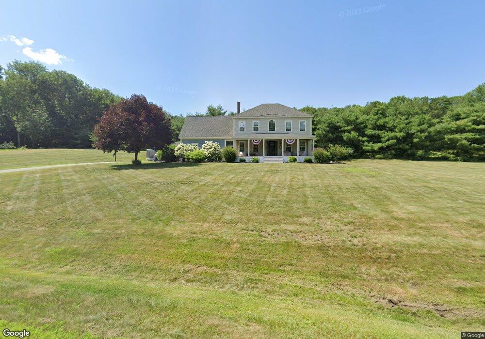
This home is located at 15 Pheasant Ln, Gorham, ME 04038 and is currently estimated at $796,634, approximately $309 per square foot. 15 Pheasant Ln is a home located in Cumberland County with nearby schools including Great Falls Elementary School, Gorham Middle School, and Gorham High School.
Ownership History
We collect this data history from publicly available records. To have your information removed, we recommend requesting removal directly through your county’s website.
Purchase Details
Home Financials for this Owner
Home Financials are based on the most recent Mortgage that was taken out on this home.Home Values in the Area
Average Home Value in this Area
Purchase History
We collect this data history from publicly available records. To have your information removed, we recommend requesting removal directly through your county’s website.
| Date | Buyer | Sale Price | Title Company |
|---|---|---|---|
| -- | -- |
Mortgage History
We collect this data history from publicly available records. To have your information removed, we recommend requesting removal directly through your county’s website.
| Date | Status | Borrower | Loan Amount |
|---|---|---|---|
| Open | $285,600 | ||
| Closed | $35,500 |
Tax History
We collect this data history from publicly available records. To have your information removed, we recommend requesting removal directly through your county’s website.
| Year | Tax Paid | Tax Assessment Tax Assessment Total Assessment is a certain percentage of the fair market value that is determined by local assessors to be the total taxable value of land and additions on the property. | Land | Improvement |
|---|---|---|---|---|
| 2025 | $8,685 | $586,800 | $135,000 | $451,800 |
| 2024 | $8,626 | $586,800 | $135,000 | $451,800 |
| 2023 | $8,069 | $586,800 | $135,000 | $451,800 |
| 2022 | $7,540 | $586,800 | $135,000 | $451,800 |
| 2021 | $6,689 | $344,800 | $106,900 | $237,900 |
| 2020 | $6,551 | $344,800 | $106,900 | $237,900 |
| 2019 | $6,428 | $339,200 | $106,900 | $232,300 |
| 2018 | $5,957 | $327,300 | $106,900 | $220,400 |
| 2017 | $5,597 | $327,300 | $106,900 | $220,400 |
| 2016 | $5,562 | $327,200 | $106,800 | $220,400 |
| 2015 | $5,333 | $327,200 | $106,800 | $220,400 |
| 2014 | $5,121 | $294,300 | $98,400 | $195,900 |
| 2013 | $5,091 | $294,300 | $98,400 | $195,900 |
Map
- 271 Fort Hill Rd
- 110 Gordon Farms Rd
- 146 Falcon Crest Dr Unit 44
- 163 State St
- 84 Johnson Rd
- 6 Narragansett St
- 10 Elm St
- 139 Harding Bridge Rd
- 0 Libby Ave
- 6 Stephanie Dr
- 91 South St
- 49 Lochwood Dr
- 32 Fairway Commons Dr Unit 11
- 168 Harding Bridge Rd
- 32 Lawn Ave
- 11 Carnation Dr
- 35 Rust Rd
- 45 Lochwood Dr
- 21 Lochwood Dr
- 36 Meadowbrook Dr Unit 2
- 3 Pheasant Ln
- 25 Pheasant Ln
- 24 Phinney St
- 244 Fort Hill Rd
- 33 Pheasant Ln
- 34 Pheasant Ln
- 232 Fort Hill Rd
- 243 Fort Hill Rd
- 1 Phinney St
- 15 Phinney St
- 239 Fort Hill Rd
- 28 Phinney St
- 45 Pheasant Ln
- 21 Phinney St
- 226 Fort Hill Rd
- 7 Phinney St
- 223 Fort Hill Rd
- 227 Fort Hill Rd
- 16 Green Trees Dr
- 1 Mercier Way
Ask me questions while you tour the home.