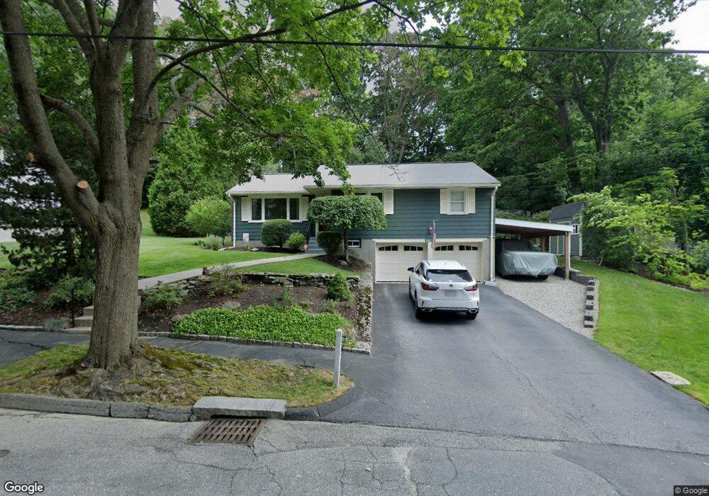
15 Pompano Rd Worcester, MA 01605
Burncoat NeighborhoodEstimated Value: $415,000 - $490,000
3
Beds
2
Baths
1,581
Sq Ft
$294/Sq Ft
Est. Value
About This Home
This home is located at 15 Pompano Rd, Worcester, MA 01605 and is currently estimated at $465,591, approximately $294 per square foot. 15 Pompano Rd is a home located in Worcester County with nearby schools including Jacob Hiatt Magnet School, Chandler Magnet, and Thorndyke Road School.
Ownership History
Date
Name
Owned For
Owner Type
Purchase Details
Closed on
Sep 22, 1995
Sold by
Hall William E and Hall Margaret
Bought by
Faucher Craig and Faucher Deanna
Current Estimated Value
Purchase Details
Closed on
Aug 26, 1987
Sold by
Lewis Meriwether
Bought by
Hall Margaret
Create a Home Valuation Report for This Property
The Home Valuation Report is an in-depth analysis detailing your home's value as well as a comparison with similar homes in the area
Home Values in the Area
Average Home Value in this Area
Purchase History
| Date | Buyer | Sale Price | Title Company |
|---|---|---|---|
| Faucher Craig | $112,500 | -- | |
| Hall Margaret | $138,900 | -- |
Source: Public Records
Mortgage History
| Date | Status | Borrower | Loan Amount |
|---|---|---|---|
| Open | Hall Margaret | $127,000 | |
| Closed | Hall Margaret | $173,000 | |
| Closed | Hall Margaret | $58,961 |
Source: Public Records
Tax History
| Year | Tax Paid | Tax Assessment Tax Assessment Total Assessment is a certain percentage of the fair market value that is determined by local assessors to be the total taxable value of land and additions on the property. | Land | Improvement |
|---|---|---|---|---|
| 2025 | $5,479 | $415,400 | $119,100 | $296,300 |
| 2024 | $5,349 | $389,000 | $119,100 | $269,900 |
| 2023 | $5,188 | $361,800 | $103,600 | $258,200 |
| 2022 | $4,609 | $303,000 | $82,800 | $220,200 |
| 2021 | $4,609 | $283,100 | $66,300 | $216,800 |
| 2020 | $4,408 | $259,300 | $66,200 | $193,100 |
| 2019 | $4,145 | $230,300 | $59,800 | $170,500 |
| 2018 | $4,009 | $212,000 | $59,800 | $152,200 |
| 2017 | $4,075 | $212,000 | $59,800 | $152,200 |
| 2016 | $4,040 | $196,000 | $44,800 | $151,200 |
| 2015 | $3,934 | $196,000 | $44,800 | $151,200 |
| 2014 | $3,830 | $196,000 | $44,800 | $151,200 |
Source: Public Records
Map
Nearby Homes
- 3205 Halcyon Dr Unit 3205
- 58 Osceola Ave
- 55 Clark St
- 45 Goldthwaite Rd
- 183 King Philip Rd
- 323 Burncoat St
- 331 Burncoat St
- 66 Eunice Ave
- 22 Huron Ave
- 13 Fatima Ln
- 15 Ericsson St
- 39 Whitmarsh Ave
- 30 Fales St
- 37 Kenwood Ave
- 30 Melrose St
- 35 Arbutus Rd
- 2 Selden St
- 655 Plantation St Unit 20B
- 17 Goucher Ave
- 30 Danielles Way
- 11 Pompano Rd
- 22 Stratton Rd
- 9 Pompano Rd
- 12 Pompano Rd
- 116 Acushnet Ave
- 18 Stratton Rd
- 10 Pompano Rd
- 7 Pompano Rd
- 110 Acushnet Ave
- 14 Stratton Rd
- 121 Acushnet Ave
- 119 Acushnet Ave
- 5 Pompano Rd
- 10 Stratton Rd
- 117 Acushnet Ave
- 6 Pompano Rd
- 105 Calumet Ave
- 123 Acushnet Ave
- 104 Acushnet Ave
- 15 Stratton Rd
Your Personal Tour Guide
Ask me questions while you tour the home.