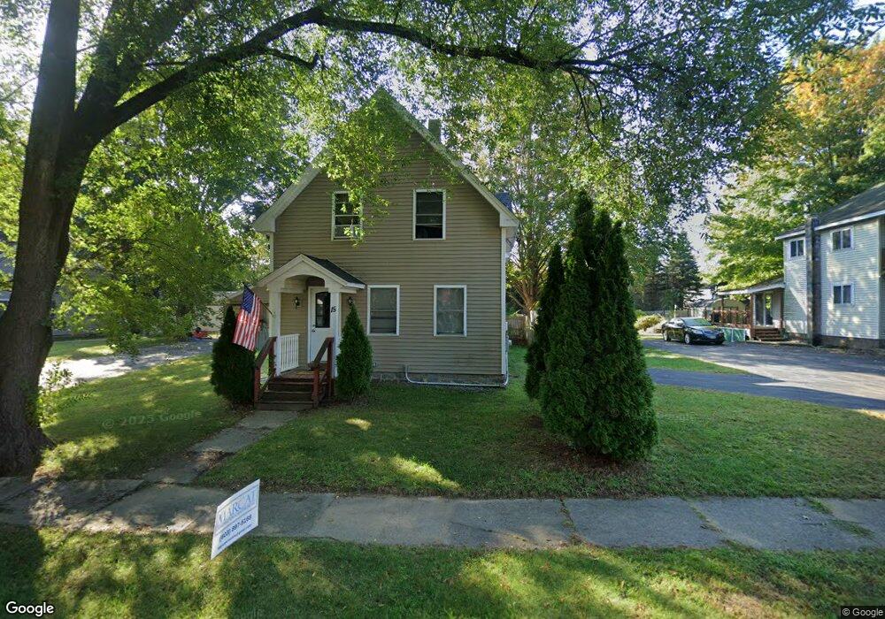
15 Railroad Ave MerriMacK, NH 03054
Estimated Value: $453,000 - $528,000
3
Beds
2
Baths
1,638
Sq Ft
$297/Sq Ft
Est. Value
About This Home
This home is located at 15 Railroad Ave, MerriMacK, NH 03054 and is currently estimated at $485,715, approximately $296 per square foot. 15 Railroad Ave is a home located in Hillsborough County with nearby schools including Thorntons Ferry School, James Mastricola Upper Elementary School, and Merrimack Middle School.
Ownership History
Date
Name
Owned For
Owner Type
Purchase Details
Closed on
Apr 9, 2018
Sold by
English Paul C and Bartis Robert J
Bought by
Railroad Ave Merrimack
Current Estimated Value
Purchase Details
Closed on
Jul 23, 2010
Sold by
Bank Of America Na Tr
Bought by
English Paul C and Bartis Robert J
Home Financials for this Owner
Home Financials are based on the most recent Mortgage that was taken out on this home.
Original Mortgage
$20,000
Interest Rate
4.76%
Mortgage Type
Unknown
Purchase Details
Closed on
Feb 25, 2010
Sold by
Huffman Kevin
Bought by
Bank Of America Na Tr
Purchase Details
Closed on
Jul 29, 2004
Sold by
Harwood Gretchen
Bought by
Huffman Kevin
Create a Home Valuation Report for This Property
The Home Valuation Report is an in-depth analysis detailing your home's value as well as a comparison with similar homes in the area
Home Values in the Area
Average Home Value in this Area
Purchase History
| Date | Buyer | Sale Price | Title Company |
|---|---|---|---|
| Railroad Ave Merrimack | -- | -- | |
| English Paul C | $128,000 | -- | |
| Bank Of America Na Tr | $181,100 | -- | |
| Huffman Kevin | $160,000 | -- |
Source: Public Records
Mortgage History
| Date | Status | Borrower | Loan Amount |
|---|---|---|---|
| Previous Owner | Huffman Kevin | $125,000 | |
| Previous Owner | Huffman Kevin | $20,000 | |
| Previous Owner | Huffman Kevin | $115,000 |
Source: Public Records
Tax History Compared to Growth
Tax History
| Year | Tax Paid | Tax Assessment Tax Assessment Total Assessment is a certain percentage of the fair market value that is determined by local assessors to be the total taxable value of land and additions on the property. | Land | Improvement |
|---|---|---|---|---|
| 2024 | $5,760 | $278,400 | $140,000 | $138,400 |
| 2023 | $5,415 | $278,400 | $140,000 | $138,400 |
| 2022 | $4,839 | $278,400 | $140,000 | $138,400 |
| 2021 | $4,780 | $278,400 | $140,000 | $138,400 |
| 2020 | $5,132 | $213,300 | $107,500 | $105,800 |
| 2019 | $4,848 | $200,900 | $102,100 | $98,800 |
| 2018 | $4,846 | $200,900 | $102,100 | $98,800 |
| 2017 | $4,695 | $200,900 | $102,100 | $98,800 |
| 2016 | $4,579 | $200,900 | $102,100 | $98,800 |
| 2015 | $4,477 | $181,100 | $85,000 | $96,100 |
| 2014 | $4,262 | $176,900 | $80,800 | $96,100 |
| 2013 | $4,230 | $176,900 | $80,800 | $96,100 |
Source: Public Records
Map
Nearby Homes
- 6 Oak St
- 16 Penacook Terrace
- 343 Charles Bancroft Hwy
- 10 Cascade Cir
- 17 Echo Shore Dr
- 2 Killian Ct
- 33 Hillside Terrace
- 315 Charles Bancroft Hwy
- 5 Lynn Dr
- 28 Winrow Dr
- 15 Joston Dr
- 12 E Ridge Rd Unit A
- 27 Pondview Dr
- 23 Pondview Dr
- 77 E Ridge Rd
- 22 Clay St
- 12 Clinton Ct
- 22 Essex Green Ct
- 10 Kingston Ct Unit 10
- 20 Essex Green Ct
- 17 Railroad Ave
- 13 Railroad Ave
- 11 Railroad Ave
- 18 Railroad Ave
- 16 Railroad Ave
- 20 Railroad Ave
- 9 Railroad Ave
- 14 Railroad Ave
- 12 Railroad Ave
- 7 Railroad Ave
- 8 Railroad Ave
- 6 Railroad Ave
- 2 Railroad Ave Unit 102
- 2 Railroad Ave Unit 1 (left side)
- 2 Railroad Ave Unit 21
- 427 Daniel Webster Hwy
- 427 Daniel Webster Hwy Unit 101
- 427 Dw Hwy
- 416 Daniel Webster Hwy
- 416 Daniel Webster Hwy Unit E