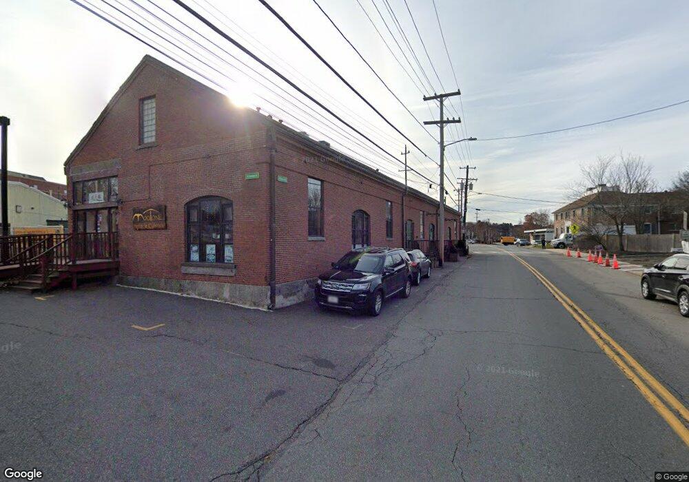
15 Railroad St Andover, MA 01810
Shawsheen Heights NeighborhoodEstimated Value: $1,093,768
--
Bed
--
Bath
4,959
Sq Ft
$221/Sq Ft
Est. Value
About This Home
This home is located at 15 Railroad St, Andover, MA 01810 and is currently estimated at $1,093,768, approximately $220 per square foot. 15 Railroad St is a home located in Essex County with nearby schools including West Elementary School, Andover West Middle School, and Andover High School.
Ownership History
Date
Name
Owned For
Owner Type
Purchase Details
Closed on
Jan 31, 2023
Sold by
Connerton Rt and Sumberg
Bought by
Eccf Real Estate Llc
Current Estimated Value
Purchase Details
Closed on
Mar 31, 1994
Sold by
Main Line Rt
Bought by
Connerton Rt
Home Financials for this Owner
Home Financials are based on the most recent Mortgage that was taken out on this home.
Original Mortgage
$152,000
Interest Rate
7.07%
Mortgage Type
Commercial
Create a Home Valuation Report for This Property
The Home Valuation Report is an in-depth analysis detailing your home's value as well as a comparison with similar homes in the area
Home Values in the Area
Average Home Value in this Area
Purchase History
| Date | Buyer | Sale Price | Title Company |
|---|---|---|---|
| Eccf Real Estate Llc | -- | None Available | |
| Eccf Real Estate Llc | -- | None Available | |
| Connerton Rt | $182,500 | -- | |
| Connerton Rt | $182,500 | -- |
Source: Public Records
Mortgage History
| Date | Status | Borrower | Loan Amount |
|---|---|---|---|
| Previous Owner | Connerton Rt | $152,000 |
Source: Public Records
Tax History Compared to Growth
Tax History
| Year | Tax Paid | Tax Assessment Tax Assessment Total Assessment is a certain percentage of the fair market value that is determined by local assessors to be the total taxable value of land and additions on the property. | Land | Improvement |
|---|---|---|---|---|
| 2024 | $27,139 | $1,065,100 | $144,200 | $920,900 |
| 2023 | $26,517 | $970,600 | $131,000 | $839,600 |
| 2022 | $25,435 | $868,400 | $119,100 | $749,300 |
| 2021 | $22,098 | $786,700 | $119,100 | $667,600 |
| 2020 | $21,183 | $780,500 | $119,100 | $661,400 |
| 2019 | $20,429 | $742,600 | $113,500 | $629,100 |
| 2018 | $18,736 | $678,600 | $113,500 | $565,100 |
| 2017 | $17,813 | $673,200 | $113,500 | $559,700 |
| 2016 | $17,356 | $667,800 | $108,100 | $559,700 |
| 2015 | $16,541 | $667,800 | $108,100 | $559,700 |
Source: Public Records
Map
Nearby Homes
- 22 Railroad St Unit 311
- 7-9 Buxton Ct
- 16 Cuba St
- 3 Weeping Willow Way
- 2 Powder Mill Square Unit 2B
- 61 Elm St Unit 61
- 14 Summer St
- 19 Smithshire Estates
- 16 Carmel Rd
- 31 Bartlet St
- 56 Central St
- 10C Washington Park Dr Unit 10
- 5 Castle Heights Rd
- 65 Central St
- 70 Washington Park Dr Unit 1
- 38 Lincoln Cir E
- 257 N Main St Unit 4
- 105 Elm St Unit A
- 4 Caileigh Ct
- 13 Leah Way
- 15 Railroad St Unit 1
- 15 Railroad St Unit 1 & 2
- 20 Amici Way
- 40 Amici Way Unit 10
- 40 Amici Way
- 22 Railroad St Unit 515
- 22 Railroad St Unit 514
- 22 Railroad St Unit 513
- 22 Railroad St Unit 512
- 22 Railroad St Unit 511
- 22 Railroad St Unit 510
- 22 Railroad St Unit 508
- 22 Railroad St Unit 507
- 22 Railroad St Unit 505
- 22 Railroad St Unit 504
- 22 Railroad St Unit 503
- 22 Railroad St Unit 502
- 22 Railroad St Unit 501
- 22 Railroad St Unit 415
- 22 Railroad St Unit 414