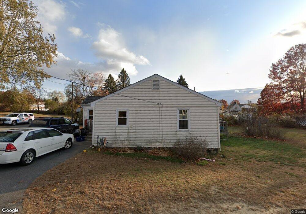
15 Randolph Ave Methuen, MA 01844
The East End NeighborhoodEstimated Value: $413,000 - $511,000
3
Beds
1
Bath
1,040
Sq Ft
$458/Sq Ft
Est. Value
About This Home
This home is located at 15 Randolph Ave, Methuen, MA 01844 and is currently estimated at $475,860, approximately $457 per square foot. 15 Randolph Ave is a home located in Essex County with nearby schools including South Point Elementary School, Methuen High School, and Community Day Charter Public School - Gateway.
Ownership History
Date
Name
Owned For
Owner Type
Purchase Details
Closed on
Mar 22, 2021
Sold by
Hanson Christopher P and Hanson Jacqueline
Bought by
Hanson Christopher P
Current Estimated Value
Purchase Details
Closed on
Jul 29, 2016
Sold by
Edith B Ricci T B and Edith Hanson
Bought by
Hanson Christopher P and Hanson Jacqueline
Home Financials for this Owner
Home Financials are based on the most recent Mortgage that was taken out on this home.
Original Mortgage
$180,412
Interest Rate
3.37%
Mortgage Type
FHA
Purchase Details
Closed on
May 13, 2016
Sold by
Ricci Edith B
Bought by
Edith B Ricci T B and Edith Hanson
Create a Home Valuation Report for This Property
The Home Valuation Report is an in-depth analysis detailing your home's value as well as a comparison with similar homes in the area
Home Values in the Area
Average Home Value in this Area
Purchase History
| Date | Buyer | Sale Price | Title Company |
|---|---|---|---|
| Hanson Christopher P | -- | None Available | |
| Hanson Christopher P | -- | None Available | |
| Hanson Christopher P | -- | None Available | |
| Hanson Christopher P | $208,600 | -- | |
| Hanson Christopher P | $208,600 | -- | |
| Hanson Christopher P | $208,600 | -- | |
| Edith B Ricci T B | -- | -- | |
| Edith B Ricci T B | -- | -- | |
| Edith B Ricci T B | -- | -- |
Source: Public Records
Mortgage History
| Date | Status | Borrower | Loan Amount |
|---|---|---|---|
| Previous Owner | Hanson Christopher P | $180,412 |
Source: Public Records
Tax History Compared to Growth
Tax History
| Year | Tax Paid | Tax Assessment Tax Assessment Total Assessment is a certain percentage of the fair market value that is determined by local assessors to be the total taxable value of land and additions on the property. | Land | Improvement |
|---|---|---|---|---|
| 2025 | $4,297 | $406,100 | $197,900 | $208,200 |
| 2024 | $4,216 | $388,200 | $179,900 | $208,300 |
| 2023 | $3,979 | $340,100 | $159,100 | $181,000 |
| 2022 | $3,794 | $290,700 | $131,500 | $159,200 |
| 2021 | $3,555 | $269,500 | $124,500 | $145,000 |
| 2020 | $3,550 | $264,100 | $124,500 | $139,600 |
| 2019 | $3,386 | $238,600 | $117,600 | $121,000 |
| 2018 | $3,212 | $225,100 | $117,600 | $107,500 |
| 2017 | $3,031 | $206,900 | $110,700 | $96,200 |
| 2016 | $2,989 | $201,800 | $110,700 | $91,100 |
| 2015 | $2,802 | $191,900 | $103,800 | $88,100 |
Source: Public Records
Map
Nearby Homes
- 29 Wallace St
- 17 Ferry Rd
- 45 Christopher Dr Unit 101
- 2 Goodrich Ave
- 27 Russell Farm Dr
- 23 Constitution Way Unit 23
- 23 Constitution Way
- 95 Pilgrim Cir Unit 95
- 86 Comet Rd
- 49 Golf Ave
- 128 Pleasant Valley St
- 122 Pleasant Valley St
- 46 Oneida St
- 50 Woburn St
- 107 Farrwood Dr Unit 107
- 68 Sterling Ln
- 369 Farrwood Dr
- 406 Farrwood Dr Unit 406
- 414 Farrwood Dr Unit 414
- 6 Aberdeen Rd