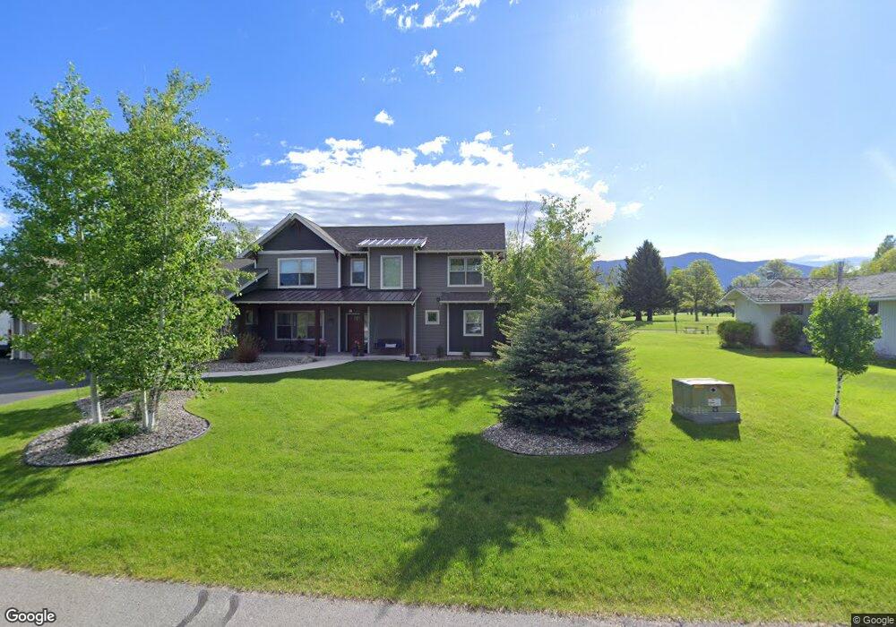
15 Riverside Dr Bozeman, MT 59715
North Bozeman NeighborhoodEstimated Value: $1,044,000 - $1,092,000
4
Beds
3
Baths
2,712
Sq Ft
$393/Sq Ft
Est. Value
About This Home
This home is located at 15 Riverside Dr, Bozeman, MT 59715 and is currently estimated at $1,066,992, approximately $393 per square foot. 15 Riverside Dr is a home with nearby schools including Hawthorne Elementary School, Chief Joseph Middle School, and Gallatin High School.
Ownership History
Date
Name
Owned For
Owner Type
Purchase Details
Closed on
Apr 17, 2023
Sold by
Henslee Kiersten
Bought by
Isaac And Kiersten Henslee Family Trust
Current Estimated Value
Purchase Details
Closed on
Jun 30, 2015
Sold by
Larson Michael and Larson Laurie
Bought by
Henslee Kiersten and Henslee Isaac
Purchase Details
Closed on
Sep 8, 2005
Sold by
Kenneth W & Karen L Kempt Family Trust
Bought by
Larson Michael and Larson Laurie
Create a Home Valuation Report for This Property
The Home Valuation Report is an in-depth analysis detailing your home's value as well as a comparison with similar homes in the area
Home Values in the Area
Average Home Value in this Area
Purchase History
| Date | Buyer | Sale Price | Title Company |
|---|---|---|---|
| Isaac And Kiersten Henslee Family Trust | -- | None Listed On Document | |
| Henslee Kiersten | -- | Montana Title & Escrow | |
| Larson Michael | -- | American Land Title Company |
Source: Public Records
Tax History
| Year | Tax Paid | Tax Assessment Tax Assessment Total Assessment is a certain percentage of the fair market value that is determined by local assessors to be the total taxable value of land and additions on the property. | Land | Improvement |
|---|---|---|---|---|
| 2025 | $4,804 | $985,400 | $0 | $0 |
| 2024 | $8,731 | $1,311,621 | $0 | $0 |
| 2023 | $9,331 | $1,311,621 | $0 | $0 |
| 2022 | $4,365 | $655,000 | $0 | $0 |
| 2021 | $5,472 | $655,000 | $0 | $0 |
| 2020 | $5,634 | $668,600 | $0 | $0 |
| 2019 | $5,788 | $668,600 | $0 | $0 |
| 2018 | $5,437 | $567,000 | $0 | $0 |
| 2017 | $3,465 | $351,203 | $0 | $0 |
| 2016 | $1,761 | $118,547 | $0 | $0 |
| 2015 | $1,734 | $118,547 | $0 | $0 |
| 2014 | $1,793 | $78,978 | $0 | $0 |
Source: Public Records
Map
Nearby Homes
- NHN Springhill Rd
- 263 Nelson Rd
- 3355 Royal Wolf Way Unit Lot 12
- 3646 N 27th Ave
- TBD Prince Ln
- TBD Royal Wolf Way
- 3391 Royal Wolf Way Unit Lot 13
- 3380 Prince Ln
- 3481 Royal Wolf Way Unit B
- 3481 Royal Wolf Way Unit A
- 3555 Royal Wolf Way Unit Lot 18
- 65 Naya-Nuki Dr
- 3341 N 27th Ave Unit 26
- 3354 Warbler Way Unit B
- TBD Catamount & Davis
- 3206 Warbler Way Unit 11
- 27737 Frontage Rd
- Lot 28 Cold Smoke Dr
- 2915 Branding Iron Rd
- 3123 Warbler Way Unit s A-D
- 14 Park Plaza Rd
- TBD Riverside Dr
- 42 Riverside Dr
- 43 Riverside Dr
- 41 Riverside Dr
- 13 Park Plaza Rd
- 17 Riverside Dr
- 40 Riverside Dr
- 44 Riverside Dr
- 12 Park Plaza Rd
- 39 Riverside Dr
- 39 Riverside Dr
- 43 Riverside Dr
- 59 Park Plaza Rd
- 18 Riverside Dr
- 45 Riverside Dr
- 111 Gallatin Dr Unit A
- 111 Gallatin Dr Unit B
- 111 Gallatin Dr Unit A
- 111 Gallatin Dr