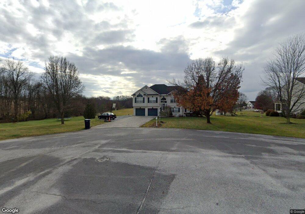
15 S Pheasant Way Unit 60 Abbottstown, PA 17301
Estimated Value: $419,000 - $542,000
4
Beds
3
Baths
2,792
Sq Ft
$167/Sq Ft
Est. Value
About This Home
This home is located at 15 S Pheasant Way Unit 60, Abbottstown, PA 17301 and is currently estimated at $466,497, approximately $167 per square foot. 15 S Pheasant Way Unit 60 is a home located in Adams County with nearby schools including New Oxford Senior High School and Paradise School.
Ownership History
Date
Name
Owned For
Owner Type
Purchase Details
Closed on
Mar 25, 2013
Sold by
Jaeckels Donald D and Jaeckels Julianne M
Bought by
Tomecek Brian P and Tomecek Crystal A
Current Estimated Value
Home Financials for this Owner
Home Financials are based on the most recent Mortgage that was taken out on this home.
Original Mortgage
$274,928
Outstanding Balance
$192,508
Interest Rate
3.37%
Mortgage Type
FHA
Estimated Equity
$273,989
Purchase Details
Closed on
Dec 22, 2005
Sold by
Gladhill Troy A and Gladhill Michelle F
Bought by
Jaeckels Donald D and Jaeckels Julianne M
Home Financials for this Owner
Home Financials are based on the most recent Mortgage that was taken out on this home.
Original Mortgage
$150,000
Interest Rate
6%
Mortgage Type
Adjustable Rate Mortgage/ARM
Create a Home Valuation Report for This Property
The Home Valuation Report is an in-depth analysis detailing your home's value as well as a comparison with similar homes in the area
Home Values in the Area
Average Home Value in this Area
Purchase History
| Date | Buyer | Sale Price | Title Company |
|---|---|---|---|
| Tomecek Brian P | $280,000 | None Available | |
| Jaeckels Donald D | $310,000 | -- |
Source: Public Records
Mortgage History
| Date | Status | Borrower | Loan Amount |
|---|---|---|---|
| Open | Tomecek Brian P | $274,928 | |
| Previous Owner | Jaeckels Donald D | $150,000 | |
| Previous Owner | Jaeckels Donald D | $98,000 |
Source: Public Records
Tax History Compared to Growth
Tax History
| Year | Tax Paid | Tax Assessment Tax Assessment Total Assessment is a certain percentage of the fair market value that is determined by local assessors to be the total taxable value of land and additions on the property. | Land | Improvement |
|---|---|---|---|---|
| 2025 | $6,337 | $279,500 | $72,900 | $206,600 |
| 2024 | $5,826 | $279,500 | $72,900 | $206,600 |
| 2023 | $5,597 | $279,500 | $72,900 | $206,600 |
| 2022 | $5,415 | $279,500 | $72,900 | $206,600 |
| 2021 | $5,267 | $279,500 | $72,900 | $206,600 |
| 2020 | $5,136 | $279,500 | $72,900 | $206,600 |
| 2019 | $5,022 | $279,500 | $72,900 | $206,600 |
| 2018 | $4,909 | $279,500 | $72,900 | $206,600 |
| 2017 | $4,692 | $279,500 | $72,900 | $206,600 |
| 2016 | -- | $279,500 | $72,900 | $206,600 |
| 2015 | -- | $279,500 | $72,900 | $206,600 |
| 2014 | -- | $279,500 | $72,900 | $206,600 |
Source: Public Records
Map
Nearby Homes
- 334 Rolling Ln Unit 2
- 484 Brough Rd
- 60 Hunters Cir Unit 19
- 224 W King St
- 486 W King St
- 290 Woods Rd Unit 1
- 0 Woods Rd
- 507 Bullet Way
- 28 Town Cir Unit 12A
- 201 Kinneman Rd Unit 25
- 6 Lobell Rd
- 221 Kinneman Rd Unit 28
- 278 Runaway Rd
- 6431 York Rd
- 702 Wind In the Willows
- 115 Creekland Dr Unit 4
- 7461 Saint Patrick Ct
- 7463 Saint Patrick Ct
- 7459 Saint Patrick Ct
- 7457 Saint Patrick Ct
- 9 S Pheasant Way Unit 15
- 24 Deer Trail Rd Unit 12
- 5 S Pheasant Way Unit 14
- 8 S Pheasant Way Unit 16
- 355 Rolling Ln Unit 13
- 20 Deer Trail Rd Unit 11
- 375 Rolling Ln Unit 20
- 385 Rolling Ln Unit 19
- 16 Deer Trail Rd Unit 10
- 11 Deer Trail Rd Unit 17
- 2 N Pheasant Way Unit 22
- 335 Rolling Ln Unit 61A
- 350 Rolling Ln Unit 21
- 3 N Pheasant Way Unit 59
- 340 Rolling Ln Unit 65
- 395 Rolling Ln Unit 18
- 8 N Pheasant Way Unit 23
- 12 Deer Trail Rd Unit 9
- 9 N Pheasant Way Unit 58
- 8 Deer Trail Rd Unit 8