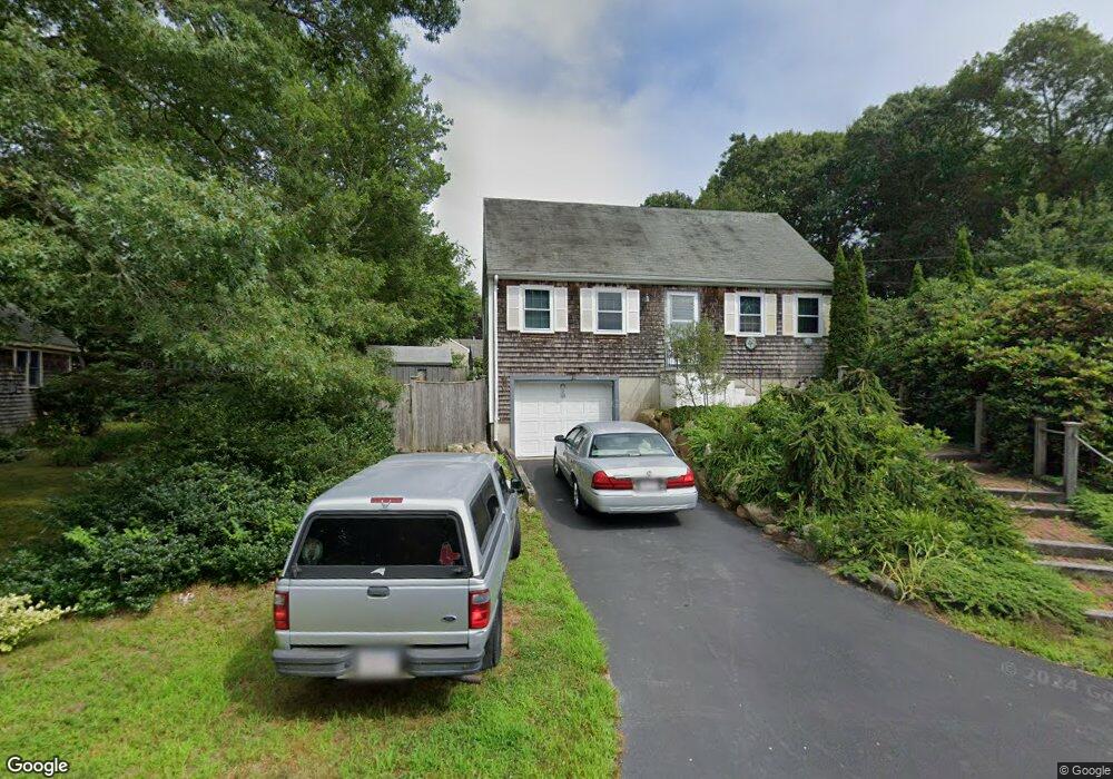
15 Sabbatt Rd Pocasset, MA 02559
Pocasset NeighborhoodEstimated Value: $503,000 - $575,000
2
Beds
2
Baths
1,224
Sq Ft
$441/Sq Ft
Est. Value
About This Home
This home is located at 15 Sabbatt Rd, Pocasset, MA 02559 and is currently estimated at $539,537, approximately $440 per square foot. 15 Sabbatt Rd is a home located in Barnstable County with nearby schools including Bourne High School, Cadence Academy Preschool - Bourne, and St Margaret Regional School.
Create a Home Valuation Report for This Property
The Home Valuation Report is an in-depth analysis detailing your home's value as well as a comparison with similar homes in the area
Home Values in the Area
Average Home Value in this Area
Tax History Compared to Growth
Tax History
| Year | Tax Paid | Tax Assessment Tax Assessment Total Assessment is a certain percentage of the fair market value that is determined by local assessors to be the total taxable value of land and additions on the property. | Land | Improvement |
|---|---|---|---|---|
| 2025 | $3,343 | $428,100 | $197,800 | $230,300 |
| 2024 | $3,389 | $422,600 | $205,400 | $217,200 |
| 2023 | $3,297 | $374,200 | $181,800 | $192,400 |
| 2022 | $3,031 | $300,400 | $147,500 | $152,900 |
| 2021 | $2,966 | $275,400 | $134,200 | $141,200 |
| 2020 | $2,806 | $261,300 | $133,000 | $128,300 |
| 2019 | $2,671 | $254,100 | $133,000 | $121,100 |
| 2018 | $2,613 | $247,900 | $132,400 | $115,500 |
| 2017 | $2,486 | $241,400 | $131,100 | $110,300 |
| 2016 | $2,401 | $236,300 | $131,100 | $105,200 |
| 2015 | $1,978 | $196,400 | $91,200 | $105,200 |
Source: Public Records
Map
Nearby Homes
- 7 Portside Dr
- 7 4th Ave
- 15 1st St
- 174 Barlows Landing Rd
- 940 County Rd
- 709 County Rd
- 940 County Rd
- 254 Barlows Landing Rd
- 39 Bennets Neck Dr
- 1094 County Rd
- 3 Red Brook Pond Dr
- 515 County Rd
- 171 Bellavista Dr
- 16 Tara Terrace
- 501 County Rd
- 48 Red Brook Harbor Rd
- 22 Nairn Rd
- 14 Navajo Rd
- 1234 Route 28a
- 30 Howard Ave