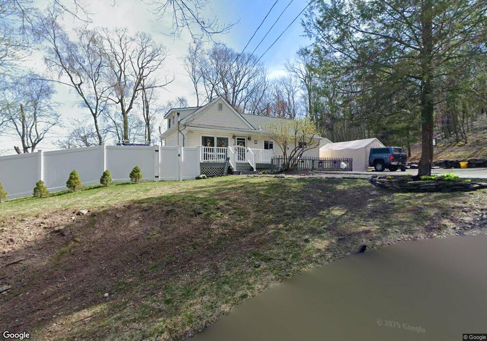
15 Secaucus Rd Hewitt, NJ 07421
Estimated Value: $370,186 - $424,000
Studio
--
Bath
1,185
Sq Ft
$338/Sq Ft
Est. Value
About This Home
This home is located at 15 Secaucus Rd, Hewitt, NJ 07421 and is currently estimated at $401,047, approximately $338 per square foot. 15 Secaucus Rd is a home located in Passaic County with nearby schools including Macopin Middle School and West Milford High School.
Ownership History
Date
Name
Owned For
Owner Type
Purchase Details
Closed on
Mar 13, 2020
Sold by
Kucera Joseph and Kucera Virginia
Bought by
Bush Ryan and Bush Laurie
Current Estimated Value
Purchase Details
Closed on
Aug 10, 2010
Sold by
Bush Ryan and Kucera Joseph
Bought by
Kucera Joseph and Kucera Virginia
Home Financials for this Owner
Home Financials are based on the most recent Mortgage that was taken out on this home.
Original Mortgage
$104,000
Interest Rate
4.57%
Mortgage Type
Purchase Money Mortgage
Create a Home Valuation Report for This Property
The Home Valuation Report is an in-depth analysis detailing your home's value as well as a comparison with similar homes in the area
Home Values in the Area
Average Home Value in this Area
Purchase History
| Date | Buyer | Sale Price | Title Company |
|---|---|---|---|
| Bush Ryan | -- | None Available | |
| Kucera Joseph | $130,000 | -- | |
| Kucera Joseph | $85,000 | -- |
Source: Public Records
Mortgage History
| Date | Status | Borrower | Loan Amount |
|---|---|---|---|
| Previous Owner | Kucera Joseph | $104,000 |
Source: Public Records
Tax History
| Year | Tax Paid | Tax Assessment Tax Assessment Total Assessment is a certain percentage of the fair market value that is determined by local assessors to be the total taxable value of land and additions on the property. | Land | Improvement |
|---|---|---|---|---|
| 2025 | $7,654 | $188,800 | $81,700 | $107,100 |
| 2024 | $7,694 | $188,800 | $81,700 | $107,100 |
| 2022 | $7,303 | $188,800 | $81,700 | $107,100 |
| 2021 | $7,146 | $188,800 | $81,700 | $107,100 |
| 2020 | $7,071 | $188,800 | $81,700 | $107,100 |
| 2019 | $6,976 | $188,800 | $81,700 | $107,100 |
| 2018 | $6,959 | $188,800 | $81,700 | $107,100 |
| 2017 | $6,991 | $188,800 | $81,700 | $107,100 |
| 2016 | $7,003 | $188,800 | $81,700 | $107,100 |
| 2015 | $6,921 | $188,800 | $81,700 | $107,100 |
| 2014 | $6,753 | $188,800 | $81,700 | $107,100 |
Source: Public Records
Map
Nearby Homes
- 628-630 N Lake Shore Dr
- 119 Lake Shore Dr
- 34 Race Track Dr
- 33 Race Track Dr
- 32 Clayton Rd
- 677 Warwick Turnpike
- 6 Florence Rd
- 630 Warwick Turnpike
- 4 Wyckoff Ct
- 0 Kresson Rd
- 19 Up Grnwd Rd
- 512 N Lake Shore Dr
- 71 Witte Rd
- 15 Hanover Rd
- 3 Riverside Rd
- 00 Jenkins Rd
- 42 Witte Rd
- 36 Chatham Rd
- 8 Tyler Place
- 67 Hanover Rd
- 6 Belmar Ct
- 16 Secaucus Rd
- 11 Secaucus Rd
- 14 Secaucus Rd
- 10 Secaucus Rd
- 166 Lake Shore Dr
- 7 Belmar Ct
- 21 Greenwich Rd
- 2 Belmont Ct
- 25 Greenwich Rd
- 172 Lake Shore Dr
- 160 Lake Shore Dr
- 6 Secaucus Rd
- 15 Greenwich Rd
- 169 N Lake Shore Dr
- 8 Durmont Ct
- 169 Lake Shore Dr
- 176 Lake Shore Dr
- 4 Secaucus Rd
- 171 Lake Shore Dr
Your Personal Tour Guide
Ask me questions while you tour the home.