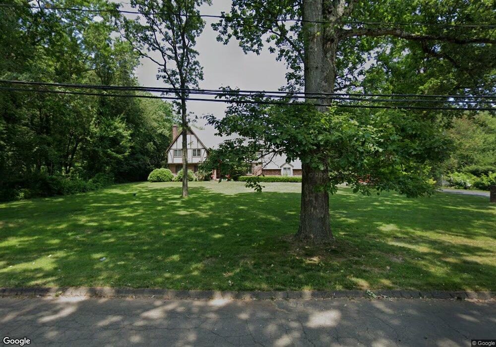
15 Smoke Rise Rd Wallingford, CT 06492
Estimated Value: $693,000 - $996,000
--
Bed
3
Baths
--
Sq Ft
1.88
Acres
About This Home
This home is located at 15 Smoke Rise Rd, Wallingford, CT 06492 and is currently estimated at $886,194. 15 Smoke Rise Rd is a home located in New Haven County with nearby schools including Evarts C. Stevens School, Pond Hill Elementary School, and Dag Hammarskjold Middle School.
Ownership History
Date
Name
Owned For
Owner Type
Purchase Details
Closed on
Dec 29, 2009
Sold by
Ferraiolo Guy A
Bought by
Ferraiolo Cheryl
Current Estimated Value
Purchase Details
Closed on
Mar 26, 1999
Sold by
Hocking Wayne R and Hocking Un Hui
Bought by
Ferraiolo Guy A and Ferraiolo Cheryl A
Home Financials for this Owner
Home Financials are based on the most recent Mortgage that was taken out on this home.
Original Mortgage
$100,000
Interest Rate
6.78%
Purchase Details
Closed on
Aug 17, 1994
Sold by
Pelizza Peter J and Pelizza Maryann H
Bought by
Hocking Wayne R and Hocking Unhui
Purchase Details
Closed on
May 21, 1993
Sold by
Geremia Carol A
Bought by
Felizza Peter J and Felizza Mary Ann H
Create a Home Valuation Report for This Property
The Home Valuation Report is an in-depth analysis detailing your home's value as well as a comparison with similar homes in the area
Home Values in the Area
Average Home Value in this Area
Purchase History
| Date | Buyer | Sale Price | Title Company |
|---|---|---|---|
| Ferraiolo Cheryl | -- | -- | |
| Ferraiolo Guy A | $387,400 | -- | |
| Hocking Wayne R | $375,000 | -- | |
| Felizza Peter J | $375,000 | -- |
Source: Public Records
Mortgage History
| Date | Status | Borrower | Loan Amount |
|---|---|---|---|
| Previous Owner | Felizza Peter J | $500,000 | |
| Previous Owner | Felizza Peter J | $96,000 | |
| Previous Owner | Felizza Peter J | $100,000 |
Source: Public Records
Tax History Compared to Growth
Tax History
| Year | Tax Paid | Tax Assessment Tax Assessment Total Assessment is a certain percentage of the fair market value that is determined by local assessors to be the total taxable value of land and additions on the property. | Land | Improvement |
|---|---|---|---|---|
| 2025 | $15,478 | $641,700 | $113,800 | $527,900 |
| 2024 | $12,991 | $423,700 | $94,700 | $329,000 |
| 2023 | $12,232 | $416,900 | $94,700 | $322,200 |
| 2022 | $12,107 | $416,900 | $94,700 | $322,200 |
| 2021 | $11,890 | $416,900 | $94,700 | $322,200 |
| 2020 | $13,244 | $453,700 | $112,900 | $340,800 |
| 2019 | $13,244 | $453,700 | $112,900 | $340,800 |
| 2018 | $12,994 | $453,700 | $112,900 | $340,800 |
| 2017 | $12,953 | $453,700 | $112,900 | $340,800 |
| 2016 | $12,654 | $453,700 | $112,900 | $340,800 |
| 2015 | $12,636 | $460,000 | $112,900 | $347,100 |
| 2014 | $12,369 | $460,000 | $112,900 | $347,100 |
Source: Public Records
Map
Nearby Homes
- 107 Woodhouse Ave
- 126 Cooke Rd
- 11 Birchwood Rd
- 22 Carlen Dr
- 84 Oxbow Ln
- 41 Northford Rd
- 12 Roxbury Ln
- 29 Oxbow Ln
- 513 Pilgrim Harbor
- 26 Mallard Ct
- 6 Cypress Ln Unit 2
- 3 Pilgrim Harbor Unit C
- 10 Pilgrim Harbor Unit D
- 3 Pilgrim Harbor Unit A
- 7 Cypress Ln Unit 3
- 60 Spruce St
- 24 Evergreen Rd
- 14 Saint Andrews Cir Unit 6
- 32 Brian Rd
- 341 Long Hill Rd
- 11 Smoke Rise Rd
- 19 Smoke Rise Rd
- 7 Smoke Rise Rd
- 12 Smoke Rise Rd
- 51 Maltby Ln
- 179 Maltby Ln
- 50 Maltby Ln
- 8 Smoke Rise Rd
- 3 Anderson Rd
- 3 Smoke Rise Rd
- 54 Maltby Ln
- 55 Maltby Ln
- 21 New England Dr
- 53 Maltby Ln
- 15 New England Dr
- 181 Maltby Ln
- 2 Smoke Rise Rd
- 4 Anderson Rd
- 11 New England Dr
- 5 Anderson Rd