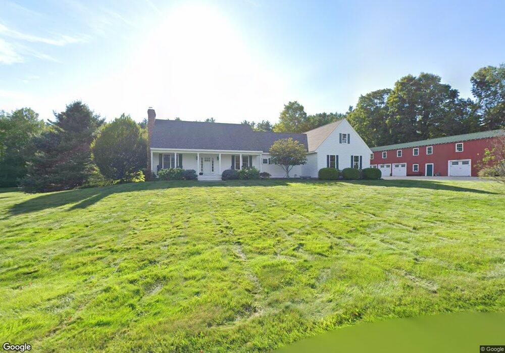
15 Spaulding Ln Hollis, NH 03049
Hollis NeighborhoodEstimated Value: $871,000 - $1,151,000
3
Beds
4
Baths
2,212
Sq Ft
$455/Sq Ft
Est. Value
About This Home
This home is located at 15 Spaulding Ln, Hollis, NH 03049 and is currently estimated at $1,006,052, approximately $454 per square foot. 15 Spaulding Ln is a home located in Hillsborough County with nearby schools including Hollis Primary School, Hollis Upper Elementary School, and Hollis-Brookline Middle School.
Ownership History
Date
Name
Owned For
Owner Type
Purchase Details
Closed on
Sep 28, 2018
Sold by
Joan F Lorden Ret
Bought by
Bolduc Wayne R
Current Estimated Value
Purchase Details
Closed on
Feb 25, 2010
Sold by
Spaulding Sumner E Est
Bought by
Lorden Raymond E and Lorden Joan F
Create a Home Valuation Report for This Property
The Home Valuation Report is an in-depth analysis detailing your home's value as well as a comparison with similar homes in the area
Home Values in the Area
Average Home Value in this Area
Purchase History
| Date | Buyer | Sale Price | Title Company |
|---|---|---|---|
| Bolduc Wayne R | $125,000 | -- | |
| Lorden Raymond E | $146,000 | -- |
Source: Public Records
Tax History Compared to Growth
Tax History
| Year | Tax Paid | Tax Assessment Tax Assessment Total Assessment is a certain percentage of the fair market value that is determined by local assessors to be the total taxable value of land and additions on the property. | Land | Improvement |
|---|---|---|---|---|
| 2024 | $15,739 | $887,700 | $281,800 | $605,900 |
| 2023 | $14,789 | $887,700 | $281,800 | $605,900 |
| 2022 | $20,035 | $887,700 | $281,800 | $605,900 |
| 2021 | $13,166 | $580,000 | $194,600 | $385,400 |
| 2020 | $4,252 | $580,000 | $194,600 | $385,400 |
| 2019 | $3,990 | $580,000 | $194,600 | $385,400 |
| 2018 | $12,569 | $580,000 | $194,600 | $385,400 |
| 2017 | $10,397 | $449,100 | $176,300 | $272,800 |
| 2016 | $10,522 | $449,100 | $176,300 | $272,800 |
| 2015 | $10,338 | $449,100 | $176,300 | $272,800 |
| 2014 | $10,388 | $449,100 | $176,300 | $272,800 |
| 2013 | $8,729 | $382,500 | $176,300 | $206,200 |
Source: Public Records
Map
Nearby Homes
- 5-A B Spaulding Ln
- 5 Spaulding Ln Unit A
- 5 Spaulding Ln
- 16 Spaulding Ln
- 83 Pepperell Rd
- 4 Spaulding Ln
- 77 Pepperell Rd
- 89 Pepperell Rd
- 73 Pepperell Rd
- 33 Spaulding Ln
- 66 Pepperell Rd
- 7 Baldwin Ln
- 69 Pepperell Rd
- 108 Pepperell Rd
- 8 Baldwin Ln
- 11 Baldwin Ln
- 113 Pepperell Rd
- 37 Eastman Ln
- 22 Black Oak Dr