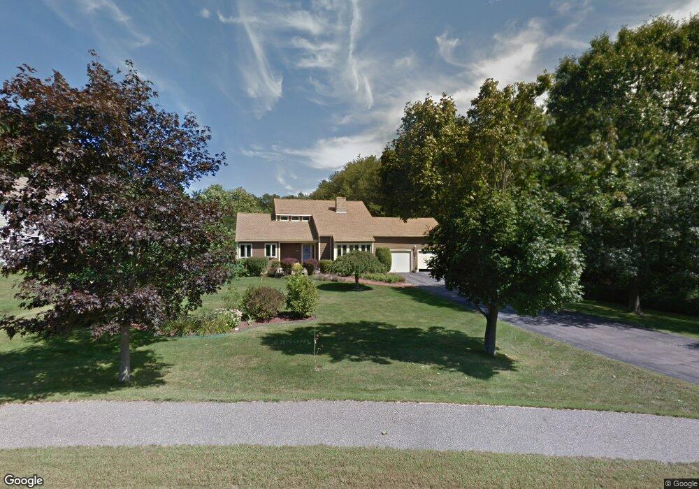
15 Stanwood Dr Franklin, MA 02038
Estimated Value: $733,000 - $1,028,000
3
Beds
4
Baths
1,929
Sq Ft
$457/Sq Ft
Est. Value
About This Home
This home is located at 15 Stanwood Dr, Franklin, MA 02038 and is currently estimated at $881,803, approximately $457 per square foot. 15 Stanwood Dr is a home located in Norfolk County with nearby schools including John F. Kennedy Memorial School, Horace Mann Middle School, and Franklin High School.
Ownership History
Date
Name
Owned For
Owner Type
Purchase Details
Closed on
Oct 27, 2020
Sold by
Mahar A Bruce A and Mahar Mary E
Bought by
Mahar Lt
Current Estimated Value
Purchase Details
Closed on
Sep 15, 1995
Sold by
Fleming Robin G and Fleming Margaret E
Bought by
Mahar A Bruce and Mahar Mary E
Home Financials for this Owner
Home Financials are based on the most recent Mortgage that was taken out on this home.
Original Mortgage
$183,000
Interest Rate
7.81%
Mortgage Type
Purchase Money Mortgage
Create a Home Valuation Report for This Property
The Home Valuation Report is an in-depth analysis detailing your home's value as well as a comparison with similar homes in the area
Home Values in the Area
Average Home Value in this Area
Purchase History
| Date | Buyer | Sale Price | Title Company |
|---|---|---|---|
| Mahar Lt | -- | None Available | |
| Mahar A Bruce | $229,000 | -- |
Source: Public Records
Mortgage History
| Date | Status | Borrower | Loan Amount |
|---|---|---|---|
| Previous Owner | Mahar A Bruce | $183,000 | |
| Previous Owner | Mahar A Bruce | $100,000 | |
| Previous Owner | Mahar A Bruce | $103,000 |
Source: Public Records
Tax History Compared to Growth
Tax History
| Year | Tax Paid | Tax Assessment Tax Assessment Total Assessment is a certain percentage of the fair market value that is determined by local assessors to be the total taxable value of land and additions on the property. | Land | Improvement |
|---|---|---|---|---|
| 2025 | $8,494 | $731,000 | $339,100 | $391,900 |
| 2024 | $8,200 | $695,500 | $339,100 | $356,400 |
| 2023 | $8,188 | $650,900 | $294,500 | $356,400 |
| 2022 | $7,593 | $540,400 | $223,100 | $317,300 |
| 2021 | $7,387 | $504,200 | $248,100 | $256,100 |
| 2020 | $6,911 | $476,300 | $231,700 | $244,600 |
| 2019 | $6,864 | $468,200 | $223,500 | $244,700 |
| 2018 | $6,464 | $441,200 | $219,400 | $221,800 |
| 2017 | $6,223 | $426,800 | $205,000 | $221,800 |
| 2016 | $6,202 | $427,700 | $207,500 | $220,200 |
| 2015 | $6,268 | $422,400 | $202,200 | $220,200 |
| 2014 | $5,744 | $397,500 | $177,300 | $220,200 |
Source: Public Records
Map
Nearby Homes
- 60 Pine St
- 14 Hawthorne Village Unit D
- 8 Mohawk Path
- 951 Pond St
- 17 Pine St
- 1081 Pond St
- 49 Palomino Dr
- 359 Hartford Ave
- 455 Hartford Ave
- 471 Pond St
- 462 Hartford Ave
- 0 Old Log Lane (Farm St) Unit 73416329
- 60 Southgate Rd
- 13 Hemlock Ln
- 21 Riverside Rd
- 405 Brenda Ln
- 30 Stone St
- 29 Hancock Rd
- 488 Maple St
- 0 Farm St
- 15 Stanwood Dr
- 11 Stanwood Dr
- 12 Stanwood Dr
- 8 Stanwood Dr
- 16 Stanwood Dr
- 23 Stanwood Dr
- 4 Stanwood Dr
- 20 Stanwood Dr
- 0 Lot D Stanwood Dr Unit 50274188
- 0 Lot A Stanwood Dr Unit 50274190
- 36 Stanwood Dr
- 27 Stanwood Dr
- 146 Pine St
- 144 Pine St
- 138 Pine St
- 31 Stanwood Dr
- 150 Pine St
- 7 Stanwood Dr
- 35 Stanwood Dr
- 152 Pine St