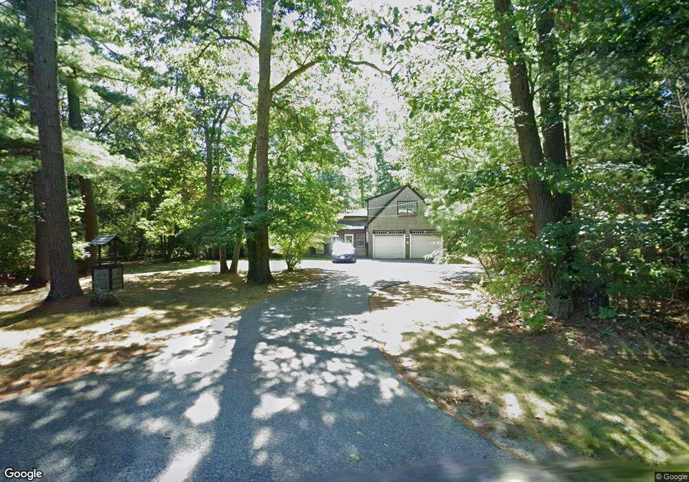
15 Thomas St Middleboro, MA 02346
Estimated Value: $572,150 - $673,000
3
Beds
1
Bath
1,040
Sq Ft
$593/Sq Ft
Est. Value
About This Home
This home is located at 15 Thomas St, Middleboro, MA 02346 and is currently estimated at $617,038, approximately $593 per square foot. 15 Thomas St is a home located in Plymouth County with nearby schools including Mary K. Goode Elementary School, Mullein Hill Christian Academy, and Samuel Fuller School.
Ownership History
Date
Name
Owned For
Owner Type
Purchase Details
Closed on
Jun 13, 1997
Sold by
Hinkle Michael J and Hinkle Jodi J
Bought by
Pedro Carol and Ramsey John
Current Estimated Value
Purchase Details
Closed on
Nov 24, 1992
Sold by
Massachusetts Coop Bk
Bought by
Hinkle Michael J and Hinkle Jodi J
Purchase Details
Closed on
Jul 3, 1992
Sold by
Broomhead Shirley A
Bought by
Massachusetts Coop Bk
Purchase Details
Closed on
Aug 11, 1988
Sold by
Mulkern Stephen M
Bought by
Broomhead Shirley A
Create a Home Valuation Report for This Property
The Home Valuation Report is an in-depth analysis detailing your home's value as well as a comparison with similar homes in the area
Home Values in the Area
Average Home Value in this Area
Purchase History
| Date | Buyer | Sale Price | Title Company |
|---|---|---|---|
| Pedro Carol | $119,900 | -- | |
| Hinkle Michael J | $92,000 | -- | |
| Massachusetts Coop Bk | $90,000 | -- | |
| Broomhead Shirley A | $142,000 | -- |
Source: Public Records
Mortgage History
| Date | Status | Borrower | Loan Amount |
|---|---|---|---|
| Open | Broomhead Shirley A | $207,198 | |
| Closed | Broomhead Shirley A | $216,000 |
Source: Public Records
Tax History
| Year | Tax Paid | Tax Assessment Tax Assessment Total Assessment is a certain percentage of the fair market value that is determined by local assessors to be the total taxable value of land and additions on the property. | Land | Improvement |
|---|---|---|---|---|
| 2025 | $6,477 | $483,000 | $175,400 | $307,600 |
| 2024 | $6,130 | $452,700 | $167,200 | $285,500 |
| 2023 | $5,996 | $421,100 | $167,200 | $253,900 |
| 2022 | $5,551 | $360,900 | $145,300 | $215,600 |
| 2021 | $5,330 | $327,600 | $133,600 | $194,000 |
| 2020 | $5,123 | $322,600 | $133,600 | $189,000 |
| 2019 | $4,913 | $317,400 | $133,600 | $183,800 |
| 2018 | $4,668 | $299,200 | $121,400 | $177,800 |
| 2017 | $4,397 | $278,800 | $117,100 | $161,700 |
| 2016 | $4,281 | $268,900 | $107,000 | $161,900 |
| 2015 | $4,213 | $267,000 | $107,000 | $160,000 |
Source: Public Records
Map
Nearby Homes
- 135 E Grove St
- 162 E Grove St
- LOT A Wood St
- 26 Susan Ln
- 17 Cobblestone Ln
- 129 Thomas St
- 7 Tispaquin St
- 308 Wood St
- 18 Rock St
- 0 Wareham Miller St Unit 73410845
- 6 Rock St
- 240 N Main St
- 124 Ashley Ln Unit 12-4
- 47 Faye Ave
- 295 Cherry St
- 15 E Grove St
- 227 E Main St
- 28 School St
- 87 Pearl St
- 1 Bloomfield Ave
- 11 Thomas St
- 19 Thomas St
- 9 Thomas St
- 20 Thomas St
- 21 Thomas St
- 22 Thomas St
- 7 Thomas St
- 12 Thomas St
- 225 Wareham St
- 223 Wareham St
- 227 Wareham St
- 29 Thomas St
- 34.4 Acres W Grove St 234 Apts
- Lot 7 Look Out Cir
- Lot 1 Miller St Unit TBD
- Lot 5 Fernway Estates
- Lot 10 Fernway Estates
- 60 Francisco da Lira
- 26 Thomas St
- 231 Wareham St
Your Personal Tour Guide
Ask me questions while you tour the home.