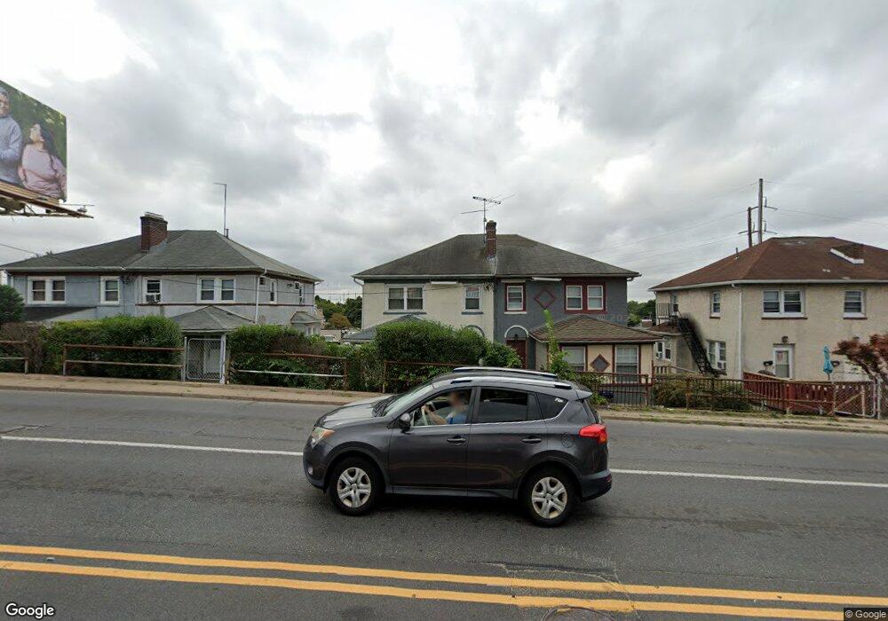
15 W Township Line Rd Upper Darby, PA 19082
Estimated Value: $232,446
--
Bed
--
Bath
1,985
Sq Ft
$117/Sq Ft
Est. Value
About This Home
This home is located at 15 W Township Line Rd, Upper Darby, PA 19082 and is currently estimated at $232,446, approximately $117 per square foot. 15 W Township Line Rd is a home located in Delaware County with nearby schools including Upper Darby Kdg Center, Drexel Hill Middle School, and Upper Darby High School.
Ownership History
Date
Name
Owned For
Owner Type
Purchase Details
Closed on
Dec 27, 2007
Sold by
Pastore E G and Morrison Paul
Bought by
Mccabe Patrick and Carberry Declan
Current Estimated Value
Home Financials for this Owner
Home Financials are based on the most recent Mortgage that was taken out on this home.
Original Mortgage
$126,000
Outstanding Balance
$79,988
Interest Rate
6.27%
Mortgage Type
Purchase Money Mortgage
Estimated Equity
$152,458
Purchase Details
Closed on
Oct 31, 2001
Sold by
Fine Nathaniel D and Fine Adeline C
Bought by
Pastore E G and Morrison Paul
Create a Home Valuation Report for This Property
The Home Valuation Report is an in-depth analysis detailing your home's value as well as a comparison with similar homes in the area
Home Values in the Area
Average Home Value in this Area
Purchase History
| Date | Buyer | Sale Price | Title Company |
|---|---|---|---|
| Mccabe Patrick | $140,000 | None Available | |
| Pastore E G | $50,000 | -- |
Source: Public Records
Mortgage History
| Date | Status | Borrower | Loan Amount |
|---|---|---|---|
| Open | Mccabe Patrick | $126,000 |
Source: Public Records
Tax History Compared to Growth
Tax History
| Year | Tax Paid | Tax Assessment Tax Assessment Total Assessment is a certain percentage of the fair market value that is determined by local assessors to be the total taxable value of land and additions on the property. | Land | Improvement |
|---|---|---|---|---|
| 2025 | $5,301 | $125,340 | $66,370 | $58,970 |
| 2024 | $5,301 | $125,340 | $66,370 | $58,970 |
| 2023 | $5,251 | $125,340 | $66,370 | $58,970 |
| 2022 | $5,110 | $125,340 | $66,370 | $58,970 |
| 2021 | $6,890 | $125,340 | $66,370 | $58,970 |
| 2020 | $7,181 | $111,020 | $88,310 | $22,710 |
| 2019 | $7,055 | $111,020 | $88,310 | $22,710 |
| 2018 | $6,974 | $111,020 | $0 | $0 |
| 2017 | $6,793 | $111,020 | $0 | $0 |
| 2016 | $609 | $111,020 | $0 | $0 |
| 2015 | $622 | $111,020 | $0 | $0 |
| 2014 | $609 | $111,020 | $0 | $0 |
Source: Public Records
Map
Nearby Homes
- 8525 Monroe Ave
- 9138 W Chester Pike
- 2228 Manor Ave
- 9 N Brighton Ave
- 142 Foster Ave
- 2287 S Harwood Ave
- 22 S Linden Ave
- 123 Cunningham Ave
- 116 Botanic Ct
- 147 Juniper Rd
- 1101 Wilson Dr
- 0 Ardmore Ave
- 221 N Linden Ave
- 1113 Harding Dr
- 235 N Linden Ave
- 2404 Stoneybrook Ln Unit 1
- 643 Saint Anthony Ln
- 1133 Agnew Dr
- 607 Darby Rd
- 447 W Chester Pike
- 15 W Township Line Rd Unit 2nd Floor
- 15 W Township Line Rd Unit 1st Floor
- 13 W Township Line Rd
- 17 W Township Line Rd
- 21 W Township Line Rd
- 19 W Township Line Rd
- 9 W Township Line Rd
- 23 W Township Line Rd
- 11 W Township Line Rd
- 25 W Township Line Rd
- 000 E Township Line Rd
- 27 Township Line Rd
- 9246 W Chester Pike
- 21 W Chester Pike
- 1 W Chester Pike Unit FIRST FLOOR
- 27 Township Line Rd
- 0 W Chester Pike Unit 6899421
- 0 W Chester Pike Unit PADE516184
- 2 W Chester Pike
- 0000 State Line Rd