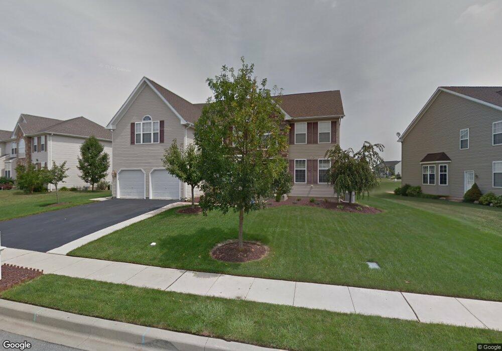
15 Watson Ln Middletown, DE 19709
Estimated Value: $535,000 - $696,560
4
Beds
3
Baths
4,175
Sq Ft
$155/Sq Ft
Est. Value
About This Home
This home is located at 15 Watson Ln, Middletown, DE 19709 and is currently estimated at $646,640, approximately $154 per square foot. 15 Watson Ln is a home located in New Castle County with nearby schools including Silver Lake Elementary School, Louis L. Redding Middle School, and Middletown High School.
Ownership History
Date
Name
Owned For
Owner Type
Purchase Details
Closed on
Sep 17, 2010
Sold by
Sandstrom Scott and Sandstrom Kimberly
Bought by
Pinto Shane F and Pinto Joy L
Current Estimated Value
Home Financials for this Owner
Home Financials are based on the most recent Mortgage that was taken out on this home.
Original Mortgage
$363,000
Outstanding Balance
$238,761
Interest Rate
4.44%
Mortgage Type
VA
Estimated Equity
$407,879
Purchase Details
Closed on
Jun 28, 2004
Sold by
Double S Fine Homes Inc
Bought by
Sandstrom Scott and Sandstrom Kimberly
Home Financials for this Owner
Home Financials are based on the most recent Mortgage that was taken out on this home.
Original Mortgage
$244,000
Interest Rate
6.3%
Mortgage Type
Purchase Money Mortgage
Purchase Details
Closed on
Jun 25, 2003
Sold by
Frog Hollow Llc
Bought by
Double S Fine Homes Inc
Create a Home Valuation Report for This Property
The Home Valuation Report is an in-depth analysis detailing your home's value as well as a comparison with similar homes in the area
Home Values in the Area
Average Home Value in this Area
Purchase History
| Date | Buyer | Sale Price | Title Company |
|---|---|---|---|
| Pinto Shane F | $365,000 | First American Title Ins Co | |
| Sandstrom Scott | $374,570 | -- | |
| Double S Fine Homes Inc | $294,000 | -- |
Source: Public Records
Mortgage History
| Date | Status | Borrower | Loan Amount |
|---|---|---|---|
| Open | Pinto Shane F | $363,000 | |
| Previous Owner | Sandstrom Scott | $244,000 |
Source: Public Records
Tax History
| Year | Tax Paid | Tax Assessment Tax Assessment Total Assessment is a certain percentage of the fair market value that is determined by local assessors to be the total taxable value of land and additions on the property. | Land | Improvement |
|---|---|---|---|---|
| 2024 | $413 | $137,800 | $11,800 | $126,000 |
| 2023 | $413 | $137,800 | $11,800 | $126,000 |
| 2022 | $4,237 | $137,800 | $11,800 | $126,000 |
| 2021 | $4,144 | $137,800 | $11,800 | $126,000 |
| 2020 | $4,095 | $137,800 | $11,800 | $126,000 |
| 2019 | $4,208 | $137,800 | $11,800 | $126,000 |
| 2018 | $3,632 | $137,800 | $11,800 | $126,000 |
| 2017 | $3,496 | $137,800 | $11,800 | $126,000 |
| 2016 | $3,141 | $137,800 | $11,800 | $126,000 |
| 2015 | $3,451 | $137,800 | $11,800 | $126,000 |
| 2014 | $3,444 | $137,800 | $11,800 | $126,000 |
Source: Public Records
Map
Nearby Homes
- 1 Hogan Cir
- 241 Porky Oliver Dr
- 57 W Sarazen Dr
- 1850 Congressional Village Dr Unit 5302
- 304 Daylilly Way
- 1840 Congressional Village Dr Unit 4201
- 561 Whispering Trail
- 1810 Congressional Village Dr Unit 1203
- 6 Bradley Cir
- 49 Springmill Dr
- 434 Spring Hollow Dr
- 228 Wickerberry Dr
- 365 Andrew Ct
- 415 Spring Hollow Dr
- 241 Wickerberry Dr
- 721 Idlewyld Dr
- 444 Spring Hollow Dr
- 448 Spring Hollow Dr
- 815 Sweet Birch Dr
- 308 Ellenwood Dr
Your Personal Tour Guide
Ask me questions while you tour the home.