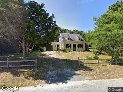
15 Whelan St Dennis Port, MA 02639
Dennis Port NeighborhoodEstimated Value: $627,000 - $711,000
3
Beds
2
Baths
1,501
Sq Ft
$444/Sq Ft
Est. Value
About This Home
This home is located at 15 Whelan St, Dennis Port, MA 02639 and is currently estimated at $666,024, approximately $443 per square foot. 15 Whelan St is a home located in Barnstable County with nearby schools including Dennis-Yarmouth Regional High School and St. Pius X. School.
Ownership History
Date
Name
Owned For
Owner Type
Purchase Details
Closed on
Sep 18, 1998
Sold by
Mannix Paul
Bought by
Beasley Glen E and Beasley Donna M
Current Estimated Value
Home Financials for this Owner
Home Financials are based on the most recent Mortgage that was taken out on this home.
Original Mortgage
$87,000
Interest Rate
6.9%
Mortgage Type
Purchase Money Mortgage
Create a Home Valuation Report for This Property
The Home Valuation Report is an in-depth analysis detailing your home's value as well as a comparison with similar homes in the area
Home Values in the Area
Average Home Value in this Area
Purchase History
| Date | Buyer | Sale Price | Title Company |
|---|---|---|---|
| Beasley Glen E | $147,000 | -- |
Source: Public Records
Mortgage History
| Date | Status | Borrower | Loan Amount |
|---|---|---|---|
| Open | Sullivan James B | $83,000 | |
| Open | Sullivan James B | $276,000 | |
| Closed | Sullivan James B | $320,000 | |
| Closed | Beasley Glen E | $208,000 | |
| Closed | Beasley Glen E | $17,000 | |
| Closed | Beasley Glen E | $87,000 |
Source: Public Records
Tax History Compared to Growth
Tax History
| Year | Tax Paid | Tax Assessment Tax Assessment Total Assessment is a certain percentage of the fair market value that is determined by local assessors to be the total taxable value of land and additions on the property. | Land | Improvement |
|---|---|---|---|---|
| 2025 | $2,619 | $604,800 | $208,900 | $395,900 |
| 2024 | $2,662 | $606,400 | $200,900 | $405,500 |
| 2023 | $2,575 | $551,400 | $182,700 | $368,700 |
| 2022 | $2,459 | $439,100 | $164,600 | $274,500 |
| 2021 | $2,507 | $415,800 | $161,300 | $254,500 |
| 2020 | $2,319 | $380,200 | $148,900 | $231,300 |
| 2019 | $2,470 | $365,800 | $146,000 | $219,800 |
| 2018 | $2,169 | $342,100 | $150,600 | $191,500 |
| 2017 | $2,314 | $330,500 | $139,000 | $191,500 |
| 2016 | $1,989 | $304,600 | $144,800 | $159,800 |
| 2015 | $1,949 | $304,600 | $144,800 | $159,800 |
| 2014 | $1,895 | $298,400 | $127,400 | $171,000 |
Source: Public Records
Map
Nearby Homes
- 14 Lower County Rd
- 136 Depot St
- 3 Newcomb Dr
- 121 Depot St A
- 67 Inman Rd Unit X
- 191 Sea St Unit 3, AKA 2C
- 50A Depot St
- 18 South St Unit 1-2
- 38 Mill St
- 41 Edwards Ave
- 7 Burton Ave
- 138 Sea St Unit 6
- 5 Birch Hill Rd
- 77 Center St
- 11 Joe Lincoln Rd
- 402 Old Wharf Rd
- 402 Old Wharf Rd
- 13 Hamilton Rd
- 9 Chase Ave Unit 1
- 1 Belmont Rd Unit 19