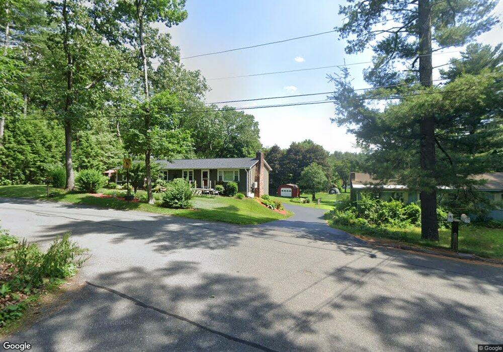
150 Log Plain Rd Unit 152 Greenfield, MA 01301
Estimated Value: $202,000 - $303,256
4
Beds
2
Baths
1,536
Sq Ft
$172/Sq Ft
Est. Value
About This Home
This home is located at 150 Log Plain Rd Unit 152, Greenfield, MA 01301 and is currently estimated at $263,814, approximately $171 per square foot. 150 Log Plain Rd Unit 152 is a home located in Franklin County with nearby schools including Greenfield Center School, Cornerstone Christian School, and Stoneleigh-Burnham School.
Ownership History
Date
Name
Owned For
Owner Type
Purchase Details
Closed on
Jun 1, 2021
Sold by
Rees Ronald F and Rees Susan R
Bought by
Olson Kevin
Current Estimated Value
Purchase Details
Closed on
Aug 24, 2012
Sold by
Rees Ronald F
Bought by
Rees Ronald F and Rees Susan R
Purchase Details
Closed on
Jun 29, 2010
Sold by
Rees Francis A Est and Curtiss
Bought by
Kirkpatrick Sandra M
Create a Home Valuation Report for This Property
The Home Valuation Report is an in-depth analysis detailing your home's value as well as a comparison with similar homes in the area
Home Values in the Area
Average Home Value in this Area
Purchase History
| Date | Buyer | Sale Price | Title Company |
|---|---|---|---|
| Olson Kevin | -- | None Available | |
| Olson Kevin | -- | None Available | |
| Rees Ronald F | -- | -- | |
| Rees Ronald F | $65,000 | -- | |
| Rees Ronald F | $65,000 | -- | |
| Kirkpatrick Sandra M | -- | -- | |
| Kirkpatrick Sandra M | -- | -- |
Source: Public Records
Tax History
| Year | Tax Paid | Tax Assessment Tax Assessment Total Assessment is a certain percentage of the fair market value that is determined by local assessors to be the total taxable value of land and additions on the property. | Land | Improvement |
|---|---|---|---|---|
| 2025 | $4,438 | $226,900 | $75,500 | $151,400 |
| 2024 | $4,435 | $217,500 | $64,300 | $153,200 |
| 2023 | $4,048 | $206,000 | $64,300 | $141,700 |
| 2022 | $4,259 | $190,800 | $64,400 | $126,400 |
| 2021 | $4,184 | $180,200 | $68,100 | $112,100 |
| 2020 | $4,162 | $181,500 | $68,100 | $113,400 |
| 2019 | $3,888 | $173,900 | $59,200 | $114,700 |
| 2018 | $3,874 | $172,700 | $58,100 | $114,600 |
| 2017 | $3,753 | $172,700 | $58,100 | $114,600 |
| 2016 | $3,817 | $175,000 | $58,100 | $116,900 |
| 2015 | $3,923 | $174,300 | $59,600 | $114,700 |
| 2014 | $3,578 | $174,300 | $59,600 | $114,700 |
Source: Public Records
Map
Nearby Homes
- 85 Verde Dr
- 001 Adams Rd
- 696 Bernardston Rd
- 47 Cross St
- 25 Barton Rd
- 111 South St
- 75 South St Unit 3
- 18 Lillian St
- 23 Industrial Dr
- 0 Fox Hill Rd Unit 73477185
- 539 Fox Hill Rd
- 1 Northfield Rd
- 132 Poplar St
- 20 Dunnell Rd
- 77 Summer St
- 9 Hancock Ln
- 372 Federal St
- 37 Cleveland St
- 18 E Cleveland St
- 171 Cleveland St
- 146 Log Plain Rd Unit 148
- 157 Log Plain Rd
- 158 Log Plain Rd
- 143 Log Plain Rd
- 164 Log Plain Rd
- 142 Log Plain Rd
- 139 Log Plain Rd
- 12 Oak Ridge Rd
- 167 Log Plain Rd
- 136 Log Plain Rd
- 17 Oak Ridge Rd
- 176 Log Plain Rd
- 135 Log Plain Rd
- 171 Log Plain Rd
- 49 Severance St
- 132 Log Plain Rd
- 180 Log Plain Rd
- 43 Severance St
- 131 Log Plain Rd
- 177 Log Plain Rd
Your Personal Tour Guide
Ask me questions while you tour the home.