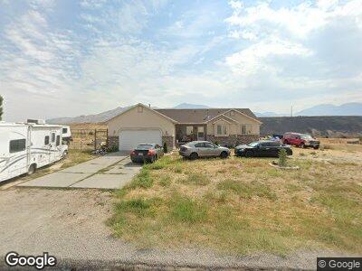
150 N New Saddle Dr Unit 6 Stockton, UT 84071
Estimated Value: $548,000 - $574,000
--
Bed
--
Bath
2,758
Sq Ft
$204/Sq Ft
Est. Value
About This Home
This home is located at 150 N New Saddle Dr Unit 6, Stockton, UT 84071 and is currently estimated at $563,136, approximately $204 per square foot. 150 N New Saddle Dr Unit 6 is a home located in Tooele County with nearby schools including Settlement Canyon Elementary School and Dugway.
Ownership History
Date
Name
Owned For
Owner Type
Purchase Details
Closed on
Oct 12, 2021
Sold by
Fedoruk Mitchell
Bought by
Browning Melanie
Current Estimated Value
Home Financials for this Owner
Home Financials are based on the most recent Mortgage that was taken out on this home.
Original Mortgage
$342,300
Outstanding Balance
$315,513
Interest Rate
2.8%
Mortgage Type
New Conventional
Estimated Equity
$247,623
Purchase Details
Closed on
Feb 1, 2005
Sold by
Gillespie Lee and Gillespie Kimberly A
Bought by
Browning Melanie
Home Financials for this Owner
Home Financials are based on the most recent Mortgage that was taken out on this home.
Original Mortgage
$36,000
Interest Rate
5.74%
Mortgage Type
Credit Line Revolving
Create a Home Valuation Report for This Property
The Home Valuation Report is an in-depth analysis detailing your home's value as well as a comparison with similar homes in the area
Home Values in the Area
Average Home Value in this Area
Purchase History
| Date | Buyer | Sale Price | Title Company |
|---|---|---|---|
| Browning Melanie | -- | Metro National Title | |
| Hinnen Landan P | -- | Metro National Title | |
| Browning Melanie | -- | First American Title Ins Inc |
Source: Public Records
Mortgage History
| Date | Status | Borrower | Loan Amount |
|---|---|---|---|
| Open | Hinnen Landan P | $342,300 | |
| Previous Owner | Browning Melanie R | $72,000 | |
| Previous Owner | Browning Melanie | $36,000 | |
| Previous Owner | Browning Melaine | $144,000 |
Source: Public Records
Tax History Compared to Growth
Tax History
| Year | Tax Paid | Tax Assessment Tax Assessment Total Assessment is a certain percentage of the fair market value that is determined by local assessors to be the total taxable value of land and additions on the property. | Land | Improvement |
|---|---|---|---|---|
| 2024 | $4,443 | $327,426 | $78,000 | $249,426 |
| 2023 | $4,443 | $303,333 | $78,000 | $225,333 |
| 2022 | $3,266 | $263,943 | $73,000 | $190,943 |
| 2021 | $3,092 | $208,071 | $73,000 | $135,071 |
| 2020 | $2,514 | $279,105 | $48,000 | $231,105 |
| 2019 | $2,315 | $272,374 | $48,000 | $224,374 |
| 2018 | $2,157 | $234,978 | $48,000 | $186,978 |
| 2017 | $1,638 | $203,815 | $48,000 | $155,815 |
| 2016 | $1,707 | $115,448 | $29,750 | $85,698 |
| 2015 | $1,707 | $115,448 | $0 | $0 |
| 2014 | -- | $115,448 | $0 | $0 |
Source: Public Records
Map
Nearby Homes
- 291 N Sheridan St
- 609 E 900 S
- 1843 W Big Sky Dr
- 1984 W Ridgeline Rd
- 0 E Bald Mountain Rd
- 2258 W Deer Run Dr Unit 174
- 2409 W Rim Rock Dr
- 3214 W Ridgeline Rd
- 1157 S 1050 W
- 1054 S 1050 W
- 923 W 1140 S
- 1081 S 900 W
- 799 3 O'Clock Dr
- 685 3 O'Clock Dr
- 765 1 O'Clock Dr
- 1082 Southland Dr
- 908 Timpie Rd
- 848 S 940 W
- 729 Timpie Rd
- 1002 W 740 S