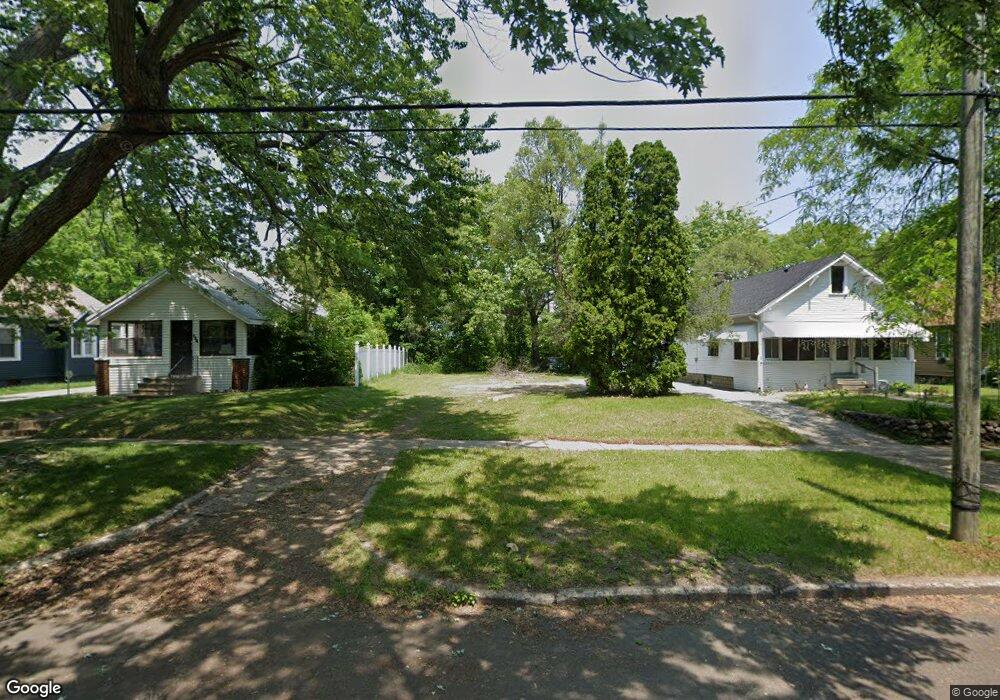
150 Rittenhouse Ave W Battle Creek, MI 49037
Central Battle Creek NeighborhoodEstimated Value: $69,000 - $122,000
--
Bed
--
Bath
--
Sq Ft
5,793
Sq Ft Lot
About This Home
This home is located at 150 Rittenhouse Ave W, Battle Creek, MI 49037 and is currently estimated at $95,500. 150 Rittenhouse Ave W is a home located in Calhoun County with nearby schools including Ann J. Kellogg School, Springfield Middle School, and Battle Creek Central High School.
Ownership History
Date
Name
Owned For
Owner Type
Purchase Details
Closed on
Nov 22, 2022
Sold by
Calhoun County Land Bank Authority
Bought by
Walker Carolyn and Clark Jamel
Current Estimated Value
Purchase Details
Closed on
Dec 14, 2012
Sold by
Calhoun County Treasurer
Bought by
The Calhoun County Land Bank Authority
Purchase Details
Closed on
Aug 7, 2000
Sold by
Rhodes Loyd C and Rhodes Mary R
Bought by
Rhodes Frank and Rhodes Lisa
Purchase Details
Closed on
Sep 6, 1994
Sold by
Bruce Myron D and Bruce Catherine E
Bought by
Rhodes Loyd C and Rhodes Mary R
Create a Home Valuation Report for This Property
The Home Valuation Report is an in-depth analysis detailing your home's value as well as a comparison with similar homes in the area
Home Values in the Area
Average Home Value in this Area
Purchase History
| Date | Buyer | Sale Price | Title Company |
|---|---|---|---|
| Walker Carolyn | $200 | -- | |
| The Calhoun County Land Bank Authority | -- | None Available | |
| Rhodes Frank | -- | -- | |
| Rhodes Loyd C | $15,000 | -- |
Source: Public Records
Tax History Compared to Growth
Tax History
| Year | Tax Paid | Tax Assessment Tax Assessment Total Assessment is a certain percentage of the fair market value that is determined by local assessors to be the total taxable value of land and additions on the property. | Land | Improvement |
|---|---|---|---|---|
| 2025 | -- | $2,200 | $0 | $0 |
| 2024 | $44 | $1,650 | $0 | $0 |
| 2023 | -- | $1,100 | $0 | $0 |
| 2022 | $0 | $0 | $0 | $0 |
| 2021 | $0 | $0 | $0 | $0 |
| 2020 | $0 | $0 | $0 | $0 |
| 2019 | $0 | $0 | $0 | $0 |
| 2018 | $0 | $0 | $0 | $0 |
| 2017 | $0 | $2,129 | $0 | $0 |
| 2016 | $0 | $2,129 | $0 | $0 |
| 2015 | -- | $2,129 | $2,129 | $0 |
| 2014 | -- | $2,129 | $2,129 | $0 |
Source: Public Records
Map
Nearby Homes
- 21 Spring St
- 96 Battle Creek Ave
- 210 Battle Creek Ave
- 30 Harris St
- 171 Goguac St W
- 212 Goguac St W
- 39 Harris St
- 180 Upton Ave
- 131 Spring St
- 207 Upton Ave Unit V/L
- 57 Boulder St
- 211 Upton Ave Unit V/L
- 178 Webber St
- 17 Tennyson Ave
- 71 Burnham St W
- 66 Cleveland St
- 111 Burnham St W
- 133 Harris St
- 35 Eldred St
- 296 Meachem Ave
- 146 Rittenhouse Ave W
- 154 Rittenhouse Ave W
- 144 Rittenhouse Ave W
- 158 Rittenhouse Ave W
- 140 Rittenhouse Ave W
- 162 Rittenhouse Ave W
- 155 Fountain St W
- 163 Fountain St W
- 151 Fountain St W
- 151 Rittenhouse Ave W
- 169 Fountain St W
- 147 Rittenhouse Ave W
- 170 Rittenhouse Ave W
- 157 Rittenhouse Ave W
- 143 Rittenhouse Ave W
- 141 Fountain St W
- 161 Rittenhouse Ave W
- 139 Rittenhouse Ave W
- 176 Rittenhouse Ave W
- 175 Fountain St W