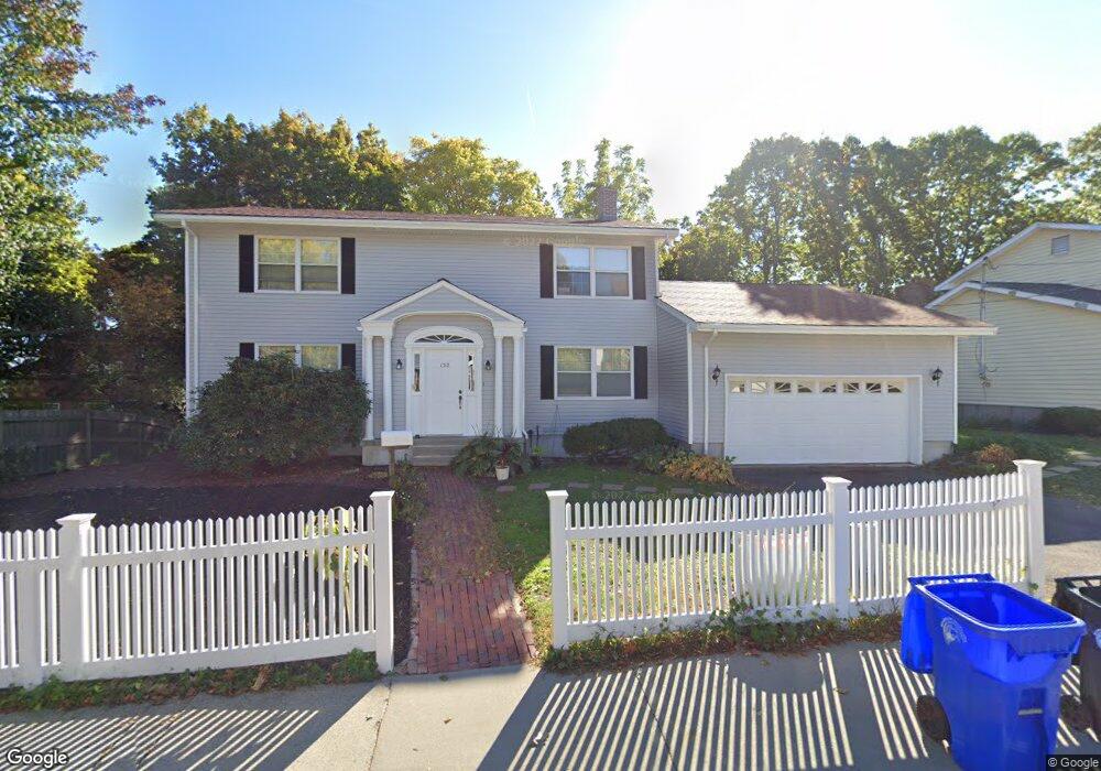
150 Summit Ave Brookline, MA 02446
Washington Square NeighborhoodEstimated Value: $2,365,000 - $3,123,000
5
Beds
4
Baths
2,650
Sq Ft
$1,029/Sq Ft
Est. Value
About This Home
This home is located at 150 Summit Ave, Brookline, MA 02446 and is currently estimated at $2,727,302, approximately $1,029 per square foot. 150 Summit Ave is a home located in Norfolk County with nearby schools including Michael Driscoll, Brookline High School, and Boston Green Academy Horace Mann Charter School.
Ownership History
Date
Name
Owned For
Owner Type
Purchase Details
Closed on
Jun 18, 2014
Sold by
Chin Kenneth R
Bought by
Chin Robert D
Current Estimated Value
Purchase Details
Closed on
Nov 19, 2012
Sold by
Chin Robert
Bought by
Chin Kenneth R
Purchase Details
Closed on
Mar 28, 1969
Bought by
Chin Robert Douglas
Create a Home Valuation Report for This Property
The Home Valuation Report is an in-depth analysis detailing your home's value as well as a comparison with similar homes in the area
Home Values in the Area
Average Home Value in this Area
Purchase History
We collect this data history from publicly available records. To have your information removed, we recommend requesting removal directly through your county’s website.
| Date | Buyer | Sale Price | Title Company |
|---|---|---|---|
| Chin Robert D | -- | -- | |
| Chin Kenneth R | -- | -- | |
| Chin Robert Douglas | -- | -- |
Source: Public Records
Mortgage History
We collect this data history from publicly available records. To have your information removed, we recommend requesting removal directly through your county’s website.
| Date | Status | Borrower | Loan Amount |
|---|---|---|---|
| Previous Owner | Chin Robert Douglas | $67,850 |
Source: Public Records
Tax History
| Year | Tax Paid | Tax Assessment Tax Assessment Total Assessment is a certain percentage of the fair market value that is determined by local assessors to be the total taxable value of land and additions on the property. | Land | Improvement |
|---|---|---|---|---|
| 2025 | $26,011 | $2,635,400 | $1,434,100 | $1,201,300 |
| 2024 | $24,755 | $2,533,800 | $1,378,400 | $1,155,400 |
| 2023 | $23,008 | $2,307,700 | $1,198,700 | $1,109,000 |
| 2022 | $22,396 | $2,197,800 | $1,141,600 | $1,056,200 |
| 2021 | $20,710 | $2,113,300 | $1,097,700 | $1,015,600 |
| 2020 | $18,482 | $1,955,800 | $954,500 | $1,001,300 |
| 2019 | $17,453 | $1,862,600 | $909,000 | $953,600 |
| 2018 | $16,082 | $1,700,000 | $776,800 | $923,200 |
| 2017 | $15,847 | $1,603,900 | $733,000 | $870,900 |
| 2016 | $15,620 | $1,499,000 | $685,000 | $814,000 |
| 2015 | $13,822 | $1,294,200 | $533,500 | $760,700 |
| 2014 | $14,305 | $1,255,900 | $485,000 | $770,900 |
Source: Public Records
Map
Nearby Homes
- 16 York Terrace
- 2 Mason Terrace
- 50 Lancaster Terrace Unit 4
- 1600 Beacon St Unit 207
- 35 Westbourne Terrace Unit 2
- 80 Mason Terrace
- 80 Mason Terrace Unit 80
- 227 Summit Ave Unit W207
- 227 Summit Ave Unit W205
- 1514 Beacon St Unit 24
- 1618 Beacon St Unit A
- 1620 Beacon St
- 197 Winchester St Unit 1
- 109 Winchester St Unit 6
- 90 Columbia St Unit 90
- 9 Bartlett Crescent Unit 1
- 249 Corey Rd Unit 409
- 249 Corey Rd Unit 203
- 249 Corey Rd Unit 301
- 249 Corey Rd Unit 207
- 149 Summit Ave
- 153 Summit Ave
- 156 Summit Ave
- 146 Summit Ave
- 142 Summit Ave
- 155 Summit Ave
- 57 York Terrace
- 57 York Terrace Unit 1
- 51 York Terrace
- 141 Summit Ave
- 139 Summit Ave
- 45 York Terrace
- 39 York Terrace
- 132 Summit Ave
- 159 Summit Ave
- 133 Summit Ave
- 54 Jordan Rd
- 31 York Terrace
- 31 York Terrace Unit upper
- 31 York Terrace Unit 31
Your Personal Tour Guide
Ask me questions while you tour the home.