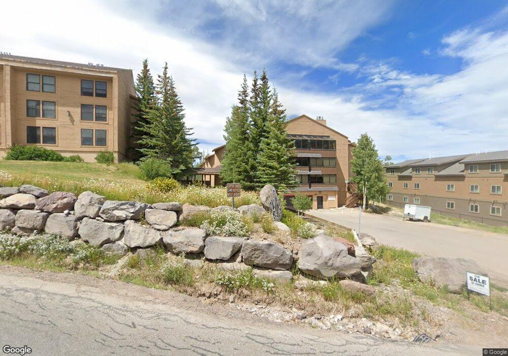
150 W Ridge View St Unit 206 Brian Head, UT 84719
Estimated Value: $179,000 - $207,109
1
Bed
1
Bath
624
Sq Ft
$311/Sq Ft
Est. Value
About This Home
This home is located at 150 W Ridge View St Unit 206, Brian Head, UT 84719 and is currently estimated at $194,277, approximately $311 per square foot. 150 W Ridge View St Unit 206 is a home located in Iron County with nearby schools including Parowan School, Parowan High School, and Cedar City High School.
Ownership History
Date
Name
Owned For
Owner Type
Purchase Details
Closed on
Sep 10, 2019
Sold by
Orbas Sallie Ann and Orbas Ronald Ray
Bought by
Orbas Ronald R and Orbas Sallie A
Current Estimated Value
Home Financials for this Owner
Home Financials are based on the most recent Mortgage that was taken out on this home.
Original Mortgage
$50,000
Outstanding Balance
$43,791
Interest Rate
3.7%
Mortgage Type
New Conventional
Estimated Equity
$150,486
Purchase Details
Closed on
Aug 22, 2019
Sold by
Dwyer Larry L and Dwyer Cheryl K
Bought by
Orbas Sallie Ann and Orbas Ronald Ray
Home Financials for this Owner
Home Financials are based on the most recent Mortgage that was taken out on this home.
Original Mortgage
$50,000
Outstanding Balance
$43,791
Interest Rate
3.7%
Mortgage Type
New Conventional
Estimated Equity
$150,486
Create a Home Valuation Report for This Property
The Home Valuation Report is an in-depth analysis detailing your home's value as well as a comparison with similar homes in the area
Home Values in the Area
Average Home Value in this Area
Purchase History
| Date | Buyer | Sale Price | Title Company |
|---|---|---|---|
| Orbas Ronald R | -- | Security Escrow & Title Insu | |
| Orbas Sallie Ann | -- | Security Escrow & Ttl Ins Ag |
Source: Public Records
Mortgage History
| Date | Status | Borrower | Loan Amount |
|---|---|---|---|
| Open | Orbas Sallie Ann | $50,000 |
Source: Public Records
Tax History Compared to Growth
Tax History
| Year | Tax Paid | Tax Assessment Tax Assessment Total Assessment is a certain percentage of the fair market value that is determined by local assessors to be the total taxable value of land and additions on the property. | Land | Improvement |
|---|---|---|---|---|
| 2025 | $752 | $95,365 | -- | $95,365 |
| 2023 | $1,439 | $182,985 | $1,100 | $181,885 |
| 2022 | $1,400 | $141,010 | $1,100 | $139,910 |
| 2021 | $828 | $83,400 | $1,100 | $82,300 |
| 2020 | $865 | $79,480 | $1,100 | $78,380 |
| 2019 | $763 | $64,825 | $1,100 | $63,725 |
| 2018 | $693 | $57,000 | $1,100 | $55,900 |
| 2017 | $673 | $55,100 | $1,100 | $54,000 |
| 2016 | $717 | $55,100 | $1,100 | $54,000 |
| 2015 | $769 | $55,100 | $0 | $0 |
| 2014 | $807 | $52,500 | $0 | $0 |
Source: Public Records
Map
Nearby Homes
- 150 W Ridgeview St Unit 204
- 150 W Ridgeview St Unit 213
- 150 W Ridgeview St Unit 220
- 150 W Ridge View Street #211
- 150 W Ridge View St Unit 128
- 150 W Ridge View St Unit 204
- 150 W Ridge View St Unit 213
- 150 W Ridge View St Unit 241
- 150 W Ridge View St Unit 220
- 150 W Ridge View St #235
- 150 Ridgeview St Unit 225
- 150 Ridgeview St
- 150 Ridgeview St Unit 213
- 0 Dr Unit 110396
- 0 Dr
- 241 Utah 143
- 241 N Highway 143 Unit 8-B
- 380 Utah 143
- 280 W Ridge View St
- 309 Ridgeview St
- 150 W Ridge View St Unit 238
- 150 W Ridge View St
- 150 W Ridge View St
- 150 W Ridge View St Unit 233
- 150 W Ridge View St Unit 136
- 150 W Ridge View St Unit 208
- 150 W Ridge View St Unit 101
- 150 W Ridge View St Unit 213
- 150 W Ridge View St Unit 128
- 150 W Ridge View St Unit 221
- 150 W Ridge View St Unit 212
- 150 W Ridge View St Unit 210
- 150 W Ridge View St Unit 140
- 150 W Ridge View St Unit 201
- 150 W Ridge View St Unit 110
- 150 W Ridge View St Unit 107
- 150 W Ridge View St Unit 224
- 150 W Ridge View St Unit 127
- 150 W Ridge View St Unit 231
- 150 W Ridge View St Unit CC 236