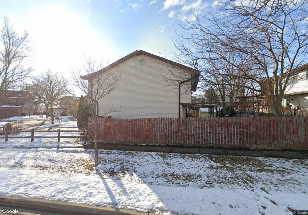
1500 Brookside Dr Hoffman Estates, IL 60169
South Hoffman Estates NeighborhoodEstimated Value: $386,153 - $428,000
3
Beds
2
Baths
1,651
Sq Ft
$245/Sq Ft
Est. Value
About This Home
This home is located at 1500 Brookside Dr, Hoffman Estates, IL 60169 and is currently estimated at $405,038, approximately $245 per square foot. 1500 Brookside Dr is a home located in Cook County with nearby schools including Neil Armstrong Elementary School, Dwight D Eisenhower Junior High School, and Hoffman Estates High School.
Ownership History
Date
Name
Owned For
Owner Type
Purchase Details
Closed on
Mar 11, 2011
Sold by
Morales Iperminio and Cintron Iliana
Bought by
Morales Herminio
Current Estimated Value
Home Financials for this Owner
Home Financials are based on the most recent Mortgage that was taken out on this home.
Original Mortgage
$120,425
Interest Rate
5.09%
Mortgage Type
New Conventional
Purchase Details
Closed on
Feb 6, 1998
Sold by
Uzumcu Al I and Uzumcu Jennifer
Bought by
Morales Hermini and Cintron Iliana
Home Financials for this Owner
Home Financials are based on the most recent Mortgage that was taken out on this home.
Original Mortgage
$154,350
Interest Rate
7.15%
Create a Home Valuation Report for This Property
The Home Valuation Report is an in-depth analysis detailing your home's value as well as a comparison with similar homes in the area
Home Values in the Area
Average Home Value in this Area
Purchase History
| Date | Buyer | Sale Price | Title Company |
|---|---|---|---|
| Morales Herminio | -- | Citywide Title Corporation | |
| Morales Hermini | $162,500 | Lawyers Title Insurance Corp |
Source: Public Records
Mortgage History
| Date | Status | Borrower | Loan Amount |
|---|---|---|---|
| Closed | Morales Herminio | $120,425 | |
| Previous Owner | Morales Hermini | $154,350 |
Source: Public Records
Tax History
| Year | Tax Paid | Tax Assessment Tax Assessment Total Assessment is a certain percentage of the fair market value that is determined by local assessors to be the total taxable value of land and additions on the property. | Land | Improvement |
|---|---|---|---|---|
| 2025 | $7,575 | $36,001 | $4,758 | $31,243 |
| 2024 | $7,575 | $28,000 | $4,325 | $23,675 |
| 2023 | $7,300 | $28,000 | $4,325 | $23,675 |
| 2022 | $7,300 | $28,000 | $4,325 | $23,675 |
| 2021 | $6,536 | $22,837 | $6,811 | $16,026 |
| 2020 | $6,457 | $22,837 | $6,811 | $16,026 |
| 2019 | $6,425 | $25,375 | $6,811 | $18,564 |
| 2018 | $6,682 | $23,928 | $5,946 | $17,982 |
| 2017 | $6,582 | $23,928 | $5,946 | $17,982 |
| 2016 | $6,385 | $23,928 | $5,946 | $17,982 |
| 2015 | $5,831 | $20,778 | $5,190 | $15,588 |
| 2014 | $5,745 | $20,778 | $5,190 | $15,588 |
| 2013 | $5,580 | $20,778 | $5,190 | $15,588 |
Source: Public Records
Map
Nearby Homes
- 1587 Brookside Dr
- 1659 Islandview Ct
- 1880 Bonnie Ln Unit 112
- 2222 Seaver Ln
- 1792 Williamsburg Dr
- 1500 Robin Cir Unit 314
- 1576 Poplar Creek Dr
- 1722 Fayette Walk Unit E
- 1724 Fayette Walk Unit J
- 1769 Sessions Walk Unit C
- 1975 Windsong Dr Unit 333E1
- 1712 Fayette Walk Unit D
- 1933 Williamsburg Dr Unit 1
- 2021 Kensington Ln Unit 3004
- 2027 Kensington Ln Unit 3001
- 2025 Kensington Ln Unit 3002
- 2023 Kensington Ln Unit 3003
- 2051 Kettering Rd Unit 2
- 2267 Briar Ct Unit 65
- 1708 Southbridge Ct
- 1490 Brookside Dr
- 1510 Brookside Dr
- 1514 Brookside Dr
- 1486 Brookside Dr Unit 2
- 1475 Brookside Dr
- 1482 Brookside Dr
- 1518 Brookside Dr
- 1573 Cornell Place Unit 13D
- 1573 Cornell Place Unit 1573
- 1465 Brookside Dr
- 1474 Brookside Dr
- 1470 Brookside Dr
- 1575 Cornell Place Unit 13A
- 2000 Brookside Ln
- 1478 Brookside Dr
- 1571 Cornell Place Unit 13C
- 1571 Cornell Place Unit 1571
- 1577 Cornell Place Unit 13B
- 1522 Brookside Dr
- 1995 Brookside Ln
Your Personal Tour Guide
Ask me questions while you tour the home.