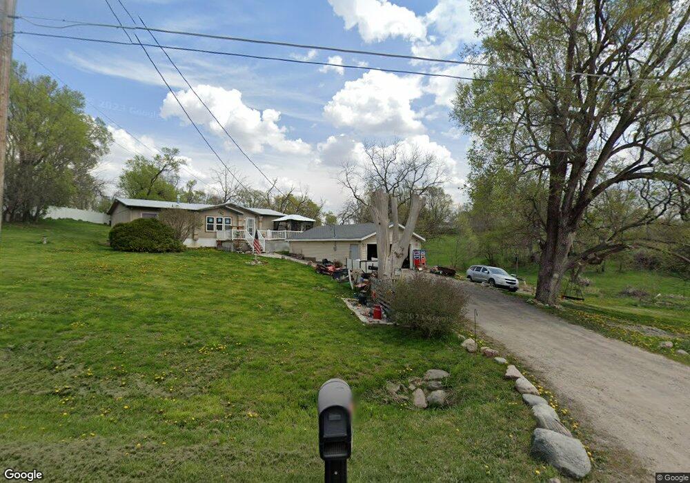
1500 E 5th St S Newton, IA 50208
Estimated Value: $155,000 - $185,564
3
Beds
2
Baths
1,400
Sq Ft
$120/Sq Ft
Est. Value
About This Home
This home is located at 1500 E 5th St S, Newton, IA 50208 and is currently estimated at $167,391, approximately $119 per square foot. 1500 E 5th St S is a home located in Jasper County with nearby schools including Berg Middle School, Newton Senior High School, and Newton Christian School.
Ownership History
Date
Name
Owned For
Owner Type
Purchase Details
Closed on
Oct 1, 2010
Sold by
Bank Iowa
Bought by
Jordan Steven I
Current Estimated Value
Home Financials for this Owner
Home Financials are based on the most recent Mortgage that was taken out on this home.
Original Mortgage
$61,669
Outstanding Balance
$40,736
Interest Rate
4.37%
Mortgage Type
FHA
Estimated Equity
$126,655
Purchase Details
Closed on
Mar 23, 2010
Sold by
Balmer Michael J
Bought by
Bank Iowa
Create a Home Valuation Report for This Property
The Home Valuation Report is an in-depth analysis detailing your home's value as well as a comparison with similar homes in the area
Home Values in the Area
Average Home Value in this Area
Purchase History
| Date | Buyer | Sale Price | Title Company |
|---|---|---|---|
| Jordan Steven I | $62,500 | United Land Title Co | |
| Bank Iowa | -- | None Available |
Source: Public Records
Mortgage History
| Date | Status | Borrower | Loan Amount |
|---|---|---|---|
| Open | Jordan Steven I | $61,669 |
Source: Public Records
Tax History Compared to Growth
Tax History
| Year | Tax Paid | Tax Assessment Tax Assessment Total Assessment is a certain percentage of the fair market value that is determined by local assessors to be the total taxable value of land and additions on the property. | Land | Improvement |
|---|---|---|---|---|
| 2025 | $1,396 | $90,670 | $26,290 | $64,380 |
| 2024 | $1,396 | $83,890 | $26,290 | $57,600 |
| 2023 | $1,384 | $83,890 | $26,290 | $57,600 |
| 2022 | $1,260 | $73,790 | $26,290 | $47,500 |
| 2021 | $1,920 | $65,600 | $26,290 | $39,310 |
| 2020 | $1,920 | $90,430 | $23,660 | $66,770 |
| 2019 | $1,890 | $86,810 | $0 | $0 |
| 2018 | $1,890 | $86,810 | $0 | $0 |
| 2017 | $1,892 | $86,820 | $0 | $0 |
| 2016 | $1,892 | $86,820 | $0 | $0 |
| 2015 | $1,842 | $83,350 | $0 | $0 |
| 2014 | $1,694 | $83,350 | $0 | $0 |
Source: Public Records
Map
Nearby Homes
- 1306 E 5th St S
- 940 E 8th St S
- 816 E 7th St S
- 103 S 8th Ave E
- 1319 W 4th St S
- 709 E 9th St S
- 1305 S 13th Ave E
- 620 E 8th St S
- 428 S 6th Ave E
- 1008 S 8th Ave E
- 305 S 5th Ave E
- 521 E 2nd St S
- 1230 S 9th Ave E
- 944 Meadow Brook Ave
- 525 W 2nd St S
- 704 W 4th St S
- 413 E 4th St S
- 903 E 14th St S
- 1004 E 14th St S
- 920 S 5th Ave E
- 1400 E 5th St S
- 1600 E 5th St S
- 1310 E 5th St S
- 1401 E 6th St S
- 1501 E 6th St S
- 1505 E 6th St S
- 1601 E 5th St S
- 1315 E 6th St S
- 1313 E 6th St S
- 1404 E 6th St S
- 1309 E 6th St S
- 1502 E 6th St S
- 1500 E 6th St S
- 1600 E 6th St S
- 1400 E 6th St S
- 1316 E 6th St S
- 1602 E 6th St S
- 1312 E 6th St S
- 1308 E 6th St S
- 525 S 13th Ave E