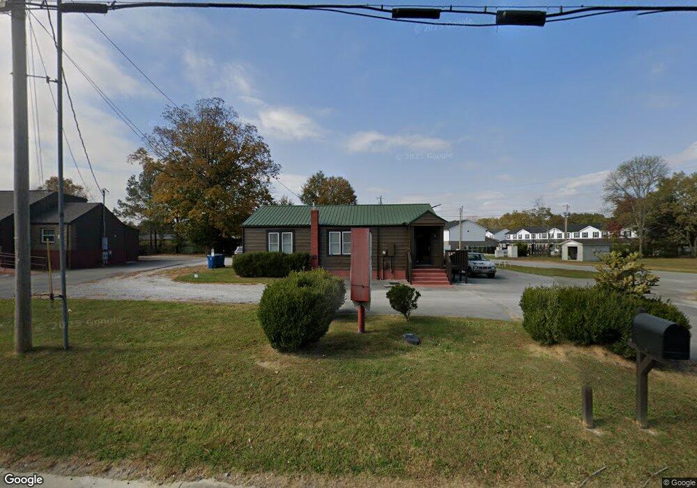
1500 Mcarthur St Manchester, TN 37355
Estimated Value: $196,313 - $257,000
--
Bed
1
Bath
1,066
Sq Ft
$206/Sq Ft
Est. Value
About This Home
This home is located at 1500 Mcarthur St, Manchester, TN 37355 and is currently estimated at $219,438, approximately $205 per square foot. 1500 Mcarthur St is a home located in Coffee County with nearby schools including Westwood Middle School and Temple Baptist Christian School.
Ownership History
Date
Name
Owned For
Owner Type
Purchase Details
Closed on
Mar 2, 2021
Sold by
Roberts John R and Roberts Charles F
Bought by
Carson Marvin and Carson Griseldis
Current Estimated Value
Purchase Details
Closed on
May 11, 2017
Sold by
Trinity Partnership
Bought by
Roberts John R and Jennings Caitlin R
Purchase Details
Closed on
Aug 21, 2013
Sold by
Watkins Todd
Bought by
The Trinity Partnership
Purchase Details
Closed on
Jul 8, 2002
Bought by
Shipley Benton David and Shipley Rowena S
Create a Home Valuation Report for This Property
The Home Valuation Report is an in-depth analysis detailing your home's value as well as a comparison with similar homes in the area
Home Values in the Area
Average Home Value in this Area
Purchase History
| Date | Buyer | Sale Price | Title Company |
|---|---|---|---|
| Carson Marvin | $157,000 | Stones River Title Llc | |
| Roberts John R | -- | -- | |
| Jennings Caitlin R | $55,000 | -- | |
| Umbarger Mitch | -- | -- | |
| The Trinity Partnership | $89,500 | -- | |
| Shipley Benton David | $71,000 | -- |
Source: Public Records
Tax History Compared to Growth
Tax History
| Year | Tax Paid | Tax Assessment Tax Assessment Total Assessment is a certain percentage of the fair market value that is determined by local assessors to be the total taxable value of land and additions on the property. | Land | Improvement |
|---|---|---|---|---|
| 2024 | $1,630 | $38,680 | $13,680 | $25,000 |
| 2023 | $1,630 | $38,680 | $0 | $0 |
| 2022 | $1,404 | $38,680 | $13,680 | $25,000 |
| 2021 | $1,458 | $31,840 | $12,000 | $19,840 |
| 2020 | $1,458 | $31,840 | $12,000 | $19,840 |
| 2019 | $1,458 | $31,840 | $12,000 | $19,840 |
| 2018 | $1,458 | $31,840 | $12,000 | $19,840 |
| 2017 | $1,658 | $31,600 | $12,000 | $19,600 |
| 2016 | $1,658 | $31,600 | $12,000 | $19,600 |
| 2015 | $1,658 | $31,600 | $12,000 | $19,600 |
| 2014 | $1,657 | $31,582 | $0 | $0 |
Source: Public Records
Map
Nearby Homes
- 1550 S Spring St
- 142 Heritage Cir
- 422 Heritage Cir
- 1003 Kennedy Dr
- 1203 Edgewood Dr
- 1306 Mcmahan St
- 905 Royal Trail
- 195 Hamilton Ct
- 355 W Doak Rd
- 1212 Woodcrest Dr
- 1011 S Spring St
- 1221 Hillcrest Dr
- 970 Oak Dr
- 112 Reynard St
- 121 Regalwood Dr
- 503 Oak Dr
- Lot 51 Interstate
- 12 Fox Creek Ct
- 23 Regalwood Dr
- 820 Keylon St
- 1502 Mcarthur St
- 1416 Mcarthur St
- 1504 Mcarthur St
- 0 Heritage Cir Unit 1516214
- 0 Heritage Cir Unit 1761904
- 0 Heritage Cir- Unit 18 1702263
- 0 Heritage Cir- Unit 19 1702278
- 0 Heritage Cir- Unit 18 1802015
- 0 Heritage Cir Unit 2008438
- 19 Heritage Cir
- 1515 Bartlett Dr
- 1414 Mcarthur St
- 14 Heritage Cir
- 13 Heritage Cir
- 1510 Mcarthur St
- 1425 Mcarthur St
- 22 Heritage Cir
- 24 Heritage Cir
- 21 Heritage Cir
- 1406 Mcarthur St