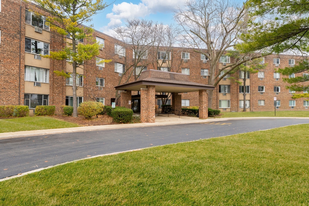
1500 Robin Cir Unit 203 Hoffman Estates, IL 60169
South Hoffman Estates NeighborhoodHighlights
- Lock-and-Leave Community
- Community Pool
- Party Room
- Dwight D Eisenhower Junior High School Rated A-
- Tennis Courts
- Elevator
About This Home
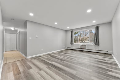
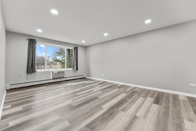
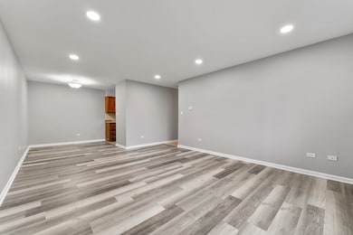
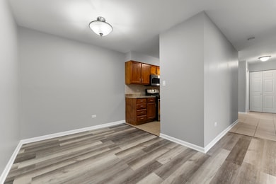
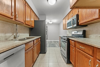
Welcome home to this stunning, fully updated 2-bedroom, 1-bath apartment in the heart of Hoffman Estates! This bright and modern unit has been renovated from top to bottom-featuring new flooring, fresh paint, updated lighting and plumbing, new doors, and new windows for improved comfort and efficiency. The open-concept living and dining area is filled with natural light, creating the perfect space for relaxing or entertaining. The sleek, refreshed kitchen comes fully equipped with all appliances, including a refrigerator, stove, microwave, and dishwasher. Both bedrooms are generously sized with ample closet space. Enjoy the convenience of two assigned parking spaces plus additional guest parking-an incredible perk in this community. The building also offers a clean communal laundry room and fantastic shared amenities such as a clubhouse, pool, tennis court, on-site maintenance, elevator, and more. Located in a quiet, well-maintained community near parks, shopping, dining, and easy highway access, this move-in-ready home offers comfort, convenience, and modern living all in one.
Listing Agent
eXp Realty Brokerage Phone: (773) 370-1489 License #475204338 Listed on: 11/21/2025

Condo Details
Home Type
- Condominium
Est. Annual Taxes
- $1,751
Year Built
- Built in 1978 | Remodeled in 2021
Home Design
- Entry on the 2nd floor
- Brick Exterior Construction
Interior Spaces
- 1,000 Sq Ft Home
- 1-Story Property
- Family Room
- Living Room
- Formal Dining Room
- Storage
- Laundry Room
Kitchen
- Range
- Microwave
- Dishwasher
Flooring
- Carpet
- Laminate
Bedrooms and Bathrooms
- 2 Bedrooms
- 2 Potential Bedrooms
- 1 Full Bathroom
Parking
- 1 Parking Space
- Circular Driveway
- Off-Street Parking
- Parking Included in Price
- Unassigned Parking
Schools
- Neil Armstrong Elementary School
- Eisenhower Junior High School
- Hoffman Estates High School
Utilities
- Baseboard Heating
- Heating System Uses Steam
- Lake Michigan Water
Listing and Financial Details
- Security Deposit $1,850
- Property Available on 11/21/25
- Rent includes heat, water, scavenger, air conditioning
Community Details
Overview
- 88 Units
- Loretta O'malley Association, Phone Number (847) 882-0728
- Moon Lake Village Subdivision
- Property managed by Moonlake Village association
- Lock-and-Leave Community
Amenities
- Party Room
- Coin Laundry
- Elevator
Recreation
- Tennis Courts
- Community Pool
Pet Policy
- No Pets Allowed
Security
- Resident Manager or Management On Site
Map
Source: Midwest Real Estate Data (MRED)
MLS Number: 12522084
APN: 07-08-300-020-1199
- 1475 Rebecca Dr Unit 217
- 1700 Robin Ln Unit 1D
- 1375 Rebecca Dr Unit 213
- 1808 Fayette Walk Unit H
- 1800 Fayette Walk Unit E
- 1704 Fayette Walk Unit B
- 1712 Fayette Walk Unit D
- 1415 N Oakmont Rd
- 1612 Islandview Ct
- 1800 Huntington Blvd Unit AE212
- 1840 Huntington Blvd Unit BW608
- 1840 Huntington Blvd Unit 412
- 1840 Huntington Blvd Unit 415
- 1764 Pebble Beach Dr Unit 1
- 1795 Marquette Ln Unit 5601
- 1711 Pebble Beach Ct
- 1685 Cornell Dr
- 1672 Cornell Dr
- 1585 W Oakmont Rd
- 1982 Leiter Way Unit 13004
- 1500 Robin Cir Unit 108
- 1880 Bonnie Ln Unit 107
- 1751 Queensbury Cir Unit 5964
- 1845 Bristol Walk Unit 1845
- 1727 Sessions Walk Unit 1727
- 1751 Queensbury Cir
- 1483 Cornell Ct Unit 4B
- 1637 Cornell Dr Unit 19A
- 2153 Seaver Ln
- 1883 Jamestown Cir Unit 3222
- Higgins Rd & Moon Lake Blvd
- 2023 Raleigh Place Unit 4
- 1987 Franklin Place Unit 4
- 938 Cardiff Ct Unit 3
- 936 Cardiff Ct
- 1900 Windsong Dr
- 1992 Holbrook Ln
- 1200 Glen Ln
- 2200 Hassell Rd
- 2021 Farnham Ct Unit 4
