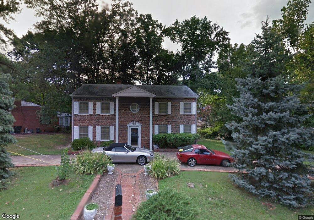
1500 Whitlone Dr Richmond, VA 23225
Cedarhurst NeighborhoodEstimated Value: $394,000 - $435,000
4
Beds
2
Baths
2,290
Sq Ft
$181/Sq Ft
Est. Value
About This Home
This home is located at 1500 Whitlone Dr, Richmond, VA 23225 and is currently estimated at $415,477, approximately $181 per square foot. 1500 Whitlone Dr is a home located in Richmond City with nearby schools including Southampton Elementary School, Lucille M. Brown Middle, and Huguenot High School.
Ownership History
Date
Name
Owned For
Owner Type
Purchase Details
Closed on
Dec 27, 2021
Sold by
Daniels Raymond E
Bought by
Daniels Raymond E
Current Estimated Value
Purchase Details
Closed on
Jan 9, 2017
Sold by
Daniels Angela B
Bought by
Daniels Raymond F
Purchase Details
Closed on
Apr 7, 1997
Sold by
Snead Cecil C and Snead Myrna S
Bought by
Daniels Raymond E and Daniels Angela B
Home Financials for this Owner
Home Financials are based on the most recent Mortgage that was taken out on this home.
Original Mortgage
$100,215
Interest Rate
7.5%
Mortgage Type
FHA
Create a Home Valuation Report for This Property
The Home Valuation Report is an in-depth analysis detailing your home's value as well as a comparison with similar homes in the area
Home Values in the Area
Average Home Value in this Area
Purchase History
| Date | Buyer | Sale Price | Title Company |
|---|---|---|---|
| Daniels Raymond E | -- | Servicelink | |
| Daniels Raymond F | -- | None Available | |
| Daniels Raymond E | $50,500 | -- |
Source: Public Records
Mortgage History
| Date | Status | Borrower | Loan Amount |
|---|---|---|---|
| Previous Owner | Daniels Raymond E | $100,215 |
Source: Public Records
Tax History Compared to Growth
Tax History
| Year | Tax Paid | Tax Assessment Tax Assessment Total Assessment is a certain percentage of the fair market value that is determined by local assessors to be the total taxable value of land and additions on the property. | Land | Improvement |
|---|---|---|---|---|
| 2025 | $3,984 | $332,000 | $66,000 | $266,000 |
| 2024 | $3,828 | $319,000 | $53,000 | $266,000 |
| 2023 | $3,624 | $302,000 | $53,000 | $249,000 |
| 2022 | $3,336 | $278,000 | $45,000 | $233,000 |
| 2021 | $2,964 | $249,000 | $35,000 | $214,000 |
| 2020 | $2,964 | $247,000 | $35,000 | $212,000 |
| 2019 | $2,700 | $225,000 | $35,000 | $190,000 |
| 2018 | $2,304 | $192,000 | $35,000 | $157,000 |
| 2017 | $2,196 | $183,000 | $35,000 | $148,000 |
| 2016 | $2,196 | $183,000 | $35,000 | $148,000 |
| 2015 | $2,040 | $182,000 | $35,000 | $147,000 |
| 2014 | $2,040 | $170,000 | $37,000 | $133,000 |
Source: Public Records
Map
Nearby Homes
- 1112 Blandy Ave
- 1937 Lansing Ave
- 2024 Cedarhurst Dr
- 2021 Cedarhurst Dr
- 1704 German School Rd
- 5612 Southern Pine Dr
- 5955 Wainwright Dr
- 6119 Primrose Place
- 6117 Primrose Place
- 5504 Riverside Heights Way
- 5600 Riverside Heights Way
- 1025 Forest View School Dr
- 5636 Forest Hill Ave
- 6713 N Grand Brook Cir
- 6739 S Grand Brook Cir
- 2320 Pineway Dr
- 1722 Leicester Rd
- 1101 Grand Brook Dr
- 6813 Grand Brook Ct
- 2324 N Riverside Dr
- 6206 Westower Dr
- 6211 Debora Dr
- 6217 Debora Dr
- 6223 Debora Dr
- 1501 Whitlone Dr
- 6201 Debora Dr
- 6216 Westower Dr
- 6131 Westower Dr
- 1507 Whitlone Dr
- 6229 Debora Dr
- 6149 Merrifield Dr
- 6146 Merrifield Dr
- 1513 Whitlone Dr
- 6218 Westower Dr
- 6212 Debora Dr
- 6220 Debora Dr
- 6123 Westower Dr
- 6206 Debora Dr
- 6226 Debora Dr
- 6124 Westower Dr