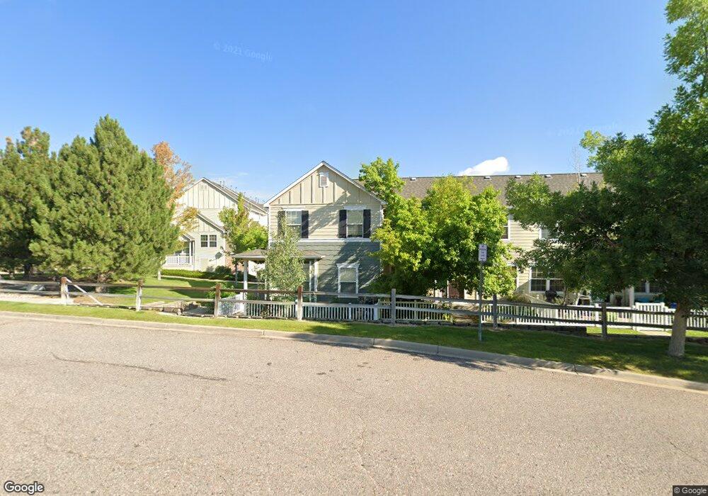
1500 Wild Cat Mountain Rd Castle Rock, CO 80109
Red Hawk NeighborhoodEstimated Value: $389,639 - $410,000
2
Beds
2
Baths
1,380
Sq Ft
$289/Sq Ft
Est. Value
About This Home
This home is located at 1500 Wild Cat Mountain Rd, Castle Rock, CO 80109 and is currently estimated at $399,410, approximately $289 per square foot. 1500 Wild Cat Mountain Rd is a home located in Douglas County with nearby schools including Clear Sky Elementary School, Castle Rock Middle School, and Castle View High School.
Ownership History
Date
Name
Owned For
Owner Type
Purchase Details
Closed on
Jun 30, 2015
Sold by
Maus Tiffany S and Robbins Tiffany S
Bought by
Christopher Krupa & Anna Krupa Revocable
Current Estimated Value
Purchase Details
Closed on
Dec 2, 2002
Sold by
Townhomes At Red Hawk Llc
Bought by
Robbins Tiffany S
Home Financials for this Owner
Home Financials are based on the most recent Mortgage that was taken out on this home.
Original Mortgage
$186,361
Interest Rate
6.28%
Purchase Details
Closed on
Aug 14, 2001
Sold by
My Way Development Corp
Bought by
Townhomes At Red Hawk Llc
Create a Home Valuation Report for This Property
The Home Valuation Report is an in-depth analysis detailing your home's value as well as a comparison with similar homes in the area
Home Values in the Area
Average Home Value in this Area
Purchase History
| Date | Buyer | Sale Price | Title Company |
|---|---|---|---|
| Christopher Krupa & Anna Krupa Revocable | $225,000 | First American | |
| Robbins Tiffany S | $188,994 | First American Heritage Titl | |
| Townhomes At Red Hawk Llc | -- | -- |
Source: Public Records
Mortgage History
| Date | Status | Borrower | Loan Amount |
|---|---|---|---|
| Previous Owner | Robbins Tiffany S | $186,361 |
Source: Public Records
Tax History Compared to Growth
Tax History
| Year | Tax Paid | Tax Assessment Tax Assessment Total Assessment is a certain percentage of the fair market value that is determined by local assessors to be the total taxable value of land and additions on the property. | Land | Improvement |
|---|---|---|---|---|
| 2024 | $1,784 | $29,430 | $4,940 | $24,490 |
| 2023 | $1,809 | $29,430 | $4,940 | $24,490 |
| 2022 | $1,385 | $20,790 | $1,320 | $19,470 |
| 2021 | $1,446 | $20,790 | $1,320 | $19,470 |
| 2020 | $1,413 | $20,750 | $1,360 | $19,390 |
| 2019 | $1,421 | $20,750 | $1,360 | $19,390 |
| 2018 | $1,302 | $18,550 | $1,440 | $17,110 |
| 2017 | $1,192 | $18,550 | $1,440 | $17,110 |
| 2016 | $984 | $14,910 | $1,590 | $13,320 |
| 2015 | $506 | $14,910 | $1,590 | $13,320 |
| 2014 | $895 | $12,100 | $1,590 | $10,510 |
Source: Public Records
Map
Nearby Homes
- 1480 Thunder Butte Rd
- 1539 Dawson Butte Way
- 1684 Marsh Hawk Cir
- 2204 Jute Ln
- 1340 Rosemary Dr
- 12 Darren St
- 10 Jason St
- 2021 Grayside Cir
- 1992 Grayside Cir
- 2011 Grayside Cir
- 1950 Grayside Cir
- 1928 Grayside Cir
- 1556 Bent Wedge Point
- 1195 Melting Snow Way
- 1105 Melting Snow Way
- 2751 Keepsake Way
- 2896 Keepsake Way
- 915 Oleander St
- 2875 Keepsake Way
- Hanford Plan at Chateau at the Meadows
- 1502 Wild Cat Mountain Rd
- 1504 Wild Cat Mountain Rd
- 1506 Wild Cat Mountain Rd
- 1493 Ophir Rd
- 1495 Ophir Rd
- 1497 Ophir Rd
- 1501 Gold Hill St
- 1505 Gold Hill St
- 1503 Gold Hill St
- 1499 Ophir Rd
- 1501 Dawson Butte Way
- 1507 Gold Hill St
- 1509 Gold Hill St
- 1503 Dawson Butte Way
- 1482 Thunder Butte Rd
- 1484 Thunder Butte Rd
- 1505 Dawson Butte Way
- 1486 Thunder Butte Rd
- 1488 Thunder Butte Rd
- 1509 Dawson Butte Way