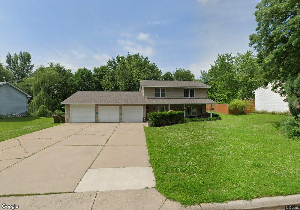
1501 Dale Ave Buffalo, MN 55313
Estimated Value: $361,357 - $403,000
4
Beds
2
Baths
2,008
Sq Ft
$188/Sq Ft
Est. Value
About This Home
This home is located at 1501 Dale Ave, Buffalo, MN 55313 and is currently estimated at $378,089, approximately $188 per square foot. 1501 Dale Ave is a home located in Wright County with nearby schools including Tatanka Elementary School, Buffalo Community Middle School, and Buffalo Senior High School.
Ownership History
Date
Name
Owned For
Owner Type
Purchase Details
Closed on
Jul 23, 2020
Sold by
Kruck Robert A and Kruck Kristine M
Bought by
Blackwood Jerrod and White Ashley
Current Estimated Value
Home Financials for this Owner
Home Financials are based on the most recent Mortgage that was taken out on this home.
Original Mortgage
$260,101
Outstanding Balance
$230,208
Interest Rate
3%
Mortgage Type
New Conventional
Estimated Equity
$147,881
Create a Home Valuation Report for This Property
The Home Valuation Report is an in-depth analysis detailing your home's value as well as a comparison with similar homes in the area
Home Values in the Area
Average Home Value in this Area
Purchase History
| Date | Buyer | Sale Price | Title Company |
|---|---|---|---|
| Blackwood Jerrod | $257,500 | Edina Realty Title |
Source: Public Records
Mortgage History
| Date | Status | Borrower | Loan Amount |
|---|---|---|---|
| Open | Blackwood Jerrod | $260,101 |
Source: Public Records
Tax History Compared to Growth
Tax History
| Year | Tax Paid | Tax Assessment Tax Assessment Total Assessment is a certain percentage of the fair market value that is determined by local assessors to be the total taxable value of land and additions on the property. | Land | Improvement |
|---|---|---|---|---|
| 2025 | $4,022 | $347,000 | $75,000 | $272,000 |
| 2024 | $4,052 | $329,500 | $70,000 | $259,500 |
| 2023 | $3,988 | $340,300 | $70,000 | $270,300 |
| 2022 | $3,414 | $312,300 | $64,000 | $248,300 |
| 2021 | $3,092 | $244,700 | $50,000 | $194,700 |
| 2020 | $3,002 | $220,600 | $45,000 | $175,600 |
| 2019 | $2,718 | $208,700 | $0 | $0 |
| 2018 | $2,658 | $183,300 | $0 | $0 |
| 2017 | $2,348 | $178,900 | $0 | $0 |
| 2016 | $2,216 | $0 | $0 | $0 |
| 2015 | $2,094 | $0 | $0 | $0 |
| 2014 | -- | $0 | $0 | $0 |
Source: Public Records
Map
Nearby Homes
- 1607 Whitetail Run
- 2454 Greenbriar Ln
- 1430 Pulaski Rd
- 2441 Greenbriar Ln
- XXX Capital Dr
- 2005 Buffalo Ridge Dr
- 2403 Meadow Dr
- 1876 Aster Ct
- 1878 Aster Ct
- 1614 Helen St
- 1816 10th St NE
- 1601 11th St NE
- 1805 10th St NE
- 1219 Lakeview Pkwy
- 2707 Buffalo Ridge Dr
- 2602 Arbor Dr
- 2049 Coneflower Point
- 2046 Coneflower Point
- 2005 Coneflower Point
- XXXX 10th St NE